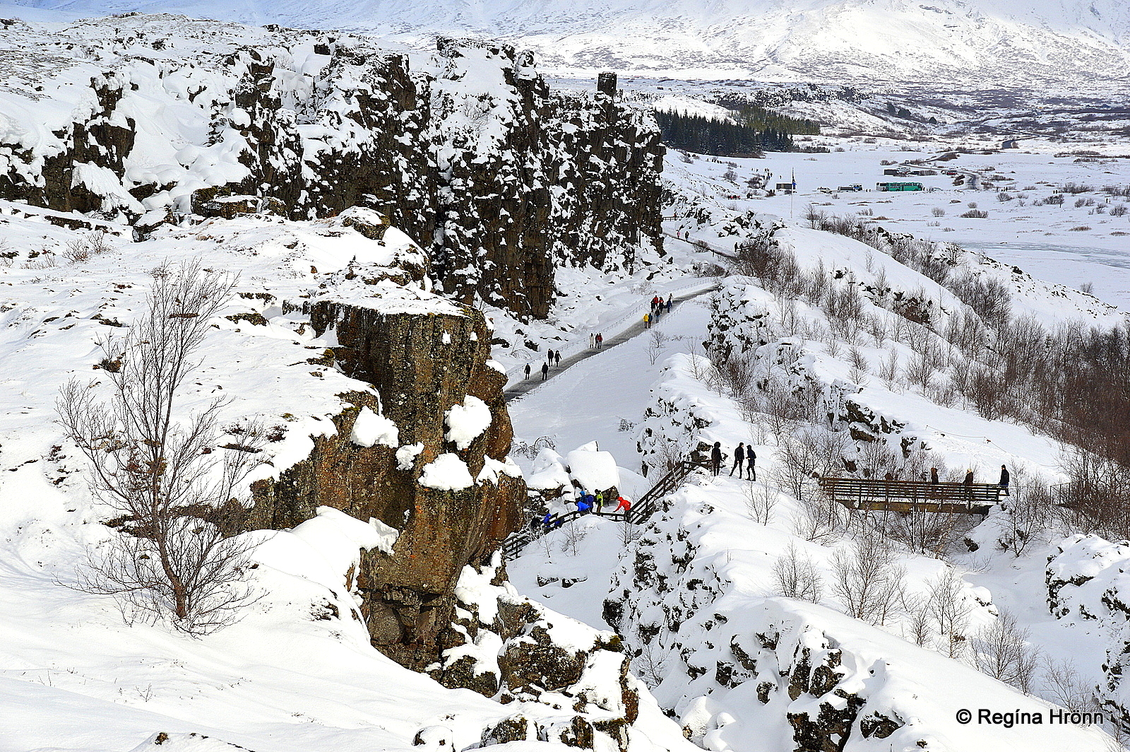
Þingvellir national park – Almannagjá in the snow
The other jewel circles are the Silver Circle in West-Iceland and the Diamond Circle in North-Iceland, which I have been showing you in many of my travel-blogs.
In this travel-blog I am going to show you what the Golden Circle has to offer, as the sights on the Golden Circle are some of Iceland’s most valuable treasures.
Gullfoss waterfall
Traditionally the main stops on the Golden Circle are Þingvellir national park, Geysir geothermal area, and Gullfoss waterfall.
But there are several other stops that can be added to the Golden Circle and there are many variations of Golden Circle tours available. Like our Secret Circle tour which is an interesting alternative to the Golden Circle.
The Golden Circle can either be visited clockwise or anti-clockwise. Let’s have a look at what it looks like driving clockwise from Reykjavík city.
Þingvellir national park
Lögberg at Þingvellir – Parliament Hill
The first major attraction on the Golden Circle is at Þingvellir National Park, which is one of Iceland’s greatest treasures and much beloved by us locals.
Þingvellir is Iceland’s first national park and here the Alþingi parliament was held from 930-1798.
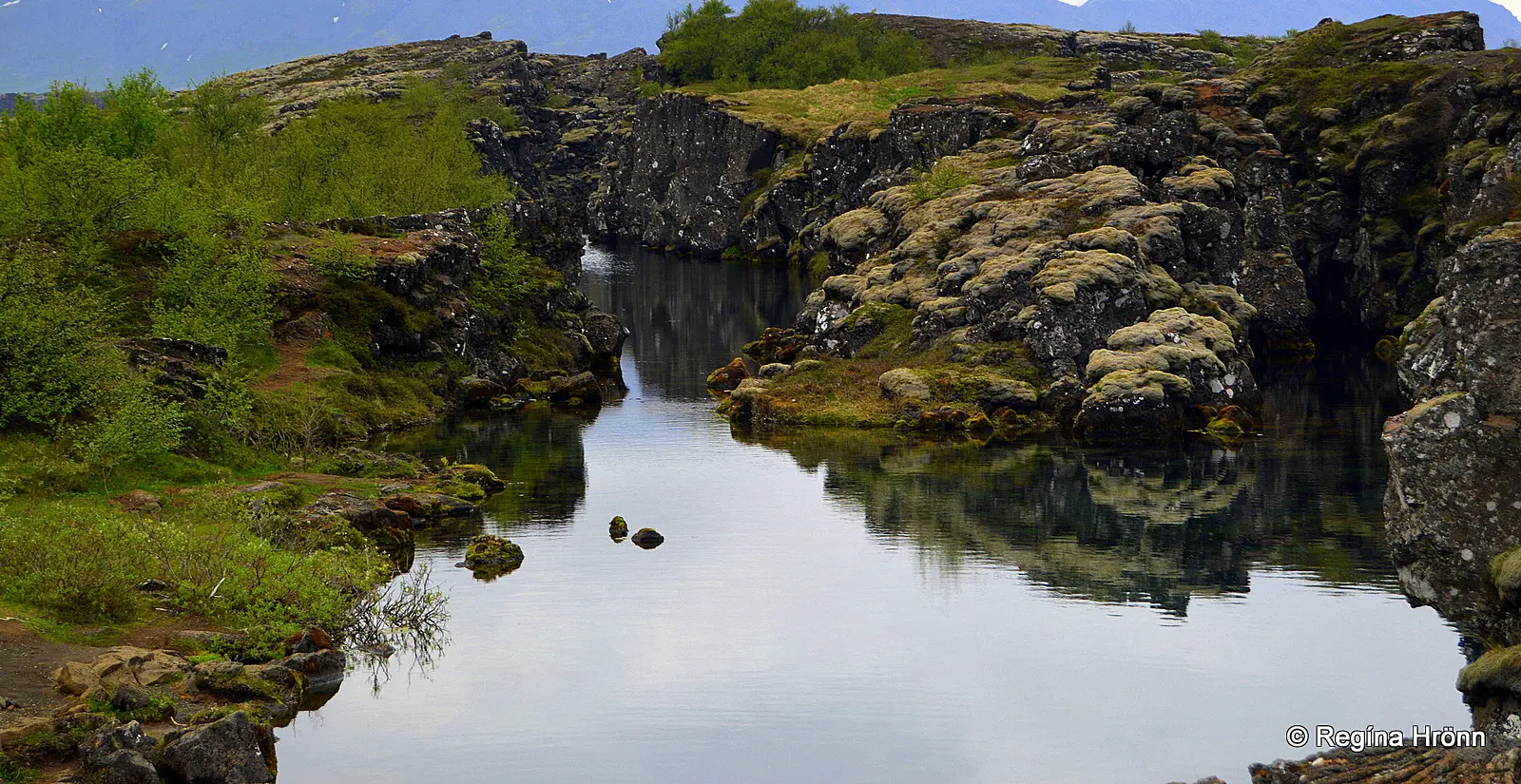
Þingvellir national park – Flosagjá rift
There are two things that make Þingvellir stand out:
The Vikings from all over Iceland established a parliament at Þingvellir back in 930 and gathered here the last 2 weeks of June.
Þingvellir became alive for these 2 weeks a year, with a myriad of tents and people from all over the country attending. Disputes were settled at Alþingi and the assembly set laws.
Almannagjá rift at Þingvellir
In the latter part of the 13th-century executions and other punishments were first carried out here at Þingvellir, and many place names in this area bear witness to the cruel fate of the accused. In the Commonwealth age from 930-1262, there were no executions at Þingvellir.
Þingvellir is for sure filled with history and many love affairs started here, f.ex. between Gunnar at Hlíðarendi and Hallgerður langbrók from the Saga of Njáll, the Crown Jewel of the Icelandic Sagas.
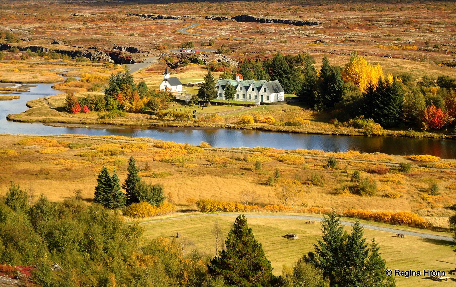
The view of Þingvellir in autumn colors from Hakið observation platform
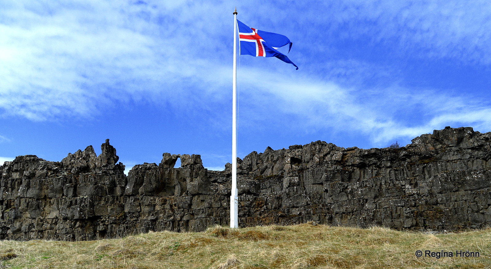
Þingvellir National Park is not only well-known for being the old parliament site. It sits on the tectonic plate boundaries of the Mid-Atlantic Ridge, the North-American, and Eurasian continents.
At Þingvellir the tectonic plates are visible above ground, which is quite remarkable and can only be seen in very few locations.
When visiting Þingvellir for the first time you stop at Hakið from where there is an excellent view of the Þingvellir area. Here you are standing on the eastern boundaries of the North-American plate.
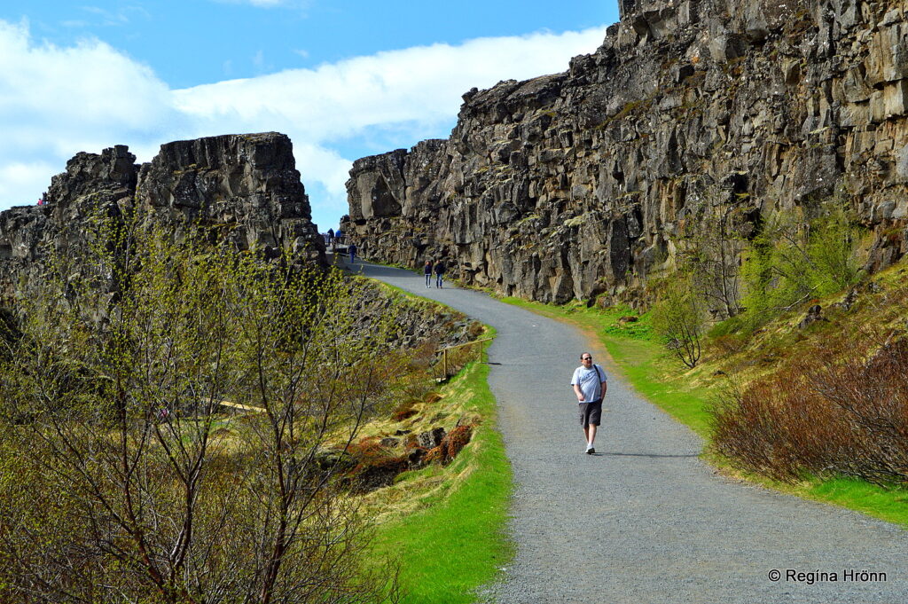
Almannagjá rift and Öxará river
A walk through Almannagjá rift will leave no man untouched. Earlier on the main road was through Almannagjá rift with cars driving through it, but nowadays it is only for pedestrians.
While exploring Þingvellir you will see Lake Þingvallavatn, which is Iceland’s largest natural lake.
Since 2004 Þingvellir has been a UNESCO World Heritage Site.
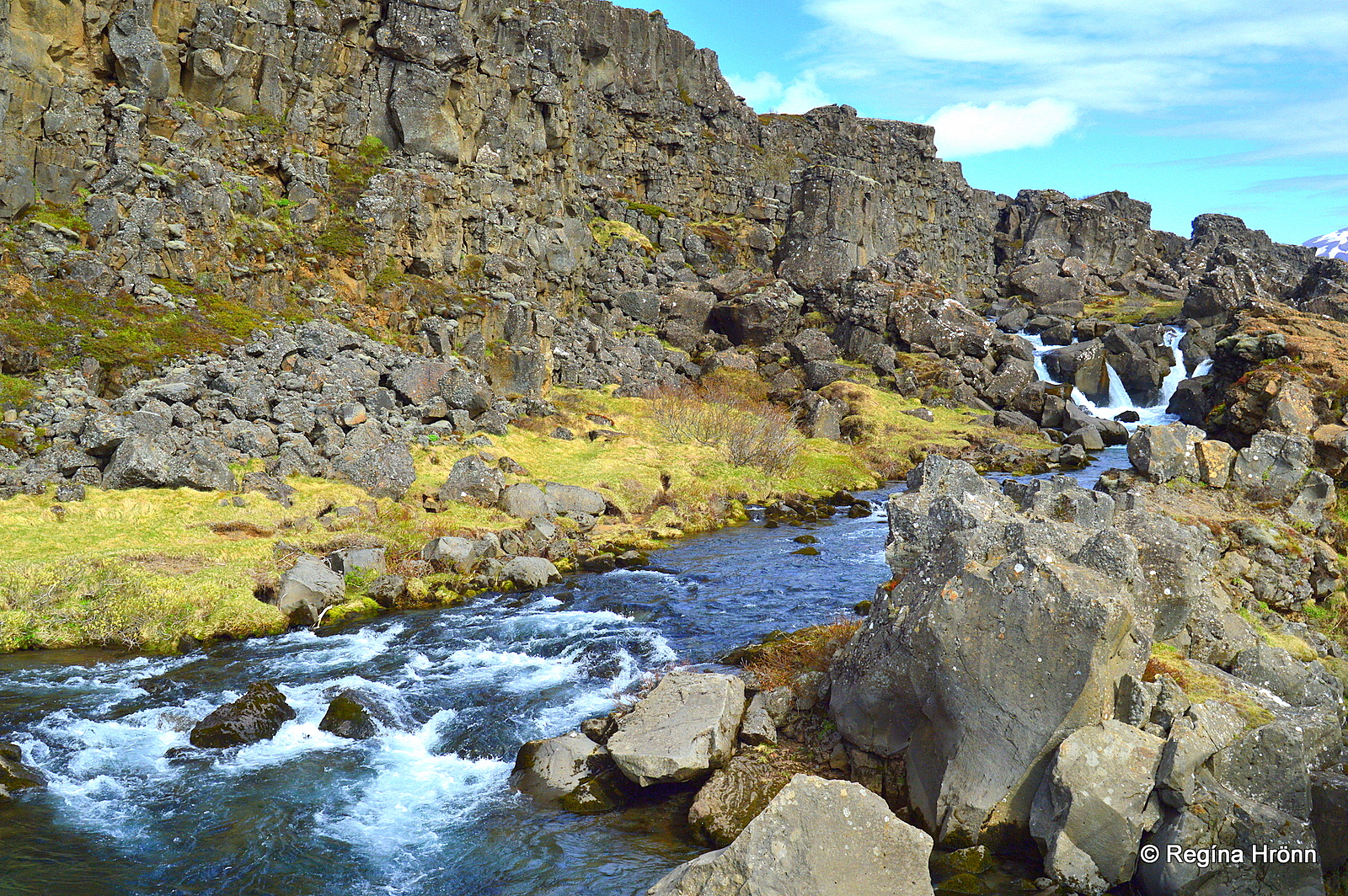
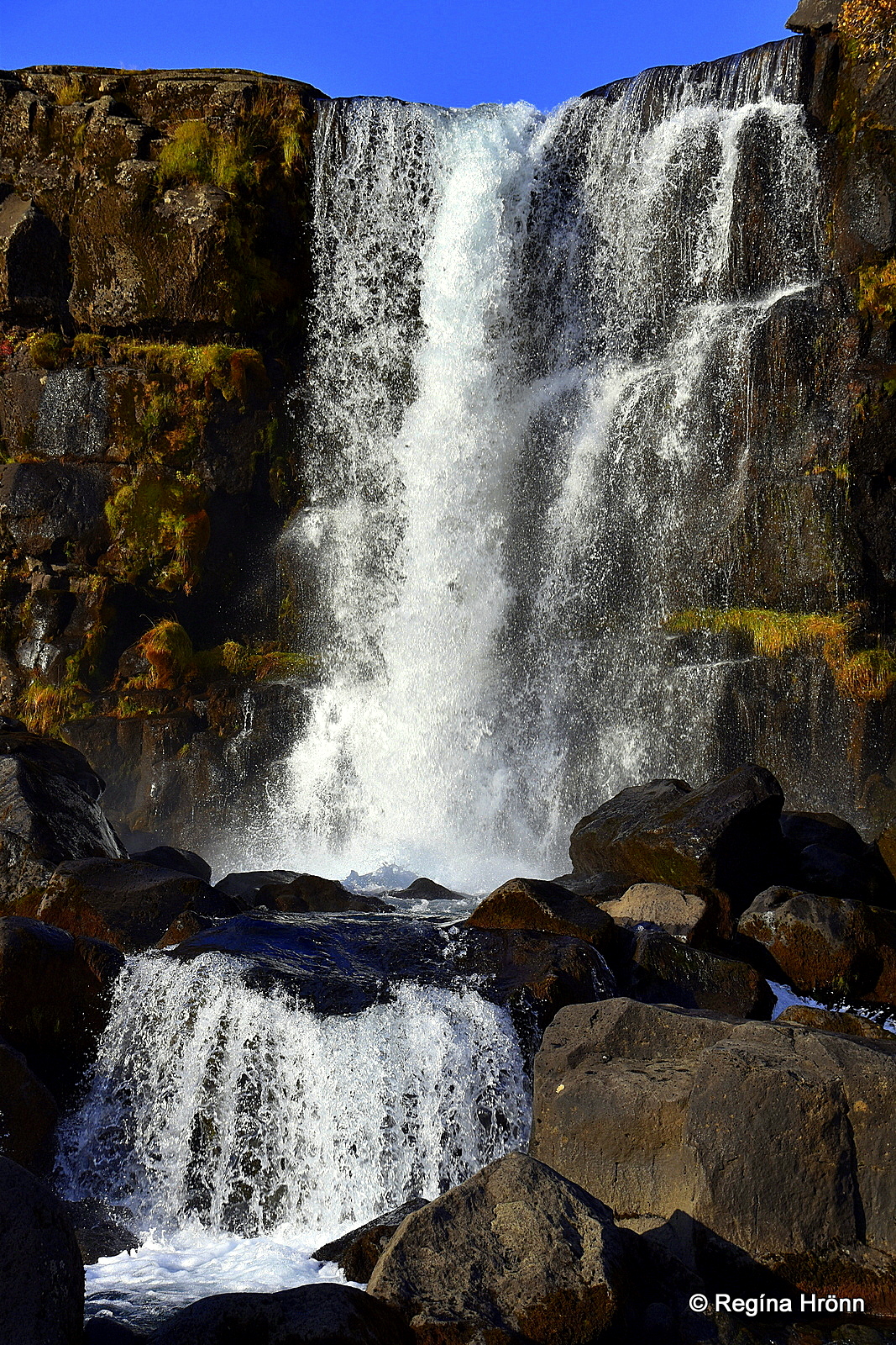
Öxarárfoss waterfall at Þingvellir
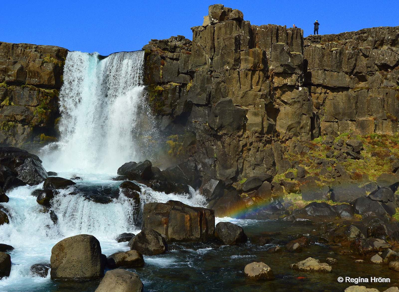
Öxarárfoss waterfall
At Þingvellir, you will find a beautiful waterfall, the Öxarárfoss waterfall in Öxará river.
The name of this historic waterfall, Öxarárfoss means Axe waterfall. If you want to know how the waterfall got this name then I explain it in my travel blog: the Temperamental Giantess Jóra in Jórukleif.
Here the Vikings changed the course of the Öxará river and channeled it into the rift, and thus this beautiful “man-made” waterfall was created.
Öxarárfoss waterfall
Öxarárfoss is not very tall, only some 12 meters, but the settings are breathtaking.
I have visited it countless times but it never looks the same, and it changes considerably in volume depending on the season.
Here you can see what Öxarárfoss waterfall looks like icebound:
A relatively short hike from Almannagjá rift leads to Öxarárfoss waterfall and wooden paths and a platform have been added to make it easier to visit this beautiful waterfall.
Be careful here in the wintertime as sometimes the path leading into the rift gets very slippery.
Þingvellir is approximately 50 km away from Reykjavík city center.
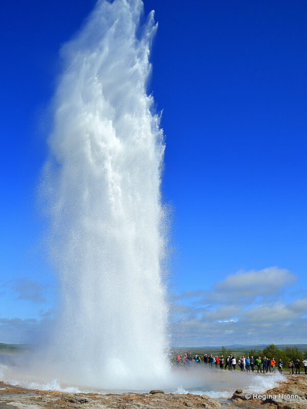
Geysir geothermal area

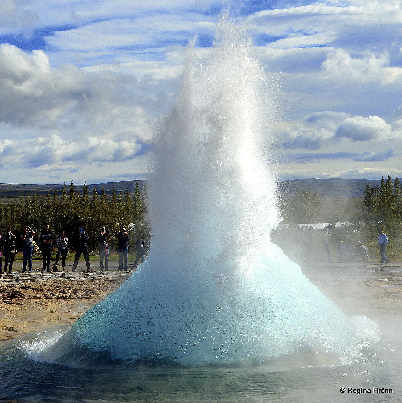
Strokkur erupting
The second major attraction on the Golden Circle is the high-temperature Geysir geothermal area, where you will see Strokkur spouting every 5-8 minutes.
The Geysir geothermal area is one of the most popular areas of Iceland, and Geysir is Iceland’s best-known geological phenomenon.
The Strokkur bubble about to burst
The old Geysir, which rarely spouts anymore, has given a collective name to spouting hot springs all around the world – geysers.
The main attraction is Strokkur, but the geothermal area has got much more to offer, as here you will find Blesi, a beautiful azure blue hot spring, Konungshver – the King’s hot spring, and many more.
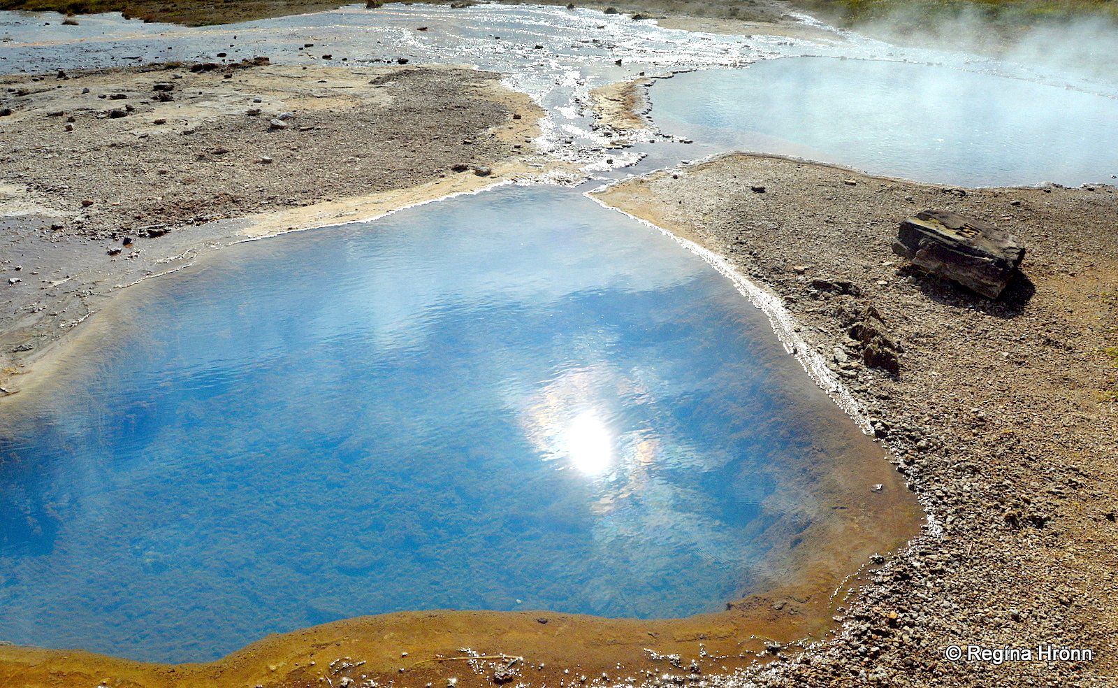
Blesi hot spring
Observation platforms were recently erected on top of Mt. Laugarfjall from where there is a beautiful view of the geothermal area.
An easy, upwards hike will take you to the top of the russet-colored mountain.
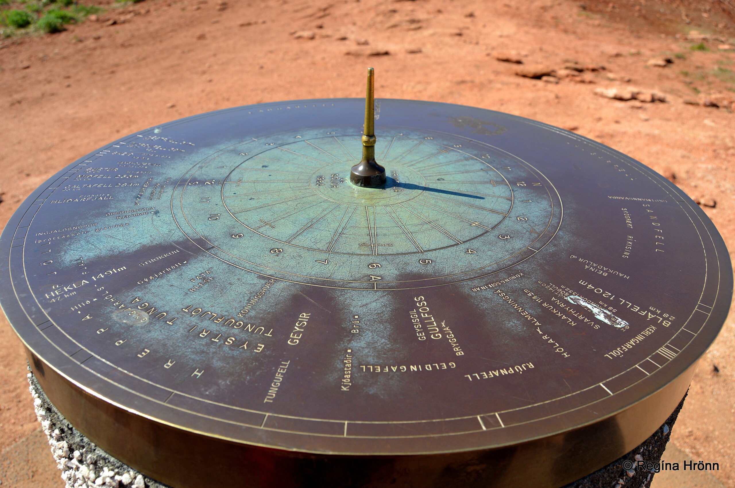
The Geysir view-dial
On the way, you will pass one of the 90+ view-dials in Iceland. I look for all the view-dials in Iceland, as my husband’s family has designed the majority of the view-dials in Iceland.
The view-dial at the Geysir geothermal area was designed by Jón J. Víðis, my husband’s great-uncle and namesake. It was erected in 1965.
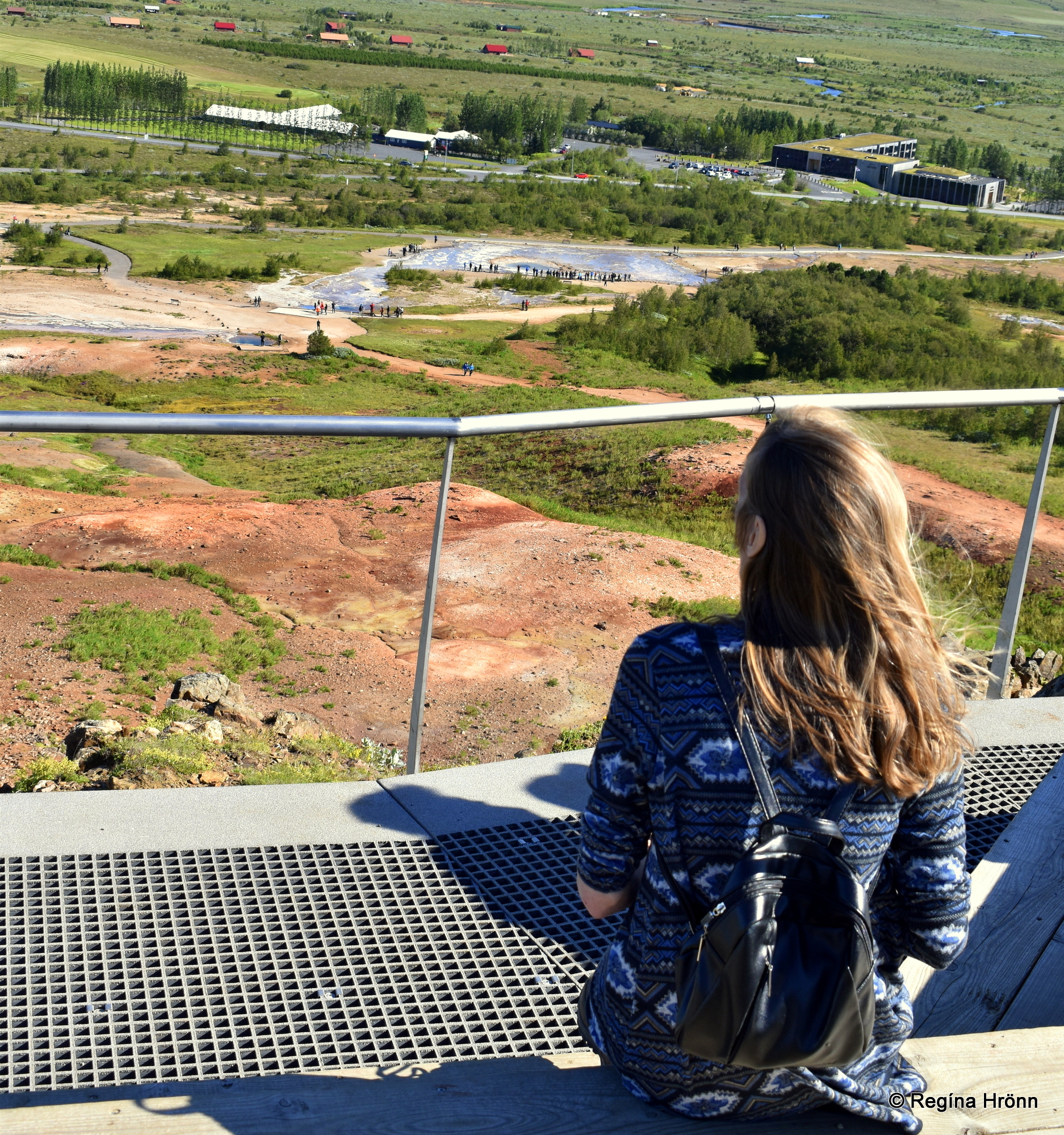
The view from the new observation platform
In my video below, you can see Strokkur erupting. The wind blew the water in the direction of the onlookers who had to retreat.
Stay upwind of Strokkur when you wait for it to erupt. I have passed by Strokkur unaware that it was about to erupt and the wind blew the erupting water and steam in my direction and it landed on me. Fortunately, it had cooled down.
I have written another much more detailed travel-blog about this area: The spectacular Geysir geothermal area, Strokkur, and all the other hot springs.
In that travel-blog I show you the King’s hot spring, the 3 rocks of the kings, and all the other hot springs and mud pools in this area, plus much more.
Geysir is 106 km away from Reykjavík’s city center.
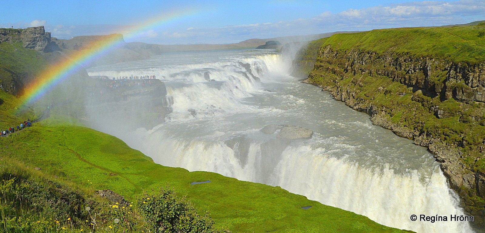
Now, let’s drive for 10 km and meet the best-known waterfall in Iceland, Gullfoss – the Golden waterfall.
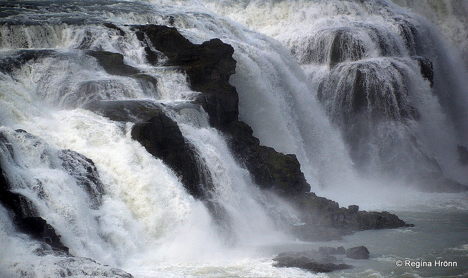
Gullfoss waterfall
Gullfoss waterfall
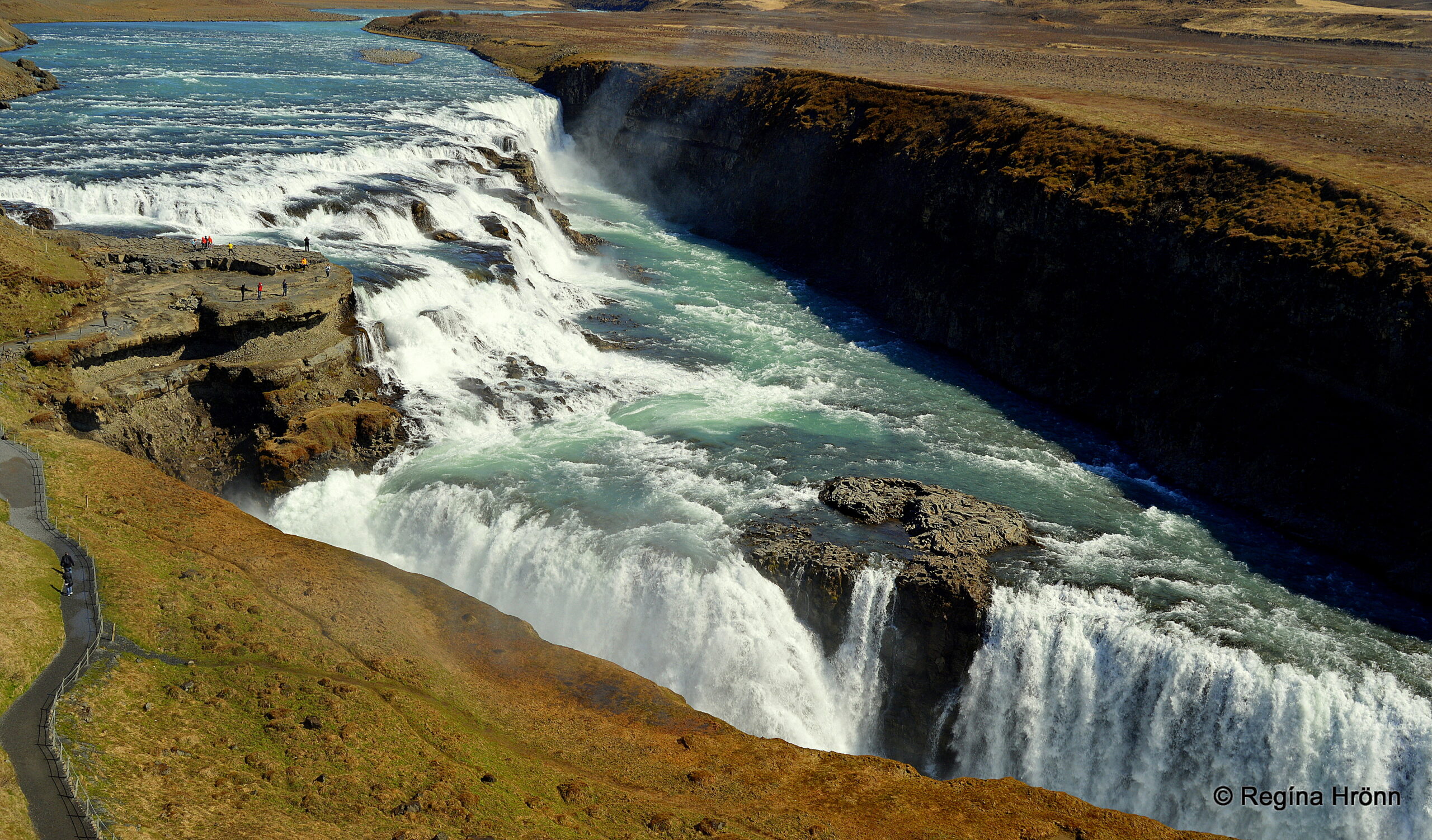
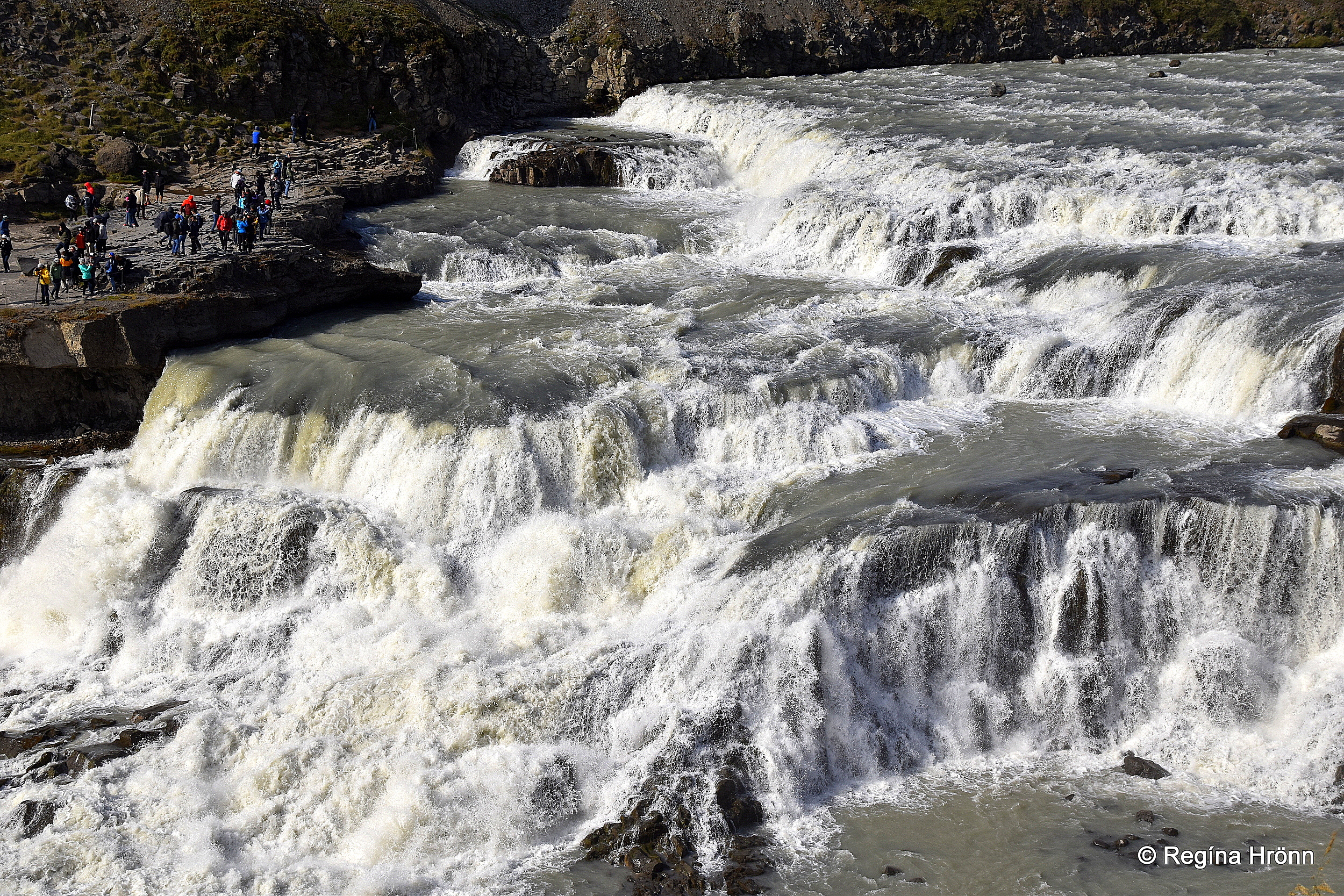
The third major attraction on the Golden Circle is the majestic Gullfoss waterfall which gives the name to the Golden Circle as its name means the Golden Waterfall.
Gullfoss is one of the landmarks of Iceland and is very dear to us Icelanders. Gullfoss has been called the southern outpost of the highland as here we are on the edge of the highland of Iceland.
In the highland by the Kjölur route other breathtaking pearls of Iceland’s nature can be visited.
The upper cascade of Gullfoss waterfall
The mightly waterfall is approximately 32 meters high, with two cascades, the upper cascade is 11 meters high, and the lower cascade is 21 meters; together they drop into the 2.5 km Hvítárgljúfur canyon.
Hvítá glacial river runs from Langjökull glacier, Iceland’s second-largest glacier, and creates Gullfoss waterfall on its way to the sea.
The Lady in Gullfoss waterfall
It is possible to walk straight up to the upper cascade of the Gullfoss waterfall to see it up close.
Bring a raincoat and protect your camera as the mist is massive and the wind can blow it straight to the path.
It is amazing standing this close to such massive powers of nature. And just imagine that Gullfoss was very close to being harnessed for electricity generation!
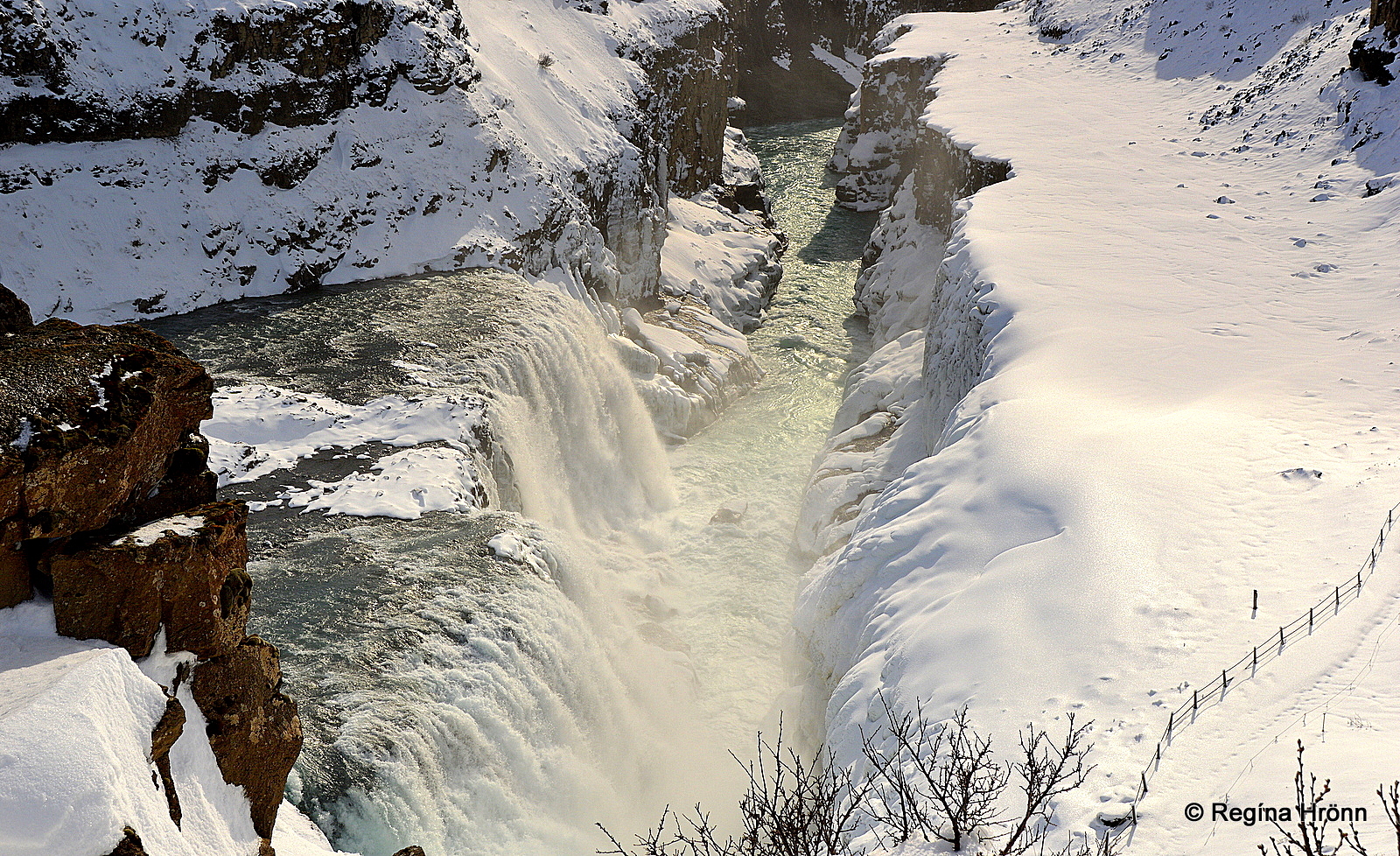
The lower cascade of Gullfoss waterfall in the snow
I have written another travel blog about Gullfoss, its history, how one woman, Sigríður in Brattholt, whom we can call Iceland’s first environmentalist, saved the waterfall, a love story by Gullfoss, dangers by the waterfall, and much more:
The majestic Gullfoss – Iceland’s Golden waterfall which gives a name to the Golden Circle
In my video below you can see what Gullfoss and Hvítárgljúfur canyon look like in the wintertime. The path is often closed in the wintertime as it gets too slippery, so I shot this video from the upper platform:
And if you want to see what the Gullfoss waterfall looks like from the other side then Glacial Experience offers a guided tour called: The Secret Circle of Iceland – the Golden Circle with a very pleasant Twist.
Faxi waterfall
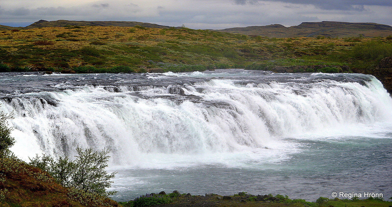
Faxi waterfall
On our way back from Gullfoss, some Golden Circle tours include a stop at another waterfall that is well worth a visit. Its name is Faxi waterfall.
Faxi waterfall, which is located in the Tungufljót river, is not tall, but it is very wide.
It is maybe not fair to this pretty waterfall to visit it straight after visiting the massive Gullfoss as Faxi waterfall doesn’t stand in comparison with Iceland’s most famous waterfall.
But it is a pretty location, well worth a visit.
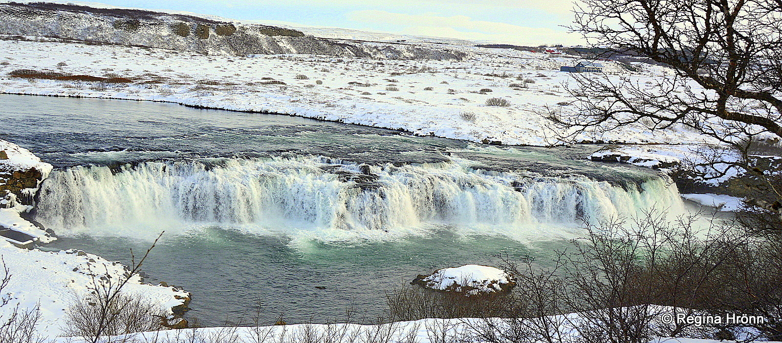
Faxi waterfall in the snow
Tungufljót river is a very popular salmon river and approximately 400 salmons are caught in the river annually.
To the left of the waterfall, a salmon ladder has been erected to help the salmon reach further up the river.
Now, let’s drive for 8 km and stop at Friðheimar in Reykholt.
Friðheimar greenhouse and restaurant
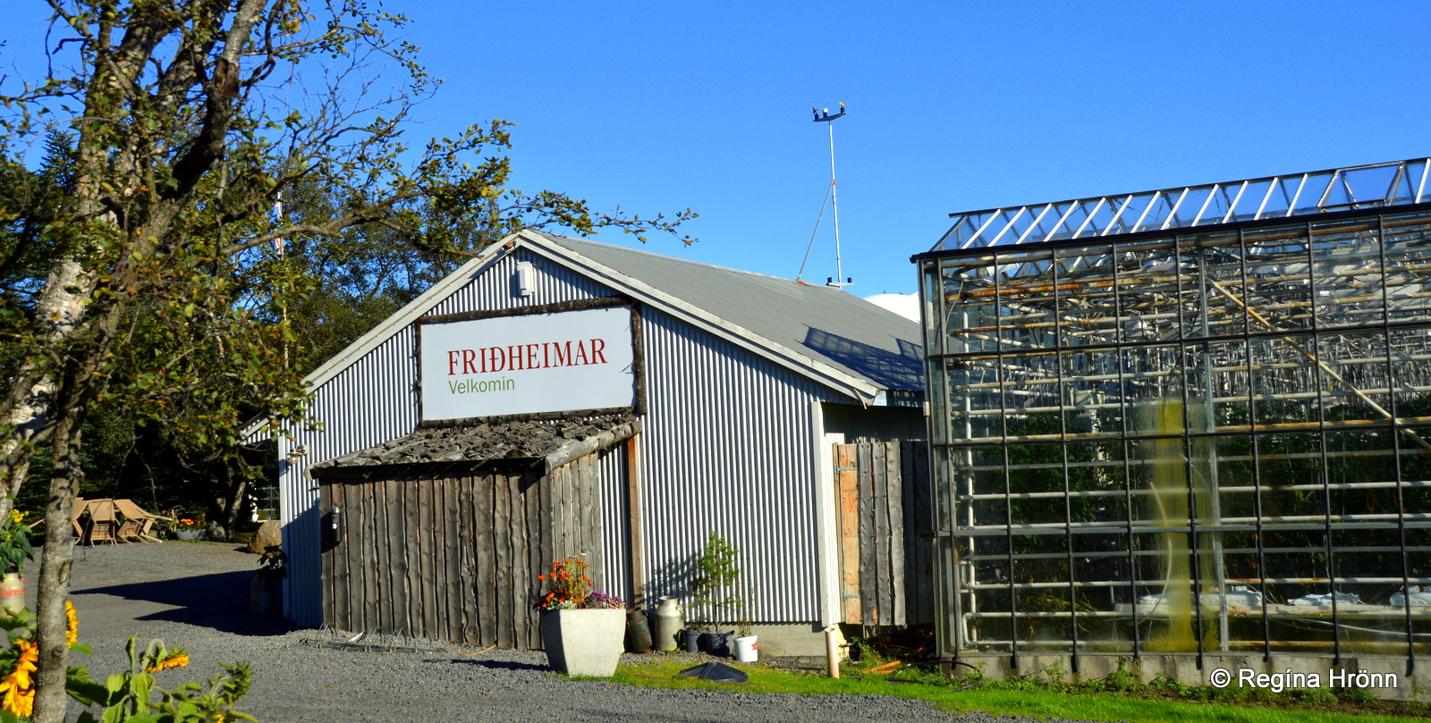
Friðheimar – greenhouses, and restaurant
By now it is time to have some refreshments in the lovely greenhouse at Friðheimar – which is a tomato greenhouse and horse farm, run by Knútur and Helena.
At Friðheimar you will find a very popular restaurant where you can have soup or coffee inside a greenhouse by the tomato plants.
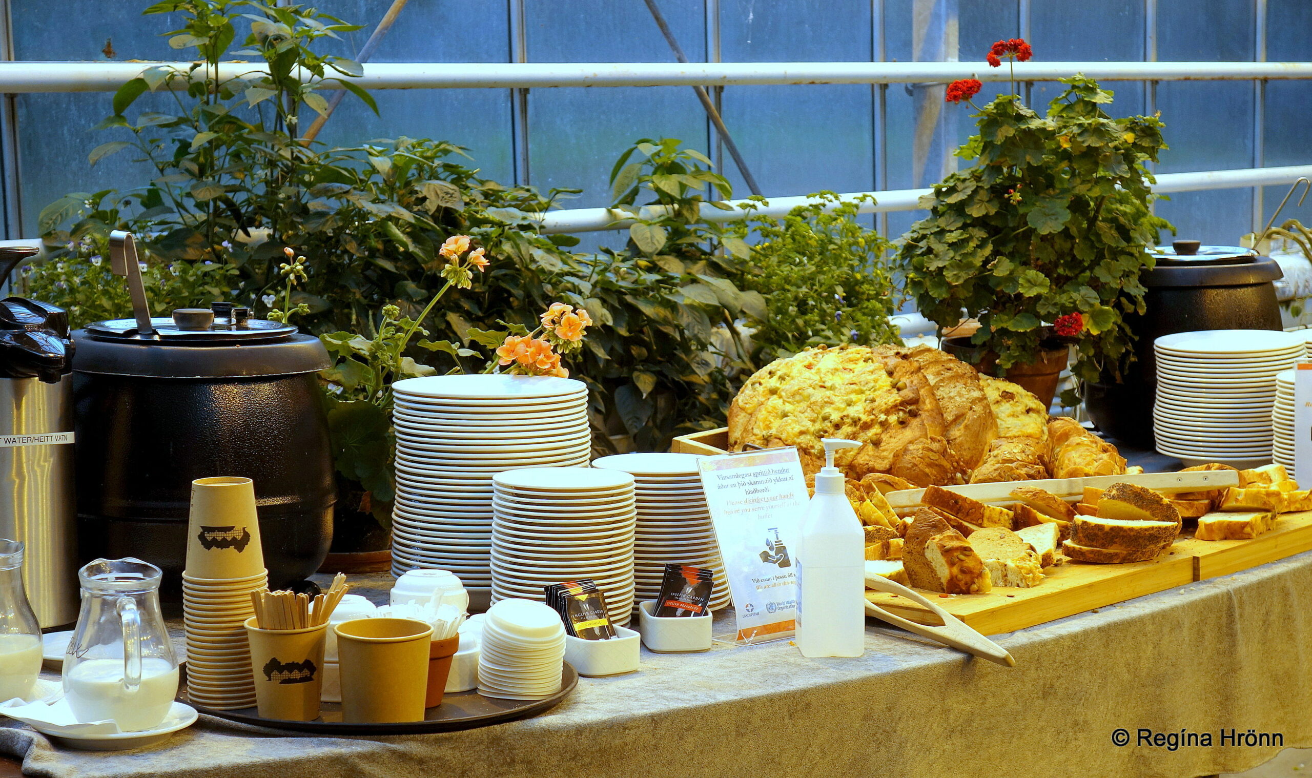
Tomato soup and bread at Friðheimar
The atmosphere is friendly and it is very lovely to have tomato soup and fresh bread (it is huge and yummy) or coffee and cakes in the warm greenhouse under the greenhouse lights.
It is especially lovely when it is cold outside. Highly recommended 🙂
Now, let’s continue on our journey on the Golden Circle and drive for a short distance (10 km) to Skálholt cathedral.
Skálholt cathedral
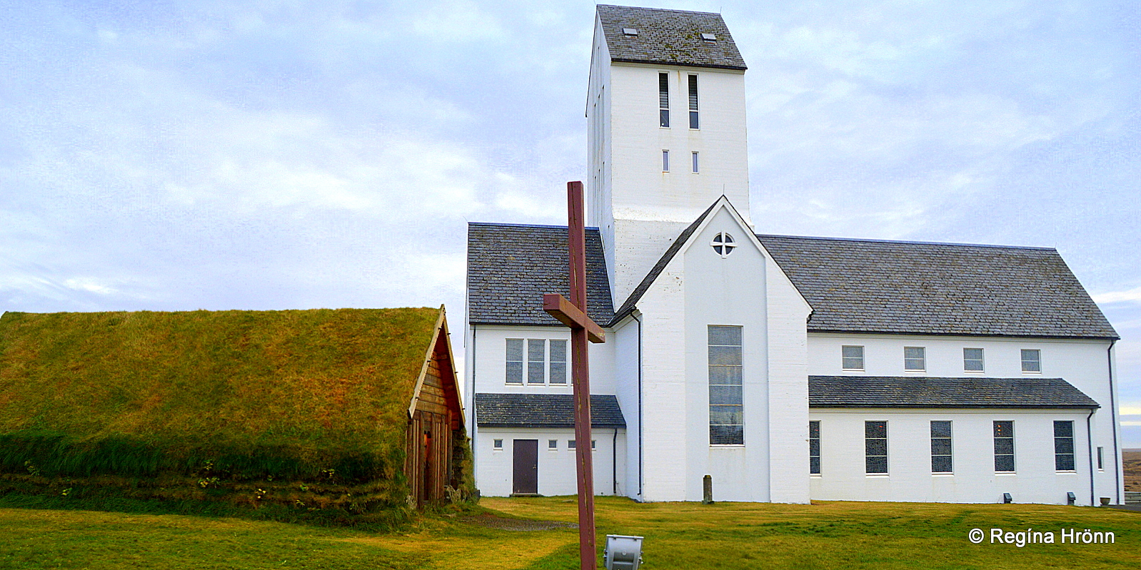
Þorláksbúð and Skálholtsdómkirkja Cathedral
The 4th major sight on the Golden Circle is Skálholt, one of Iceland’s most historic places. Some of the Golden Circle tours stop here.
I always stop by Skálholt when I travel on the Golden Circle and it is with great reverence that I visit this historic place.
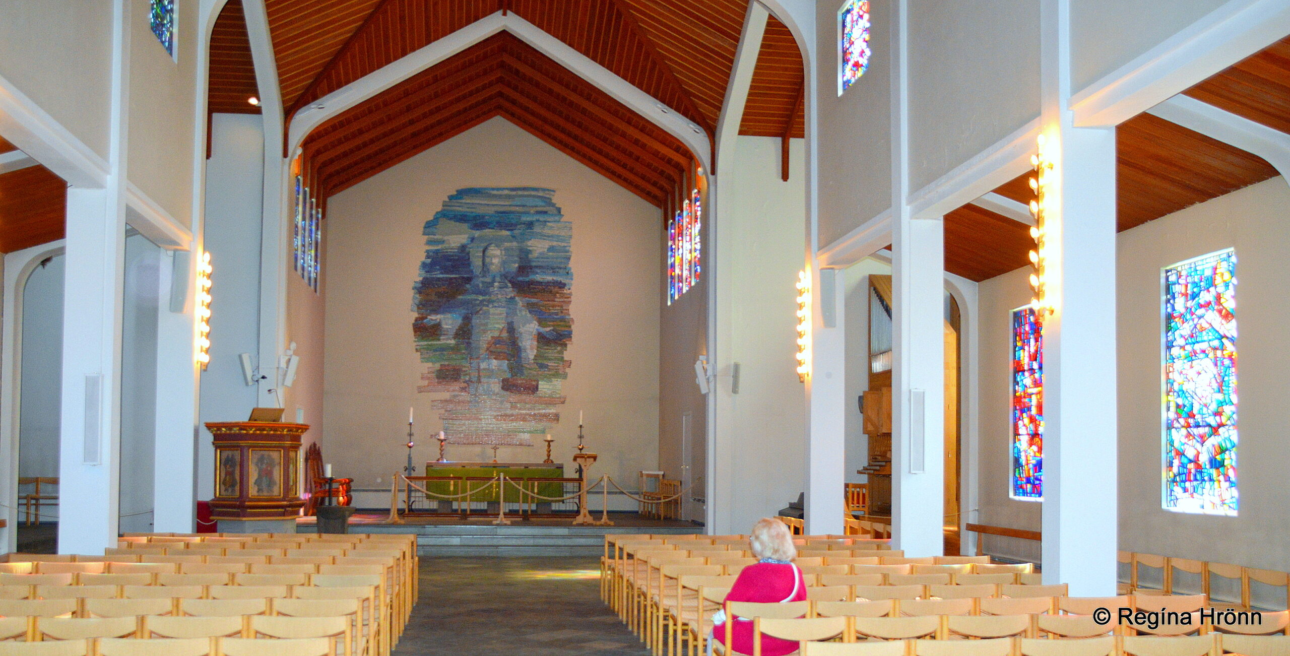
Inside Skálholtsdómkirkja Cathedral
For almost 700 years Skálholt was the center of ecclesiastic power in Iceland.
The first Episcopal See was founded at Skálholt in 1056, and Skálholt became the center of worldly power, culture, and learning in Iceland.
The current cathedral at Skálholt, which is the 12th church built at Skálholt, was consecrated in 1963.
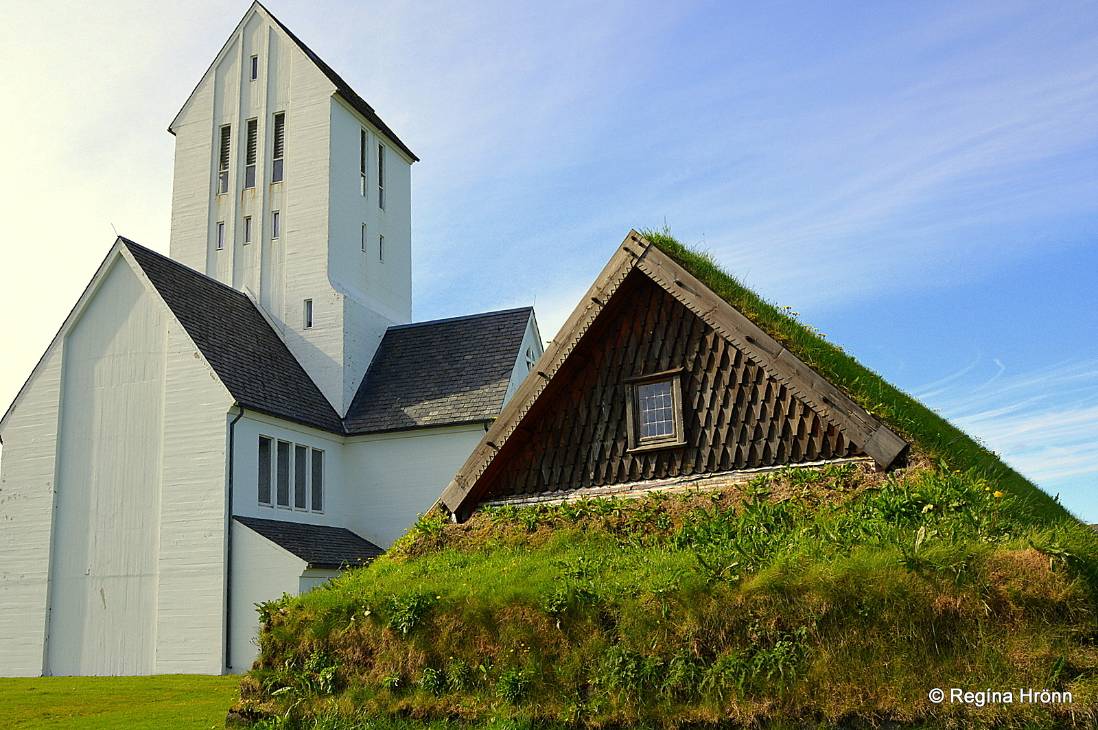
Skálholtsdómkirkja cathedral and Þorláksbúð
And Þorláksbúð is a hypothesis turf house, erected in 2012.
The old Þorláksbúð was built on the ruins of a temporary chapel, which was erected following the fire in 1527 at Árnakirkja church (1311) at Skálholt. It is named after Þorlákur helgi, who was the bishop at Skálholt in 1178-1193.
In 1550 during the Reformation – the change from Catholicism to Lutheranism in Iceland, Bishop Jón Arason at Hólar and his 2 sons, Ari and Björn, were beheaded here at Skálholt.
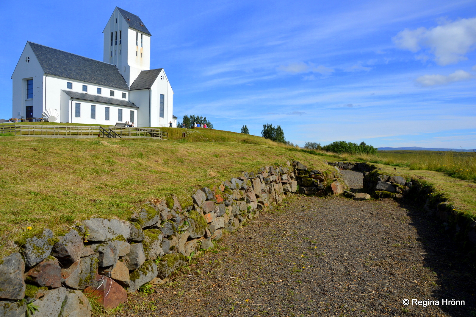
Skálholtsdómkirkja cathedral and the archaeological area
If you want to read up on Skálholt, the archaeological ruins, and the beheading of the bishop and his sons, then I have written a special travel blog about Skálholt:
The historic Skálholt Episcopal See in South-Iceland.
After visiting Skálholt let’s drive for 23 km to the last stop on the Golden Circle – Kerið crater.
Kerið crater
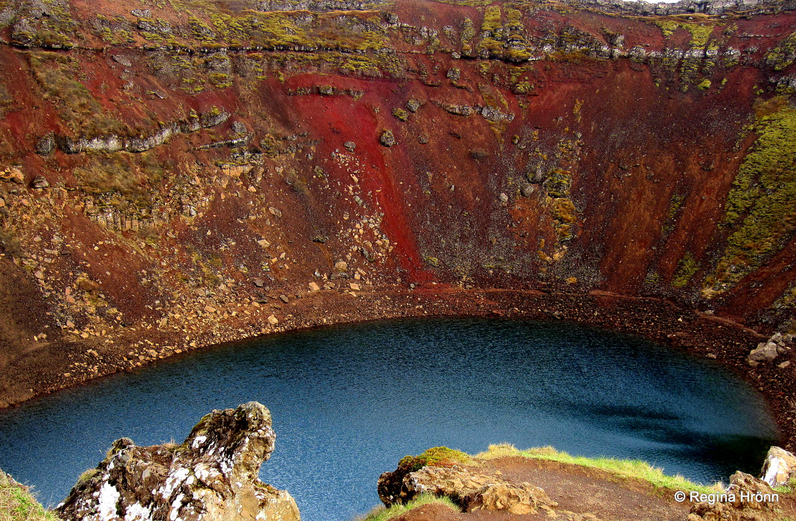
The russet-colored Kerið crater
The last stop on the Golden Circle, or the first, depending on whether you are driving clockwise or anticlockwise, is the Kerið crater.
Kerið in Grímsnes is quite an impressive lake-filled volcanic crater, formed in a volcanic eruption some 6,500 years ago.
The beautiful russet-colored crater, which is approximately 170 meters wide, 270 meters long, and 55 meters deep, is one of the Tjarnarhólar craters, which is a row of 3 craters in Grímsnes.
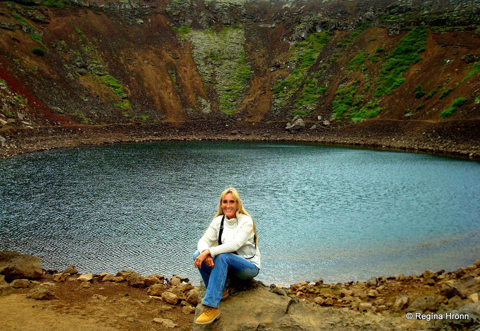
By the lake in Kerið crater
The lake in the middle of the crater is 7-14 meters deep and I have often seen fish swimming in it.
We often had picnics inside the crater by the lake when I was younger. It is possible to walk around the rim of the crater and the ambiance here is quite fairytale-like.
Kerið crater is privately owned and there is an admittance fee of ISK 400, which is used for the maintenance and security of the crater and the surrounding area. It is well worth a visit and right by the road.
Kerið is located 70 km away from the center of Reykjavík.
Kerið is the last stop I am going to show you on the most popular tour in Iceland, the Golden Circle tour, but as I said earlier then there are many variations and detours, which can be added to the Golden Circle.
Have a lovely time on the Golden Circle of Iceland 🙂