Djúpivogur village
Along the way, we will stop at waterfalls, lovely little villages by the sea, and drive by the roots of the tall mountains and screes of the Eastfjords, which along with the Westfjords, are the oldest part of Iceland.
This is a long route with many stops so I will only be able to show you a preview, as it were, of this interesting part of Iceland.
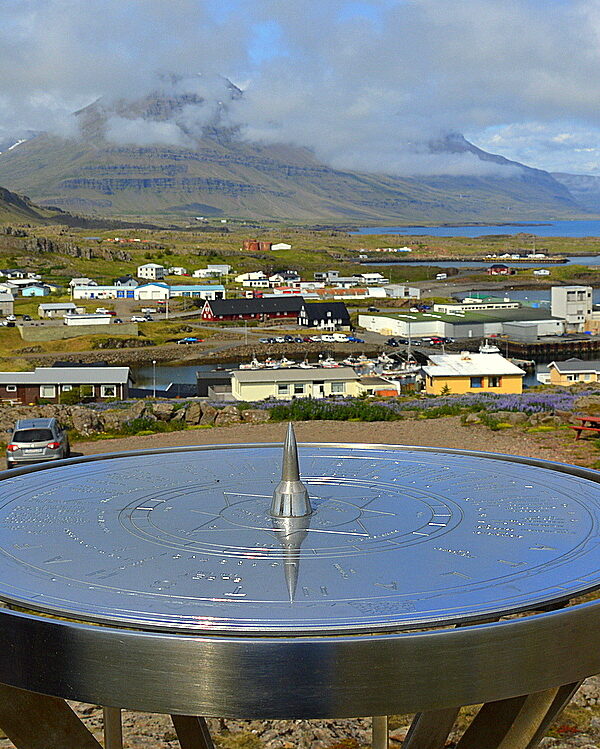
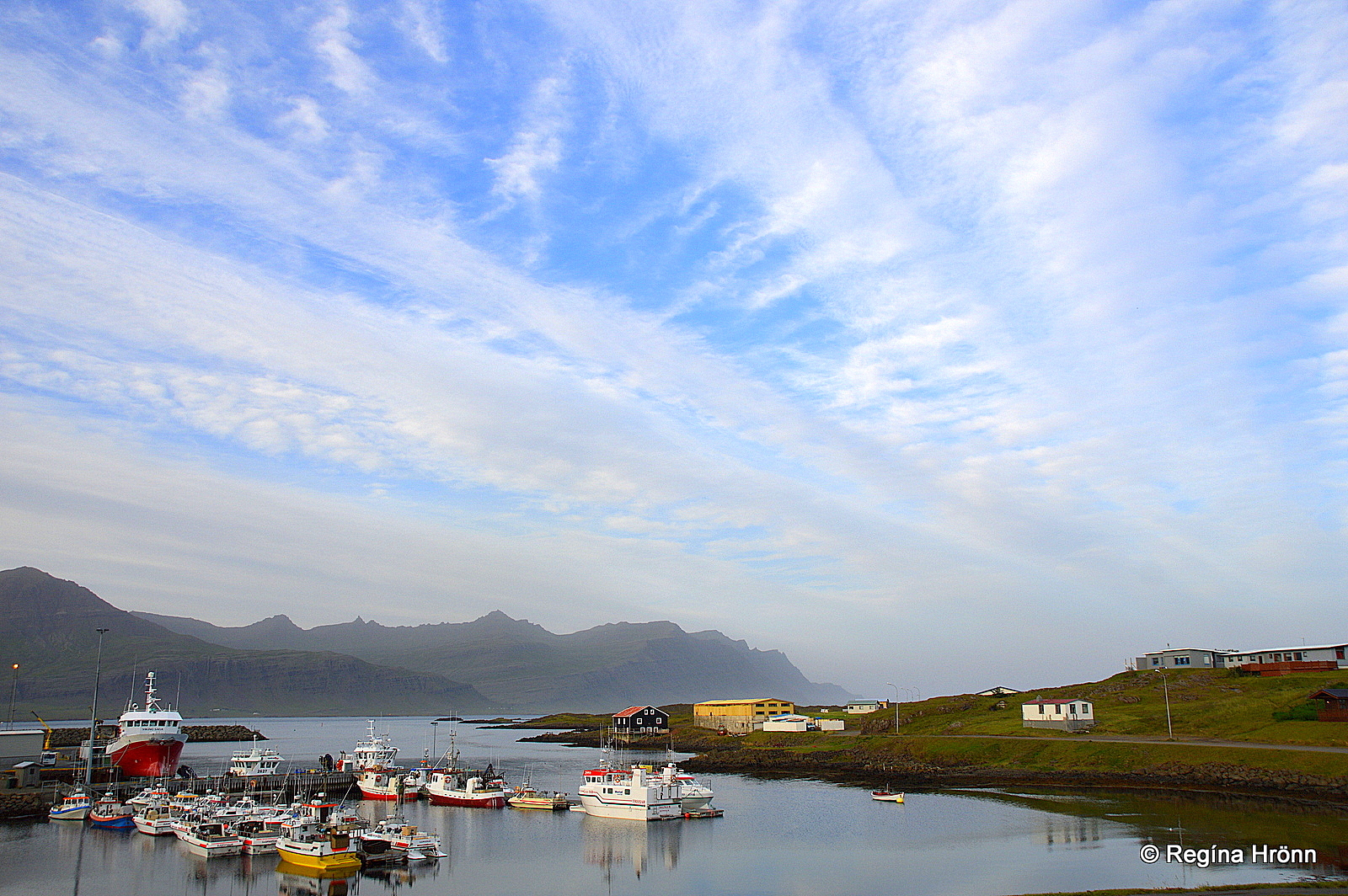
Höfn in Hornafjörður
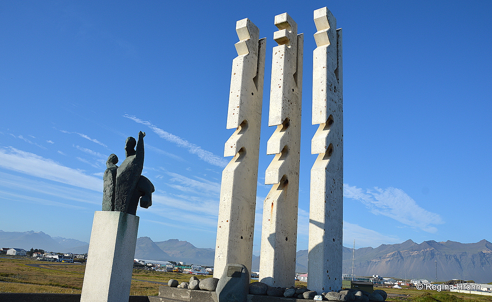
The memorial for fishermen and fishing
Höfn in Hornafjörður fjord is a vibrant fishing town on a peninsula on the very southeast corner of Iceland, with a population of approx. 1,710.
At Höfn you will find several good hotels, various restaurants, and museums. Tourism has become one of the main industries at Höfn along with fishing.
Höfn is often referred to as the lobster town of Iceland and the town festival is called Humarhátíðin – the Lobster festival.
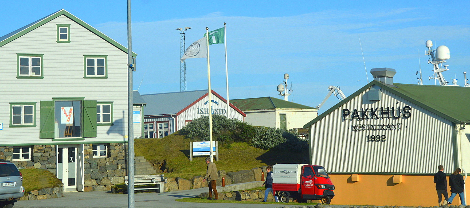
Höfn – Gamlabúð to the left
The Höfn Visitor center is located in an old renovated building called Gamlabúð – the Old Shop.
The view from Höfn is extraordinary, as here you will see several glacial outlets extending from the Vatnajökull glacier, Europe’s largest glacier by volume.
I have been showing you some of the icefalls from the Vatnajökull glacier in my previous travel-blogs like Skaftafell nature reserve, Jökulsárlón glacial lagoon, and the ice caves in Breiðamerkurjökull.
I visited the glacial lagoon by the glacier outlet Hoffellsjökull close to Höfn and took this video:
It was such an amazing experience as here we were alone and the only sounds that could be heard were the sounds of nature.
Now, let’s take a small detour from ring-road 1 and explore some picturesque mountains.
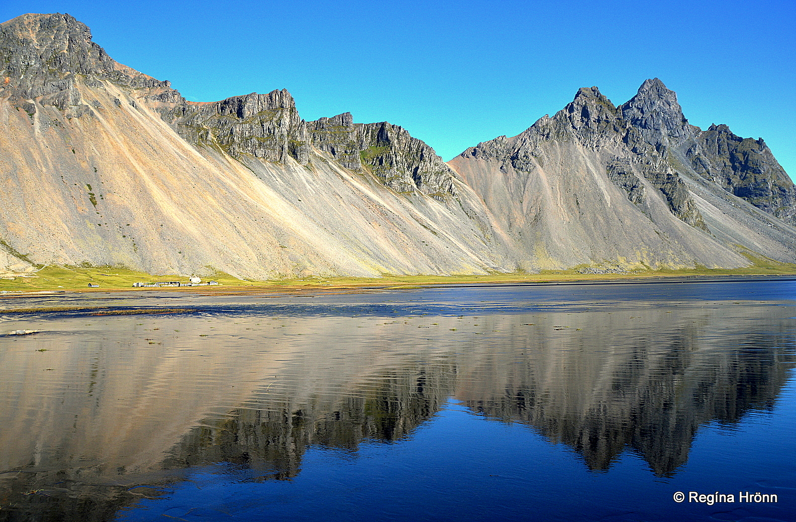
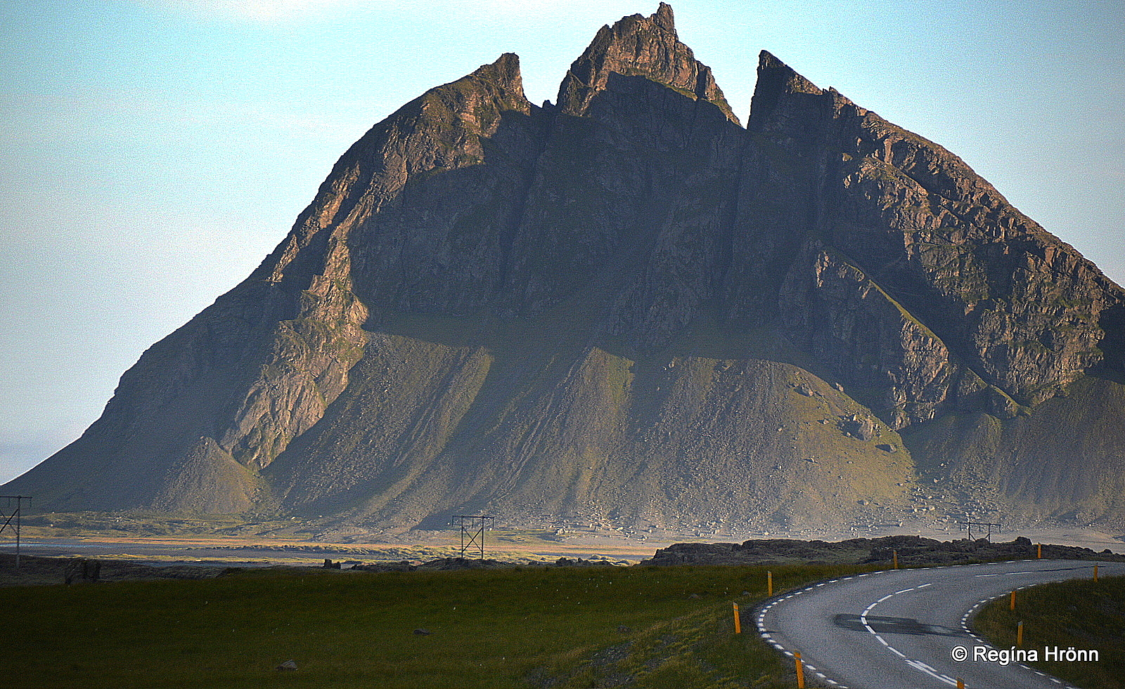
Mt. Vestrahorn and the Viking village movie set
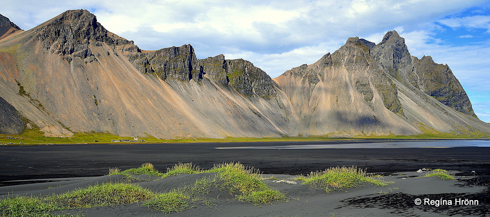
Mt. Vestrahorn
One of the major attractions close to Höfn is Mt. Vestrahorn and the Stokksnes peninsula. Mt. Vestrahorn is a 454 meters tall gabbro mountain with granophyre.
Mt. Vestrahorn is one of the 3 mountains which are prominent in this area, the other ones are Mt. Brunnhorn and Mt. Eystrahorn and collectively they are often referred to as the 3 horny mountains of Iceland.
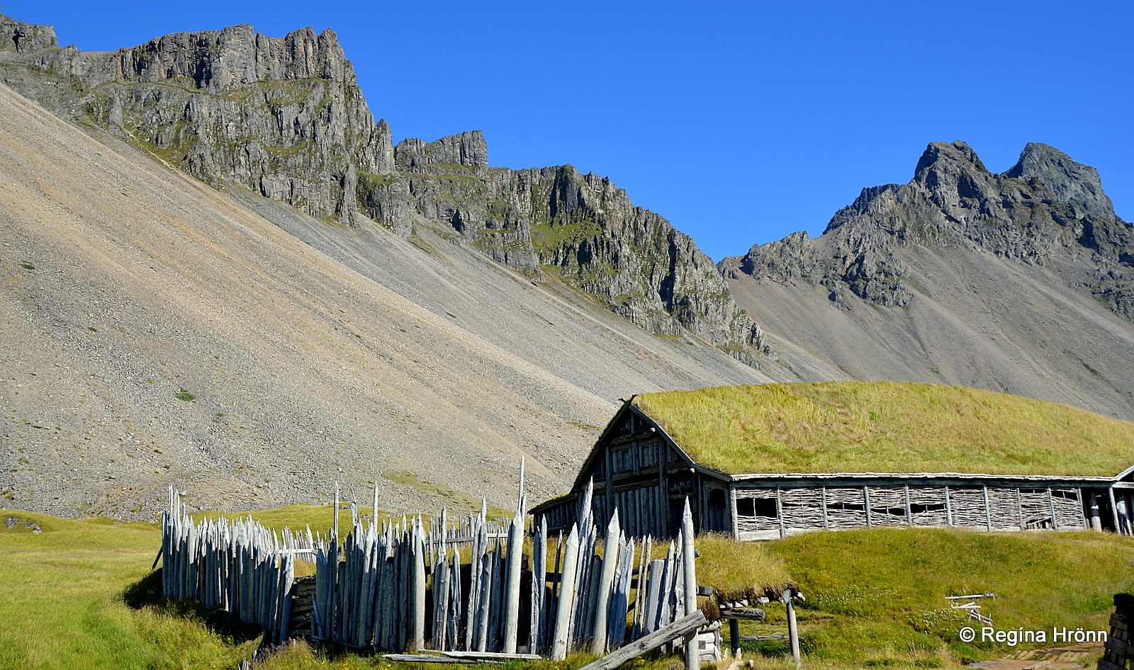
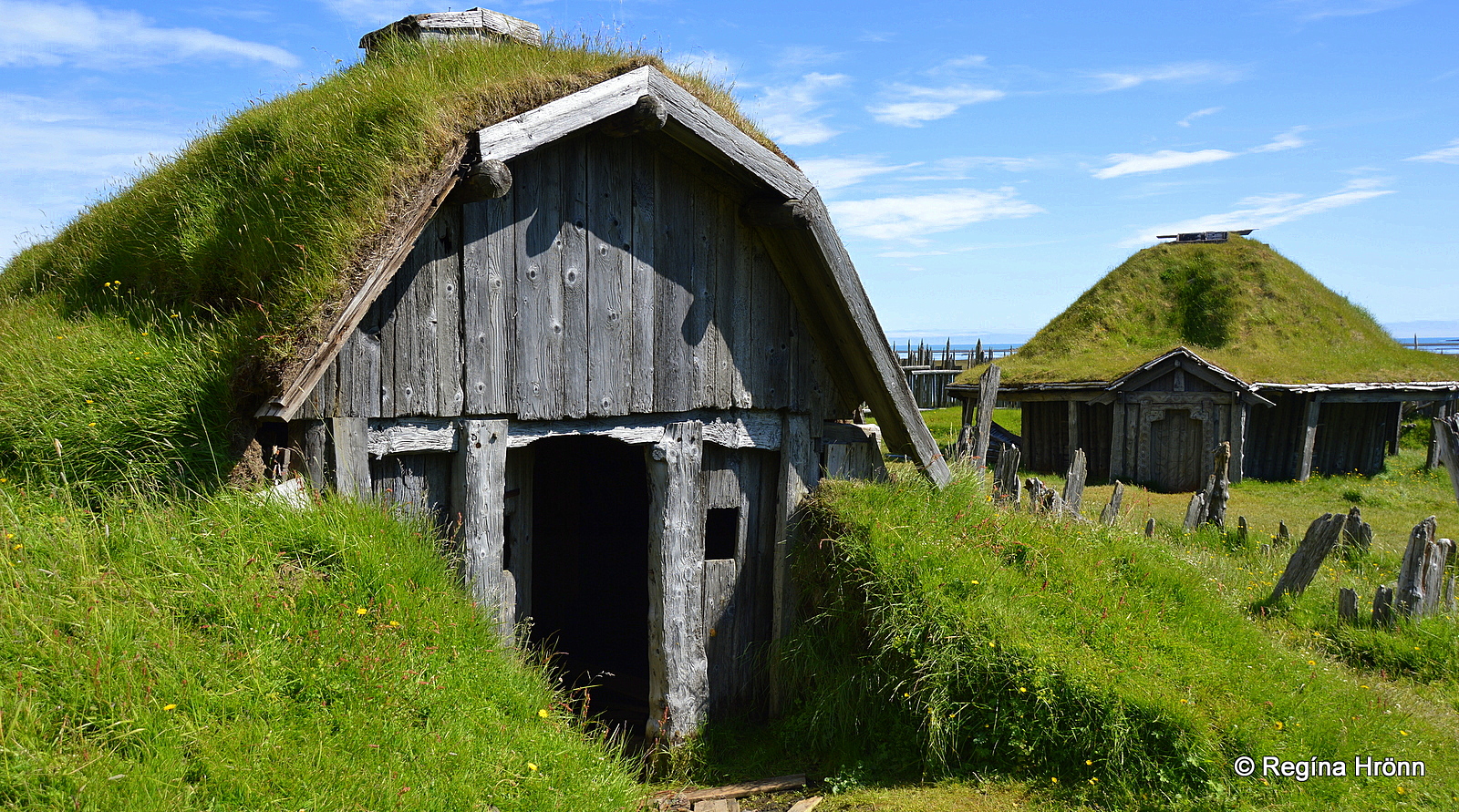
The Viking village movie set
There are some fantastic photo opportunities by Mt. Vestrahorn and at Stokksnes.
Right beneath the mountain, the remnants of a Viking village can be visited.
The Viking village is a movie set from 2009, and the shooting of the movie was supposed to start in 2010. It never took place and the Viking village is now a big tourist attraction.
Do be careful when visiting it as it is not maintained.
The Viking village movie set
There is a small entrance fee to Stokksnes and the Viking village which the owners use for the maintenance of the road.
After visiting the Viking village drive further down the road for good photo spots of the mountain. Seal spotting is also popular further down the road.
Here you will also see the restricted area of the radar station erected by the American army in 1955, in use until 1988. It is now operated by the Icelandic coast guard.
Mt. Vestrahorn
This is such a stunning location that I have visited it several times and stayed at the family-run Viking café guesthouse for the night to be able to photograph the mountains and the beautiful scenery in a different light.
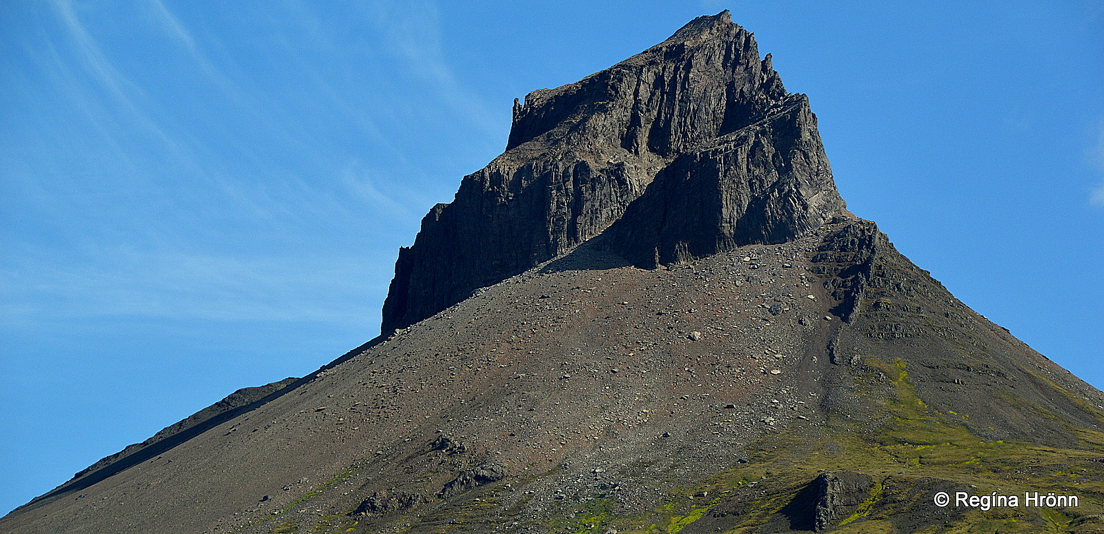
Mt. Brunnhorn – the Batman mountain
Mt. Brunnhorn
Coming from Höfn and driving north-east via the 1.3 km long Almannaskarðsgöng tunnel, which replaced the steep Almannaskarð pass, you enter East-Iceland with lovely little villages, steep mountains, screes, and roadside waterfalls.
As you drive along ring-road 1, you will notice the shape of Mt. Brunnhorn.
We are driving anti-clockwise so you will have to look back to notice this mountain. What does the shape of the mountain remind you of?
Skútafoss waterfall – the Hidden waterfall
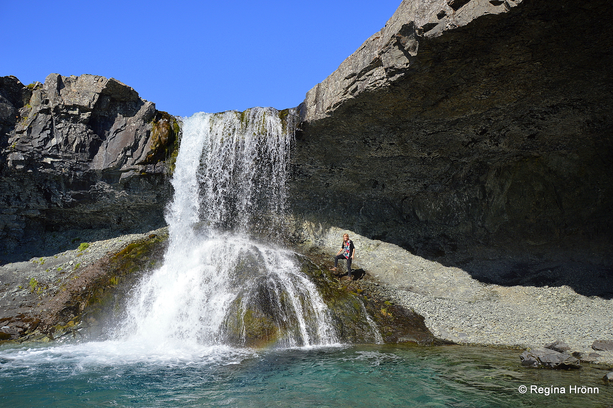
Skútafoss waterfall
A beautiful waterfall is hidden away in this area. It is an interesting waterfall well worth a visit.
The waterfall, which cascades in the Þorgeirsstaðaá river is called Skútafoss waterfall and is right off ring-road 1 on your left-hand side.
The waterfall cannot be seen from the ring road and it is not easy to spot where to turn from the ring road.
Skútafoss waterfall
A very course road leads to a parking lot. You can leave your car relatively close to the waterfall and a short hike will take you to Skútafoss waterfall.
The scenery here is amazing. The waterfall is named after a small cave (skúti in Icelandic) on its right-hand side.
It is possible to walk behind the waterfall to reach the other side of the river.
This waterfall used to be referred to as the Hidden waterfall, but now more and more people are visiting it due to its beautiful settings.
Mt. Eystrahorn and Hvalnes
Mt. Eystrahorn
After having driven through the beautiful landscape of Lón (Lagoon) between the Horns with many farms along the way, we will reach Mt. Eystrahorn and Hvalnes, which is one of the best-known mountains in the Eastfjords.
Mt. Eystrahorn, which is 756 meters tall, is made of granophyre and gabbro.
It is best to stop at Hvalnestangi spit by the Hvalnesviti lighthouse and walk down to the beach.
The farm you see in my photo below is called Hvalnes í Lóni. I stopped by the road to take this photo.
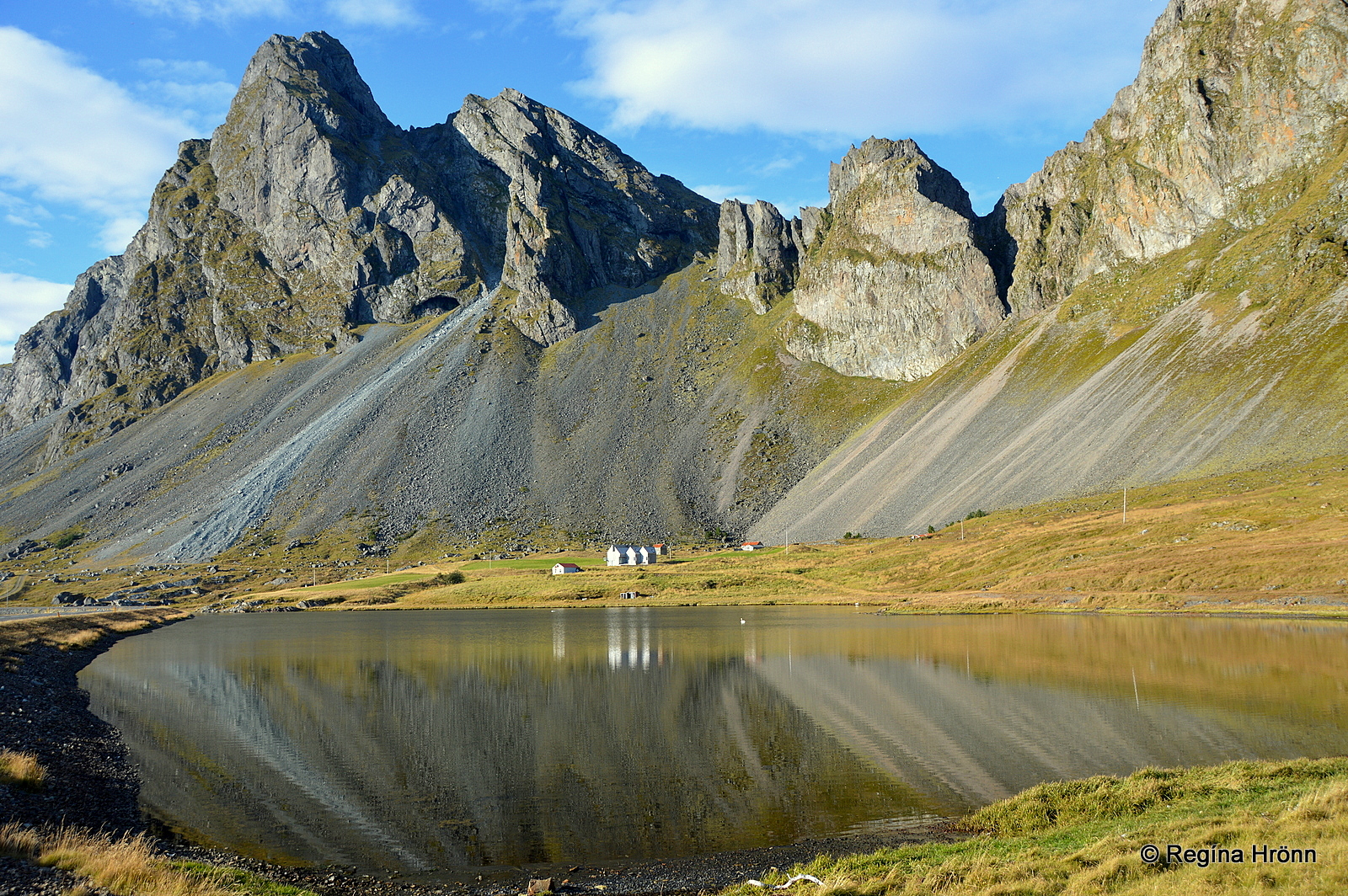
Hvalnes by Mt. Eystrahorn
I find this area of Lón so beautiful that I stayed for the night in a cottage at Stafafell midway between Mt. Vestrahorn and Mt. Eystrahorn – there is magic in the air in this area.
Now that we have entered the outpost of the Eastfjords it is best that I tell you about the notorious Austfjarðaþoka – the Fog of the Eastfjords, which can all of a sudden creep up on you.
Once while trying to get a decent photo of Mt. Eystrahorn, the fog crept up on me and ended up totally covering the mountain. So be prepared for that to happen while visiting the Eastfjords.
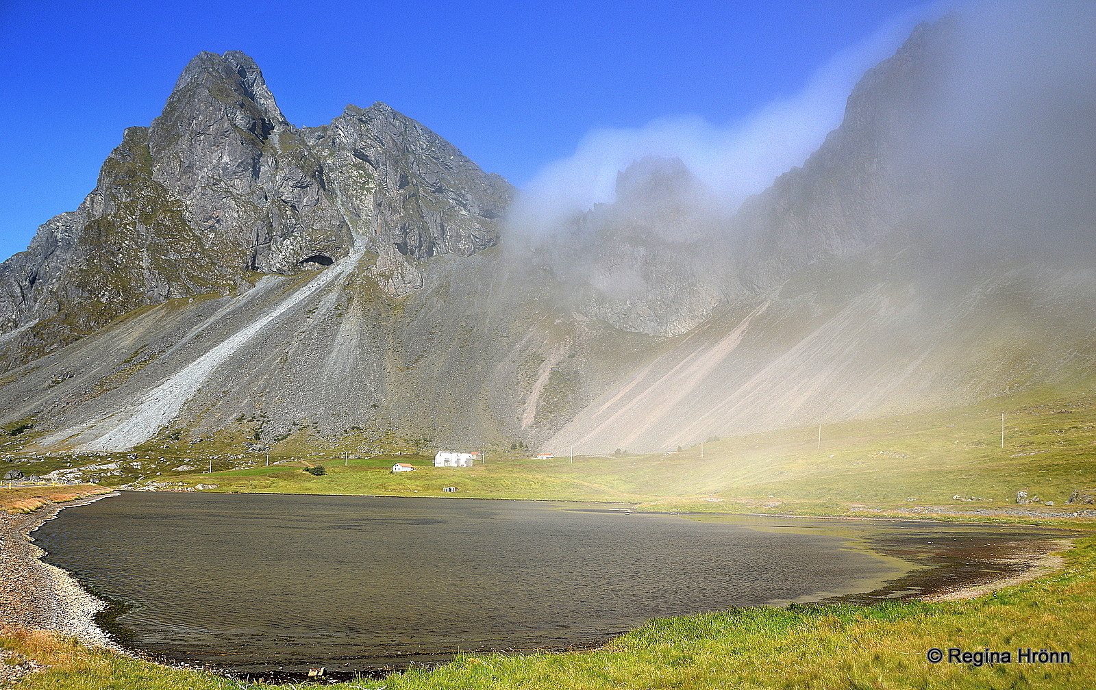
The fog of the Eastfjords
Now, let’s continue on our journey of the Eastfjords and drive through the Hvalnesskriður and Þvottárskriður screes. Beware of landslides in the screes.
A popular stop is at Stapinn in Stapavík cove by Þvottárskriður screes. The rock is approx. 20 meters tall.
The official website for East-Iceland marks this rock as one of the Instagram spots in the east.
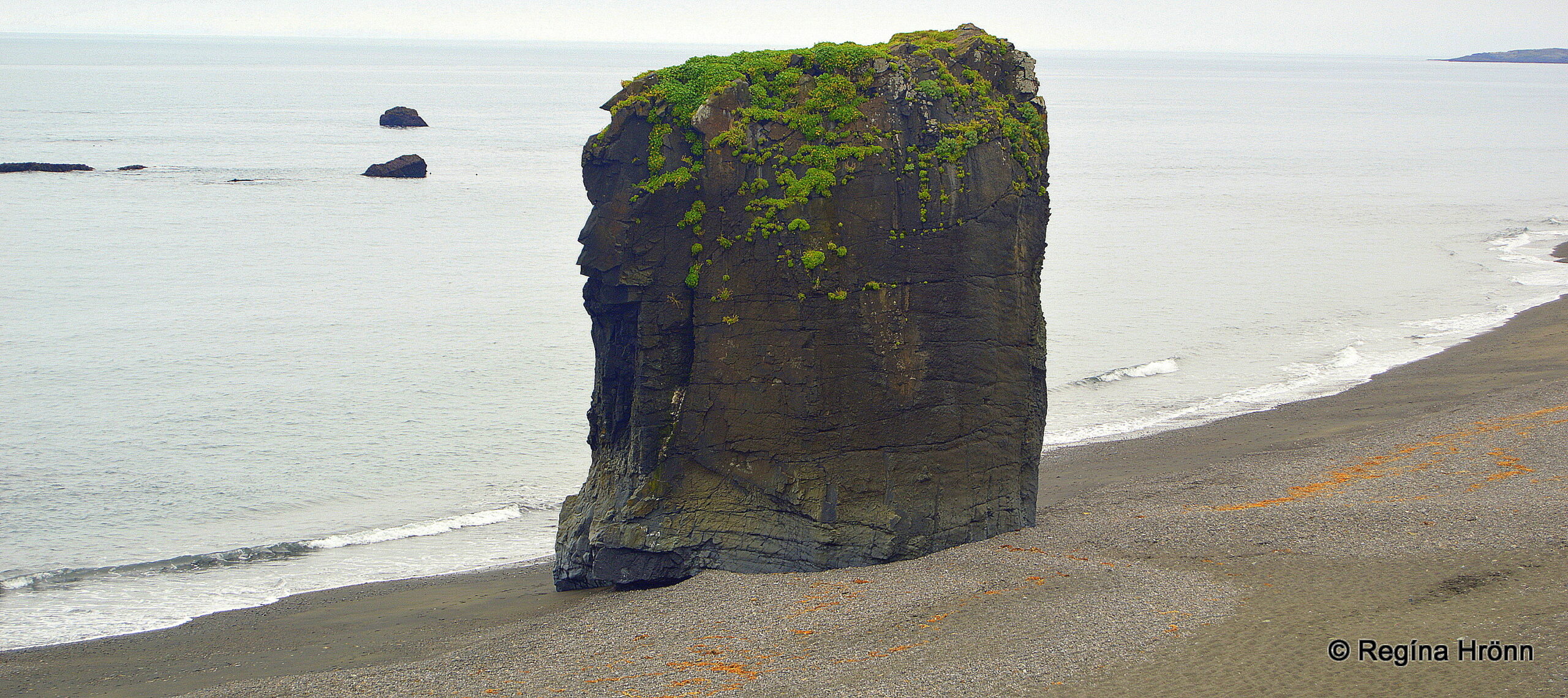
Stapinn rock
The next fjord is called Álftafjörður – the Swan fjord and you might see a myriad of swans in this area.
The first settler of Iceland, Ingólfur Arnarson, and his second cousin Hjörleifur Hróðmarsson, whom I told you about in my Hjörleifshöfði travel-blog, went on an exploration voyage before deciding on settling Iceland back in 874 (give or take a few years).
Ingólfur and Hjörleifur are believed to have spent the winter at Geithellnar in Álftafjörður bay.
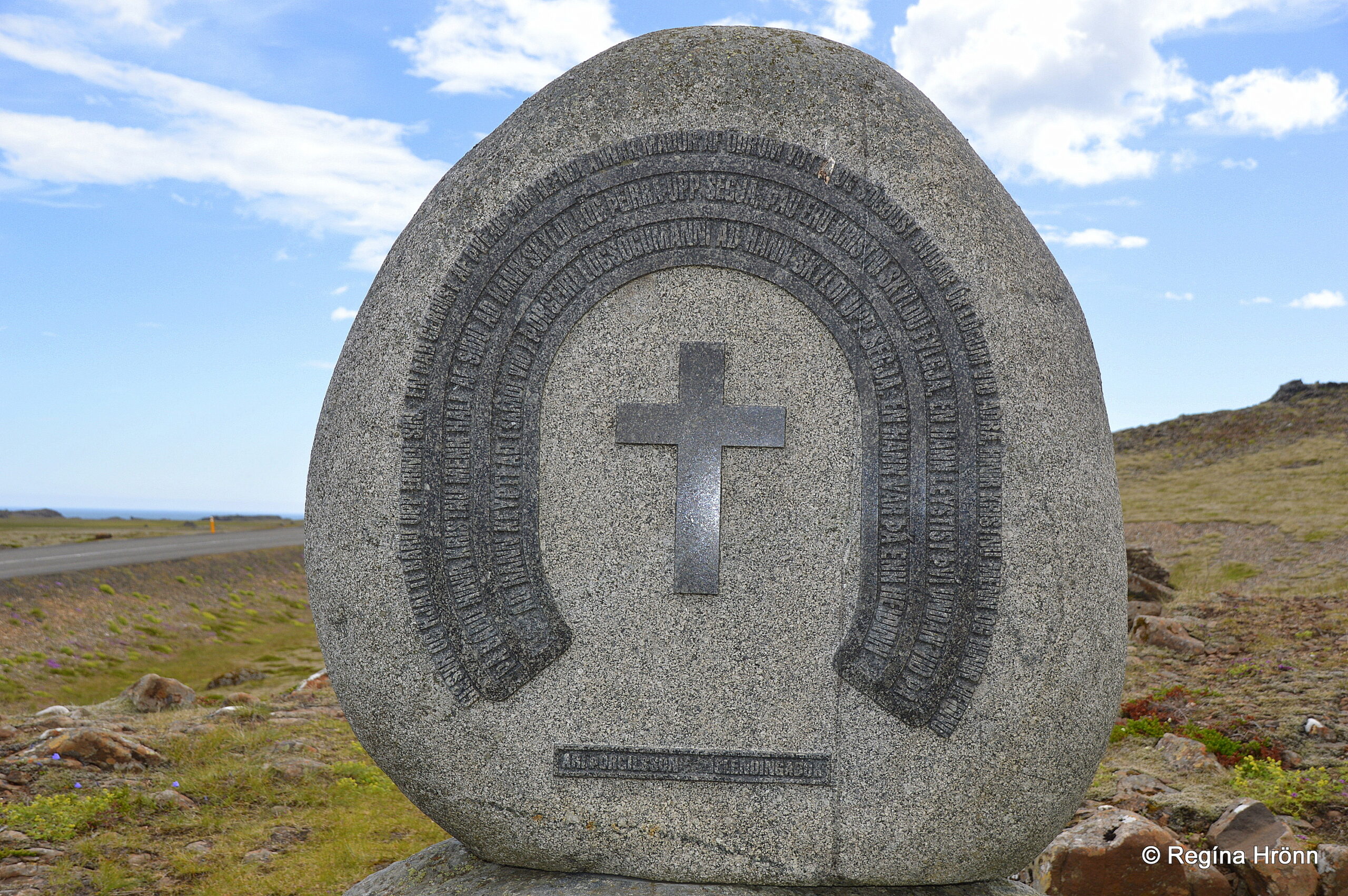
The memorial for the adoption of Christianity
At Þvottá í Álftafjörður the renowned Chieftain Síðu-Hallur lived around 1000. Síðu-Hallur is a well-known character from our Sagas.
When King Olav of Norway sent the priest Þangbrandur to Iceland to convert Icelanders to Christianity, Síðu-Hallur got baptized in the river with his household, which from then on got the name Þvottá (Wash river).
Síðu-Hallur was instrumental in the adoption of Christianity in the year 1000 at Þingvellir parliament.
A memorial for the adoption of Christianity of Iceland is right by the road.
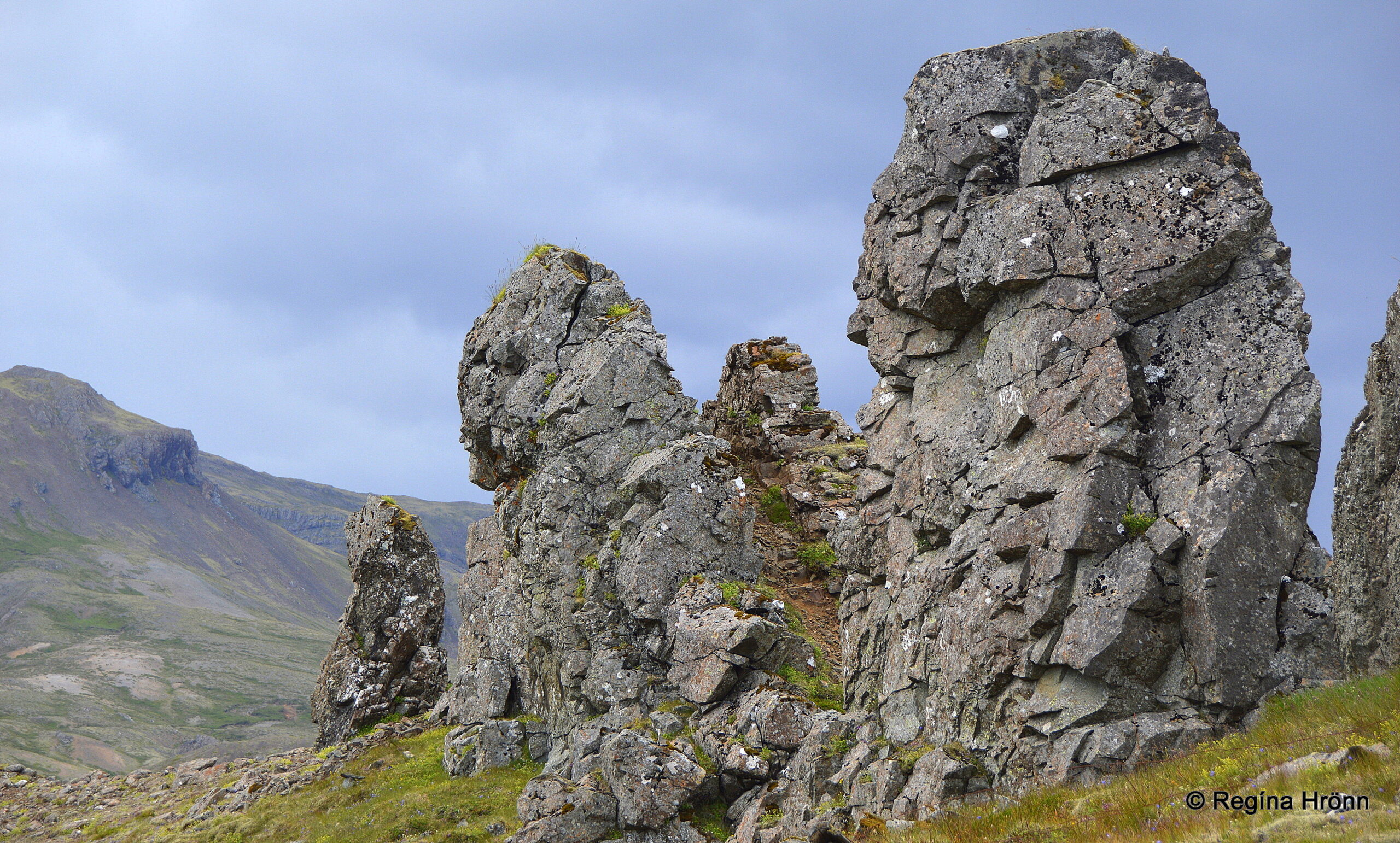
Eastfjord trolls
This area is filled with the most amazing dykes and rock formations, so it is well worth it stopping by the memorial and having a look around.
Our folklore is filled with troll stories and you will understand why when you see the trolls in this area.
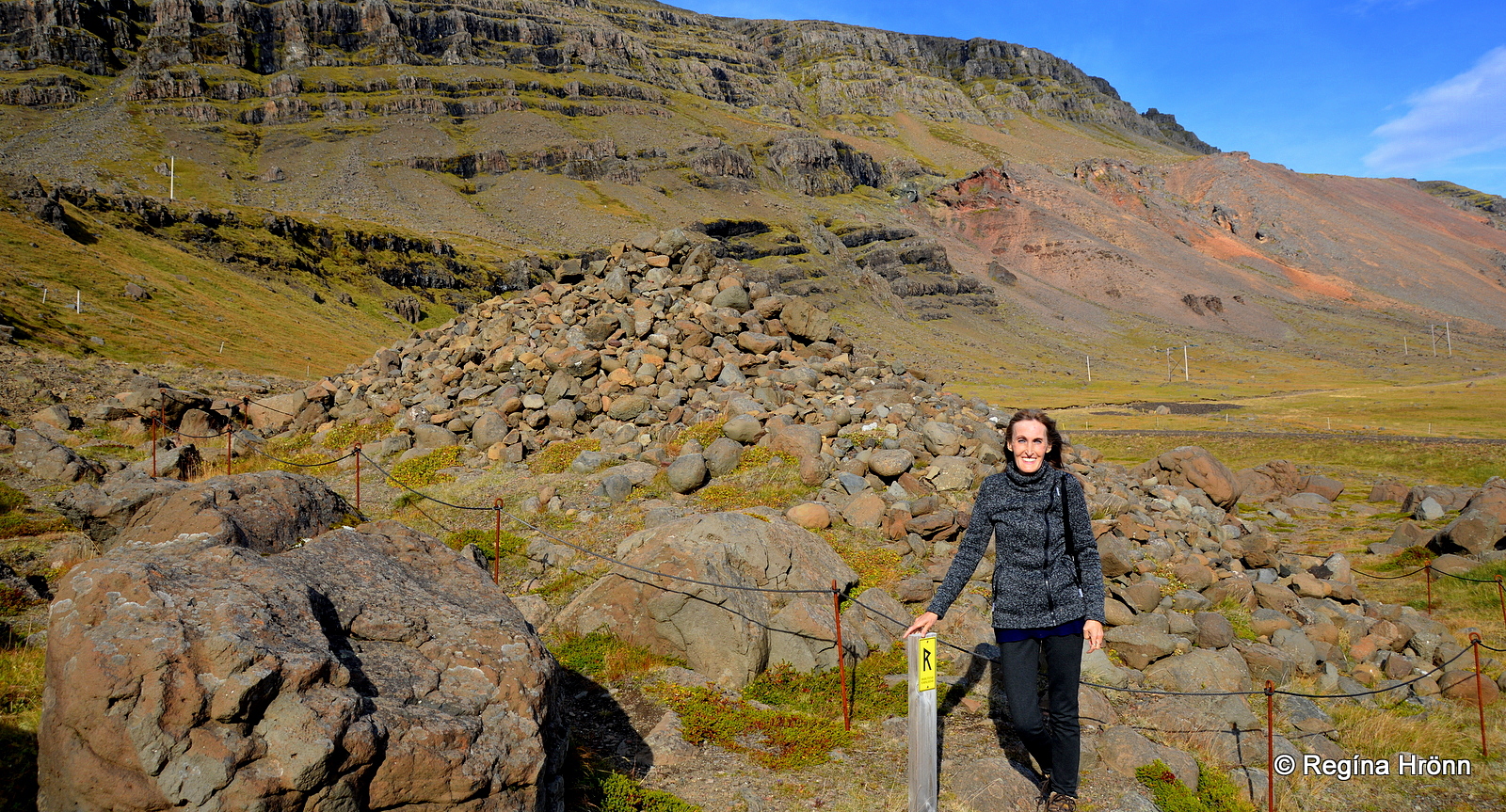
A huge stone pile might (or might not) catch your eye in the next fjord, Hamarsfjörður fjord.
Djáknadys burial mound in Hamarsfjörður
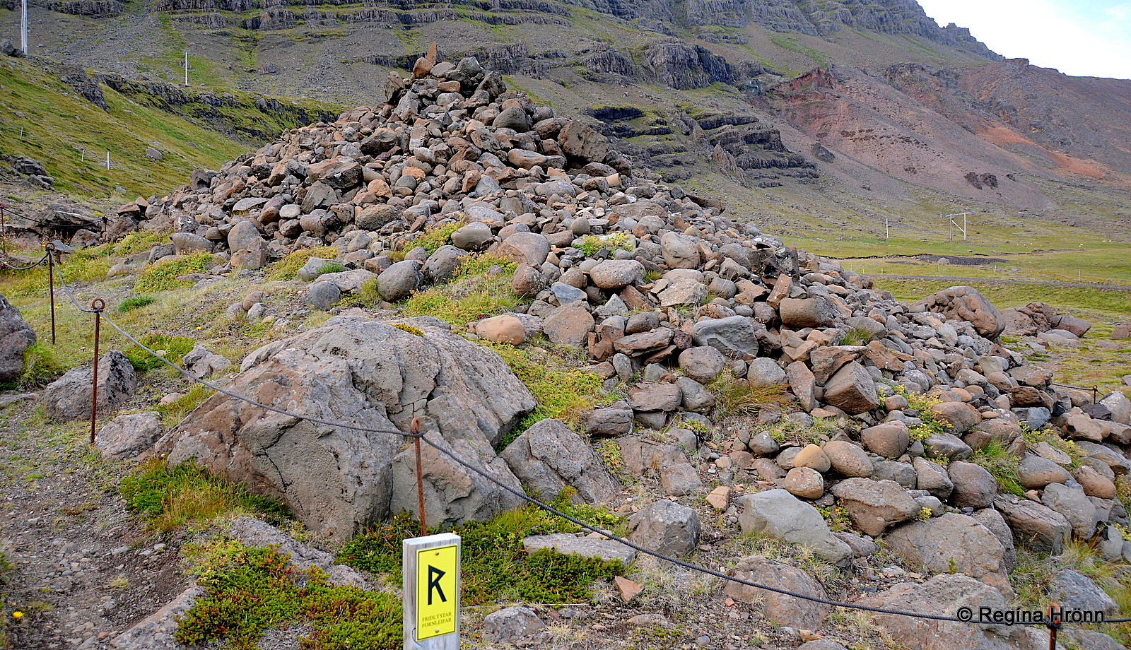
Djáknadys burial mound
The pile of stones is a burial mound called Djáknadys – Deacon’s burial mound.
At this spot, according to legend, the deacon of Hamar and the pastor of Háls fought to the death. They were buried here and thus the burial mound got its name – the Deacon’s burial mound.
According to tradition then every traveler who passes by the burial mound for the first time is obliged to throw a stone onto the burial mound.
And one stone for dogs or horses in their company. Thus the burial mound constantly grows in size.
Djáknadys
If you don’t throw a stone to the burial mound you will lose your way, or so the legend states. So better obey and throw a stone and pay homage to the dead.
We don’t know when the pastor and the deacon fought or why they were fighting, but Djáknadys has been a protected heritage site since 1964.
The yellow sign indicates that this is a protected site. If you are interested in burial mounds and archaeological sites in Iceland then I have written another travel-blog about the sites I have visited: Viking ruins and Burial mounds I have visited on my travels in Iceland.
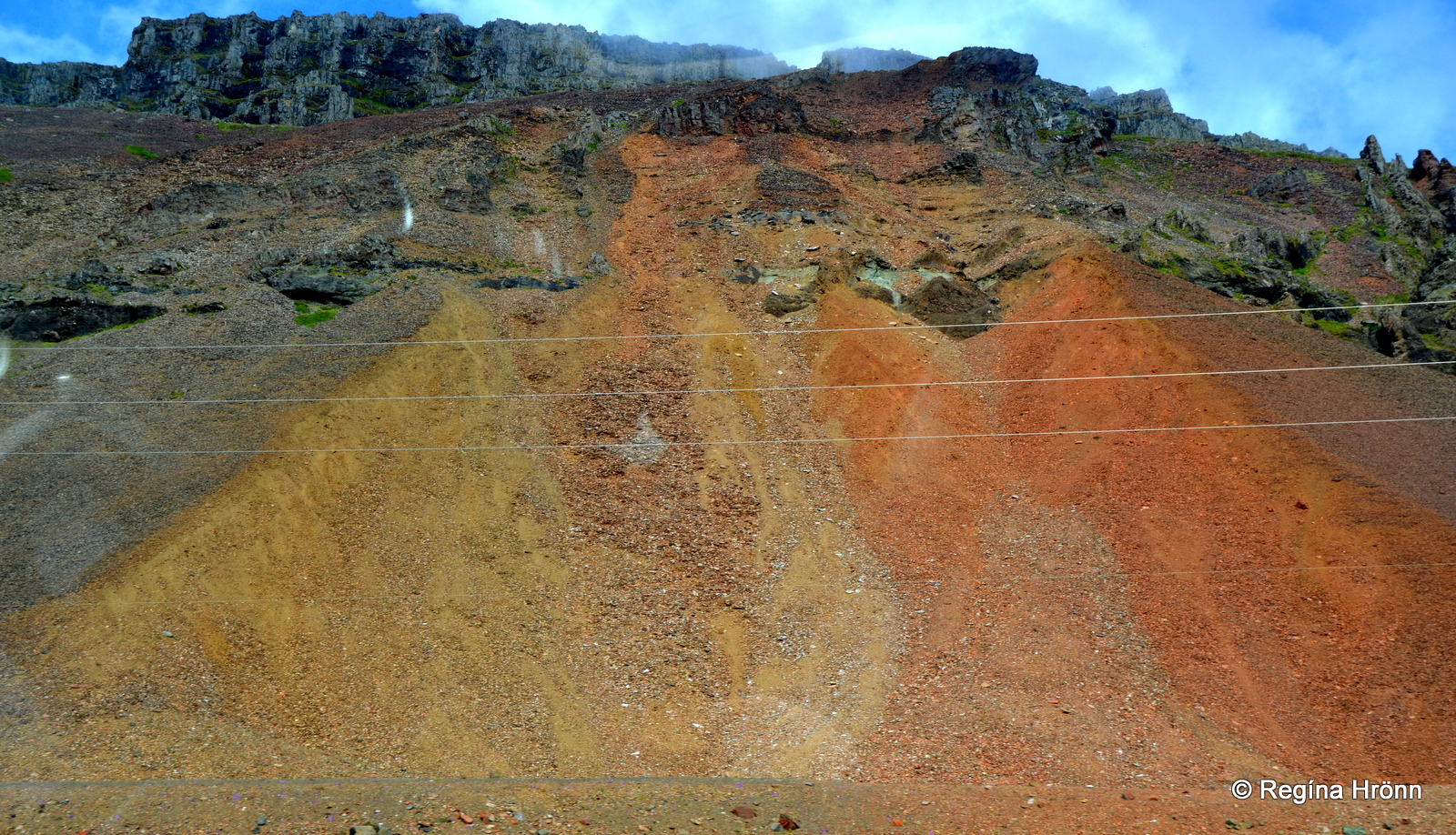
Rauðaskriða – the Red Scree
Behind me, in the photo of the burial mound, you will see Rauðaskriða – the Red Scree, which is scree with yellow, orange, and red hues.
We will be driving by many screes in the Eastfjords, some of which a really steep.
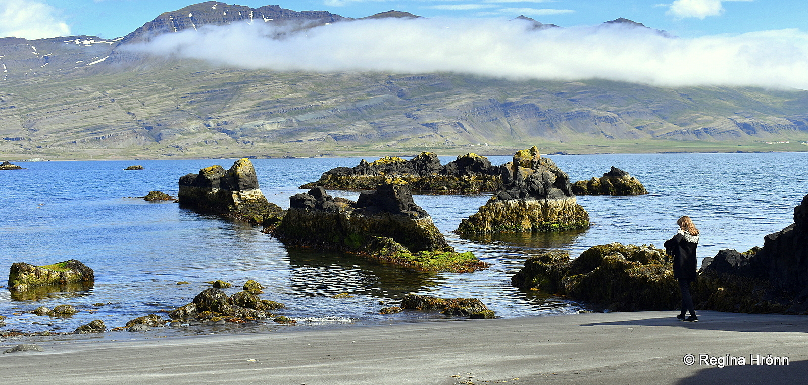
Now, let’s visit the lovely little village Djúpivogur, which is located on a peninsula between Hamarsfjörður and Berufjörður fjords.
Djúpivogur village and the Eggs at Gleðivík bay
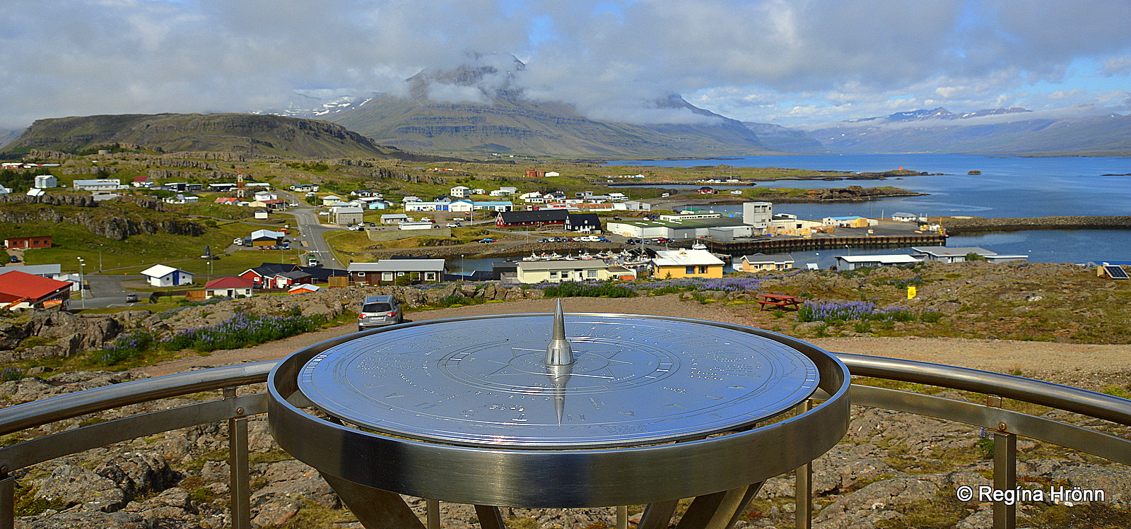
The view-dial at Bóndavarða and Djúpivogur
The inhabitants of Djúpivogur village are approx. 450.
This lovely little fishing village, which is a part of the Cittaslow network, has a history of trading since 1589 with both Danish and German (Hansa) traders.
Prominent in this area is the pyramid-shaped mountain Búlandstindur at 1069 meters. And just outside Djúpivogur village, you will spot Papey, the biggest island in the east.
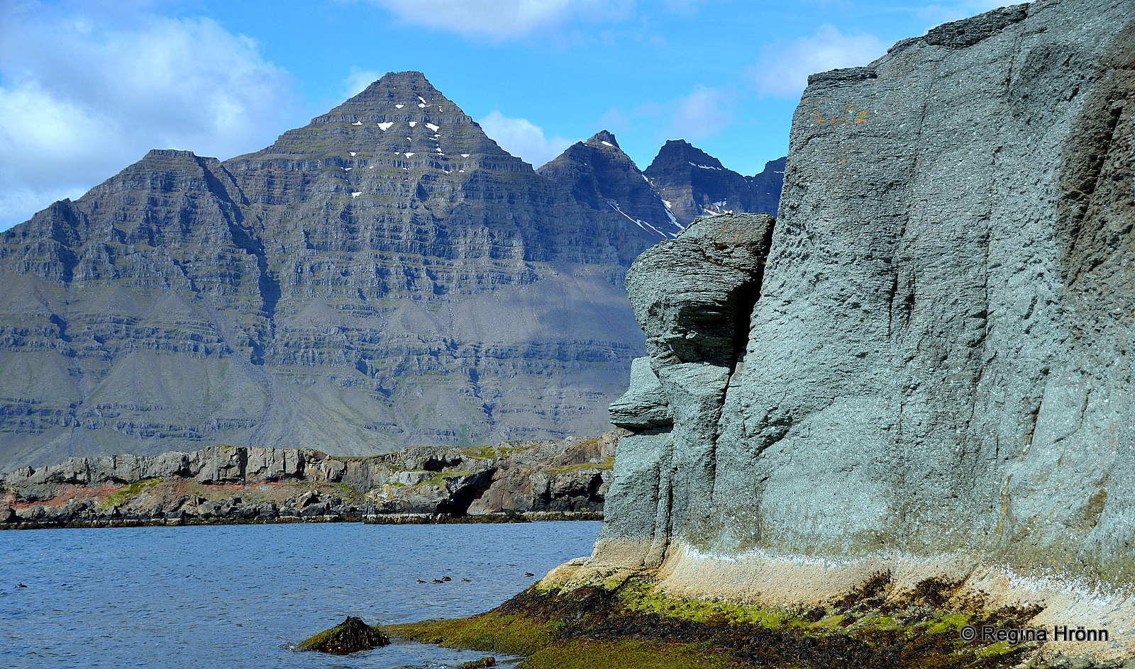
Mt. Búlandstindur as seen from Blábjörg cliff
Mt. Búlandstindur is one of Iceland’s most beautifully shaped mountains and the symbol of Djúpivogur.
The locals believe that Mt. Búlandstindur has got some supernatural powers and that it is an energy center like Snæfellsjökull glacier on the Snæfellsnes peninsula in West-Iceland.
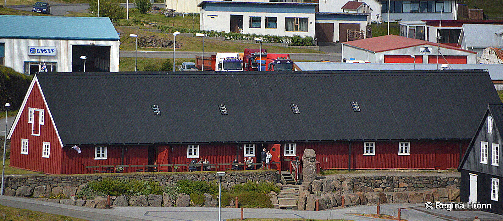
Langabúð built in 1790
The oldest house in Djúpivogur is the red-painted Langabúð, which was built out of logs in 1790.
It now serves as the Cultural center of Djúpivogur. In Langabúð you will find a coffee shop and local craft gallery and a museum of the art of the well-known Icelandic sculptor Ríkarður Jónsson.
Another good museum in Djúpivogur is Auðunn’s Stone & Mineral collection, with a great selection of extraordinary rocks from the Eastfjords.
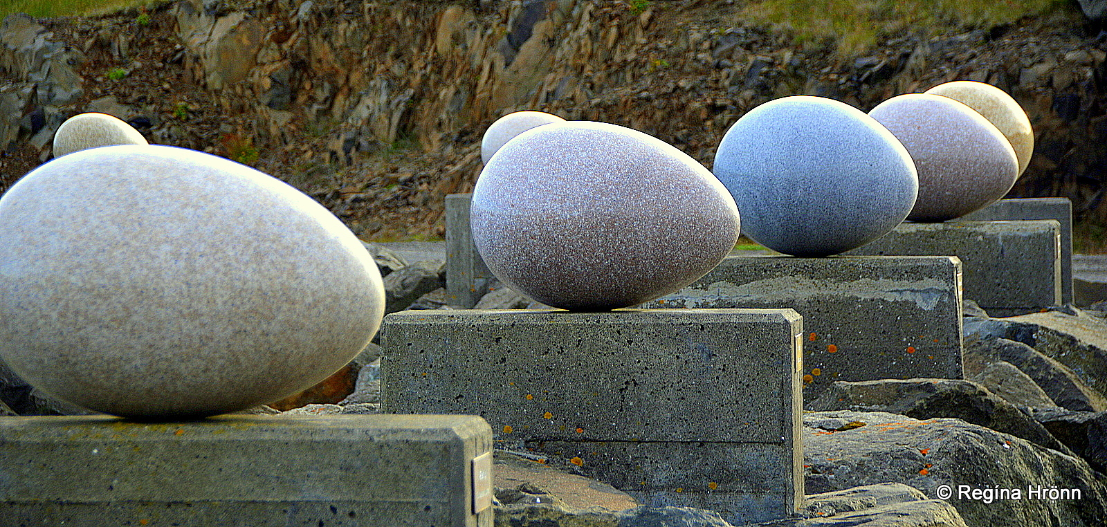
The Eggs at Gleðivík bay
The biggest attraction in Djúpivogur is an artwork in a small bay, hidden away from sight when you visit the village.
The artwork is called Eggin in Gleðivík – the Eggs at Merry bay. It was created by the Icelandic visual artist, Sigurður Guðmundsson, who has received international awards for his visual artwork.
The artwork is 34 large granite eggs, representing the eggs of each of the nesting birds in this area.
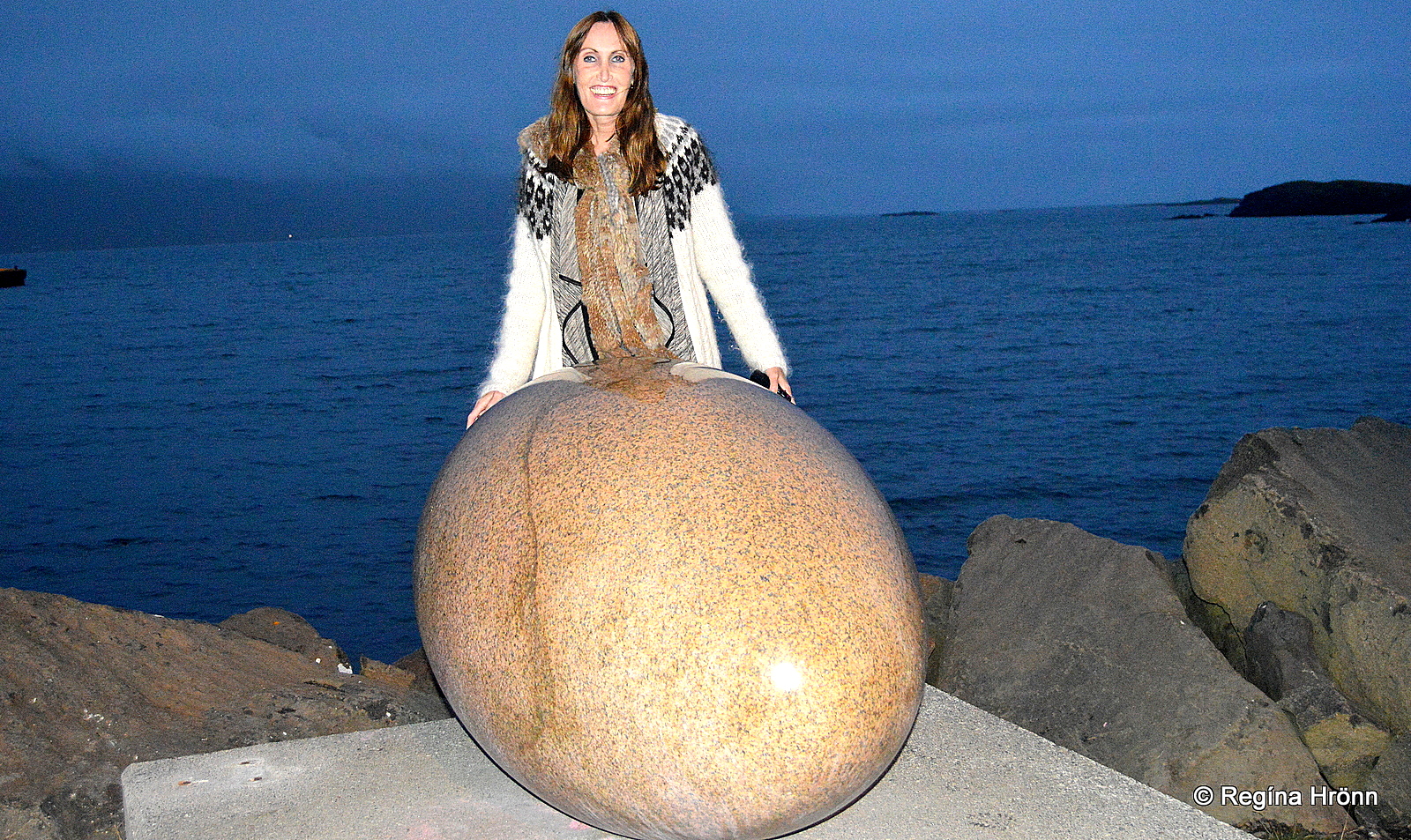
The biggest egg
The eggs are an exact replica of the eggs of the birds – only oversized as you can see in my photo above.
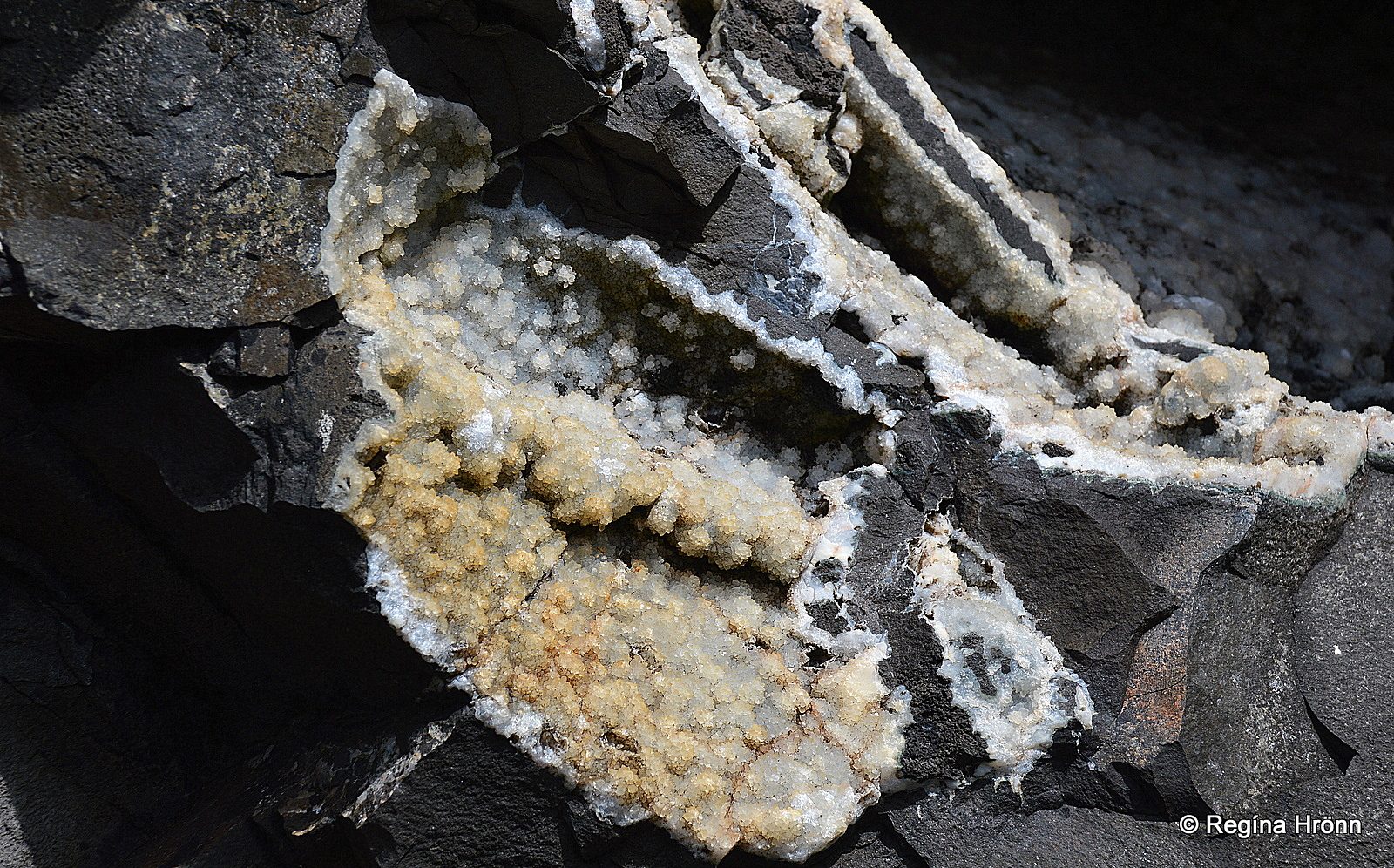
Teigarhorn and the Zeolites
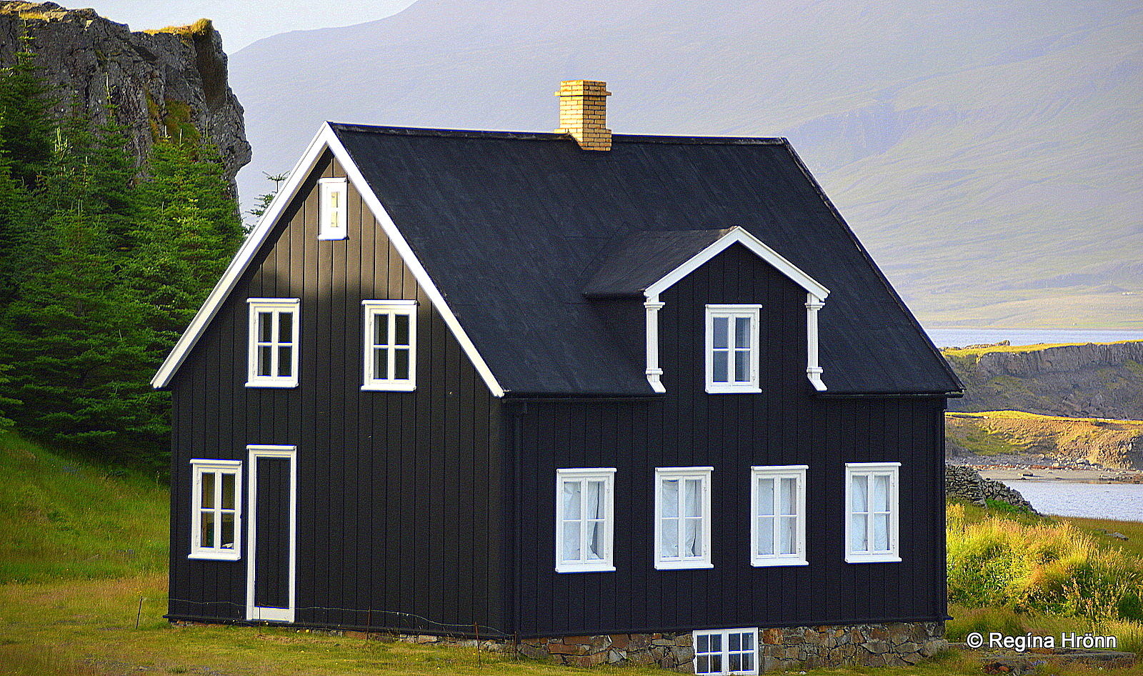
The black house at Teigarhorn
Our next stop is at Teigarhorn in Berufjörður fjord which is only 4 km away from Djúpivogur.
From ring-road 1 you will notice the beautiful black house built in 1880-1882. This house is now a part of the Buildings Collection of the National Museum of Iceland.
Teigarhorn was created in a volcanic eruption some 9-10 million years ago. It is world-famous for having one of the largest selections of zeolite crystals in the world.
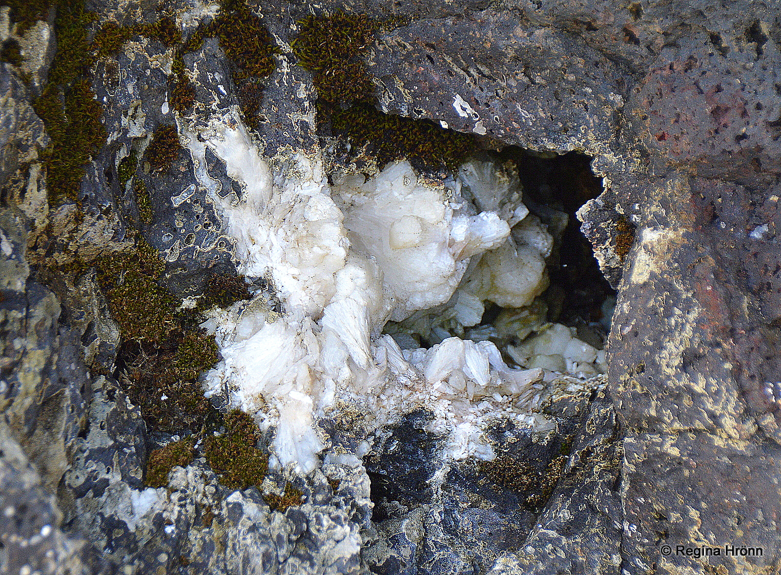
Zeolites at Teigarhorn
There is a beautiful short walk to the shore where you can have a look at the zeolites.
Unfortunately, a huge amount of zeolites have been removed and there are instances of people coming at night with tools to remove the zeolites.
Zeolites at Teigarhorn
Thus the zeolites at Teigarhorn have been protected as a natural monument since 1976 and there is a supervisor on site.
In the sea at Teigarhorn, you will also see a myriad of dykes, which are remnants of the many volcanic eruptions in this area.
Dykes at Teigarhorn
It is a beautiful location and I would recommend stopping here to have a look around and follow the circular path.
Now, let’s have a look at another waterfall in Berufjörður fjord, which is my favorite fjord in East-Iceland.
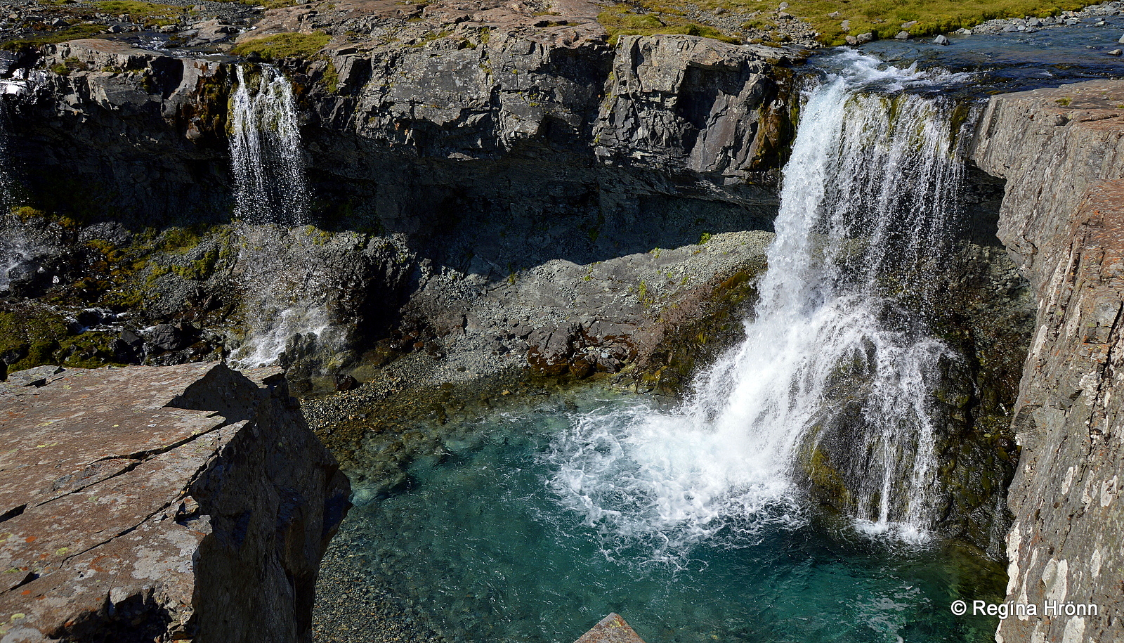
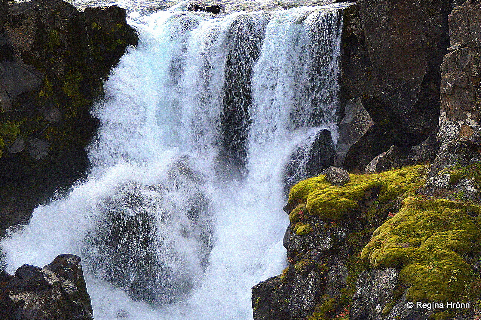
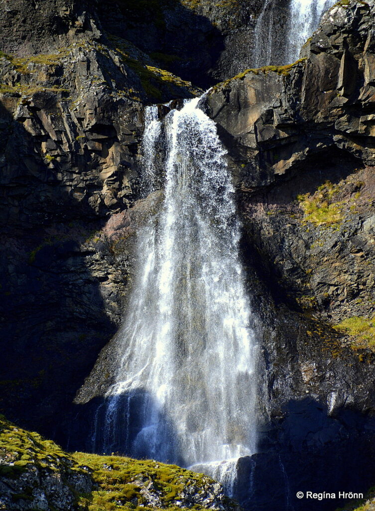
Nykurhylsfoss waterfall
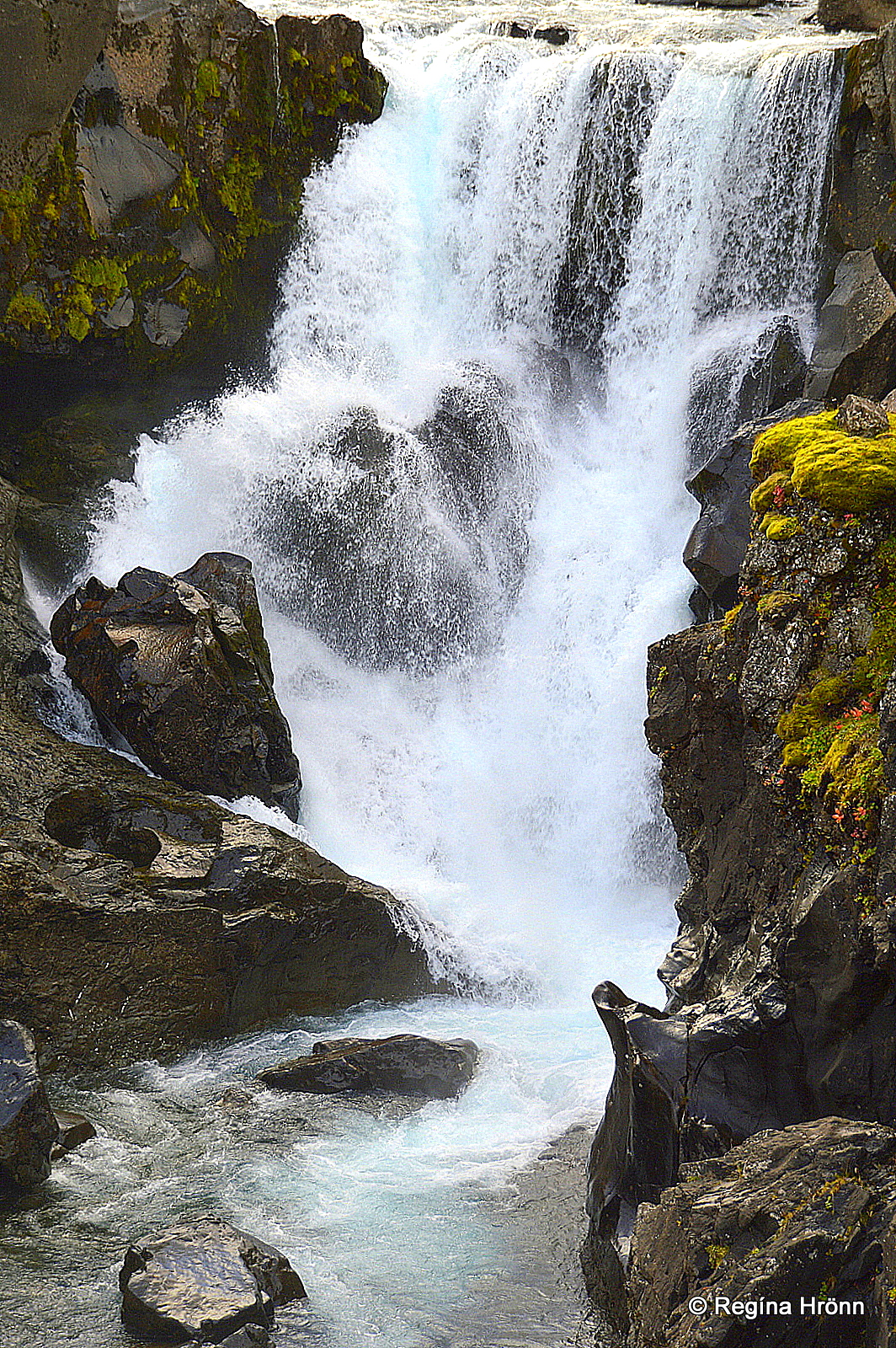
Nykurhylsfoss waterfall
The river Fossá runs from Lake Líkárvatn through Fossárdalur – the Valley of the Waterfalls and creates approx. 30 waterfalls in the 20 km long valley.
Nykurhylsfoss – a.k.a. Sveinsstekksfoss waterfall is the last waterfall in Fossá in Fossárvík in Berufjörður.
The waterfall is not tall, only 16 m, but it is well worth a visit.
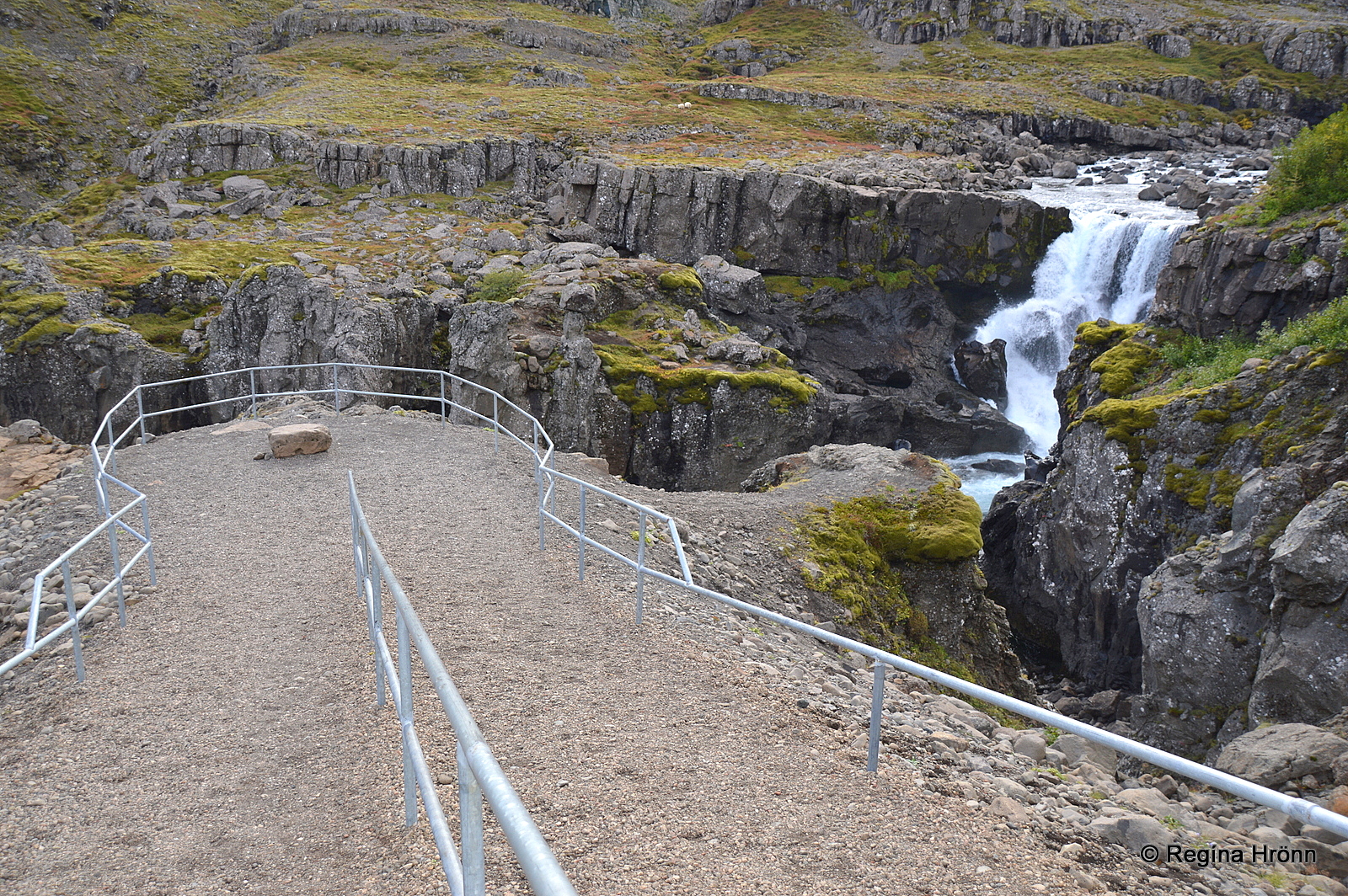
There is good access to the waterfall
Legend is related to this area:
Once upon a time the farmers in Fossárdalur valley, close to Djúpivogur, were slaughtering their livestock. For some reason, they went away for some time and left a half-flayed horse.
When they came back the horse was gone. From that day on people started noticing a kelpie (nykur) in a pool below the last waterfall (Nykurhylsfoss) of the Fossá river which runs through the valley.
Nykurhylsfoss waterfall
Later on, a child was baptized in Fossárdalur valley. The holy water from the baptismal font was poured into the Fossá river.
The baptismal water drove the kelpie away and it moved away from the river and into the Berfjörður fjord. People say that he still lives there.
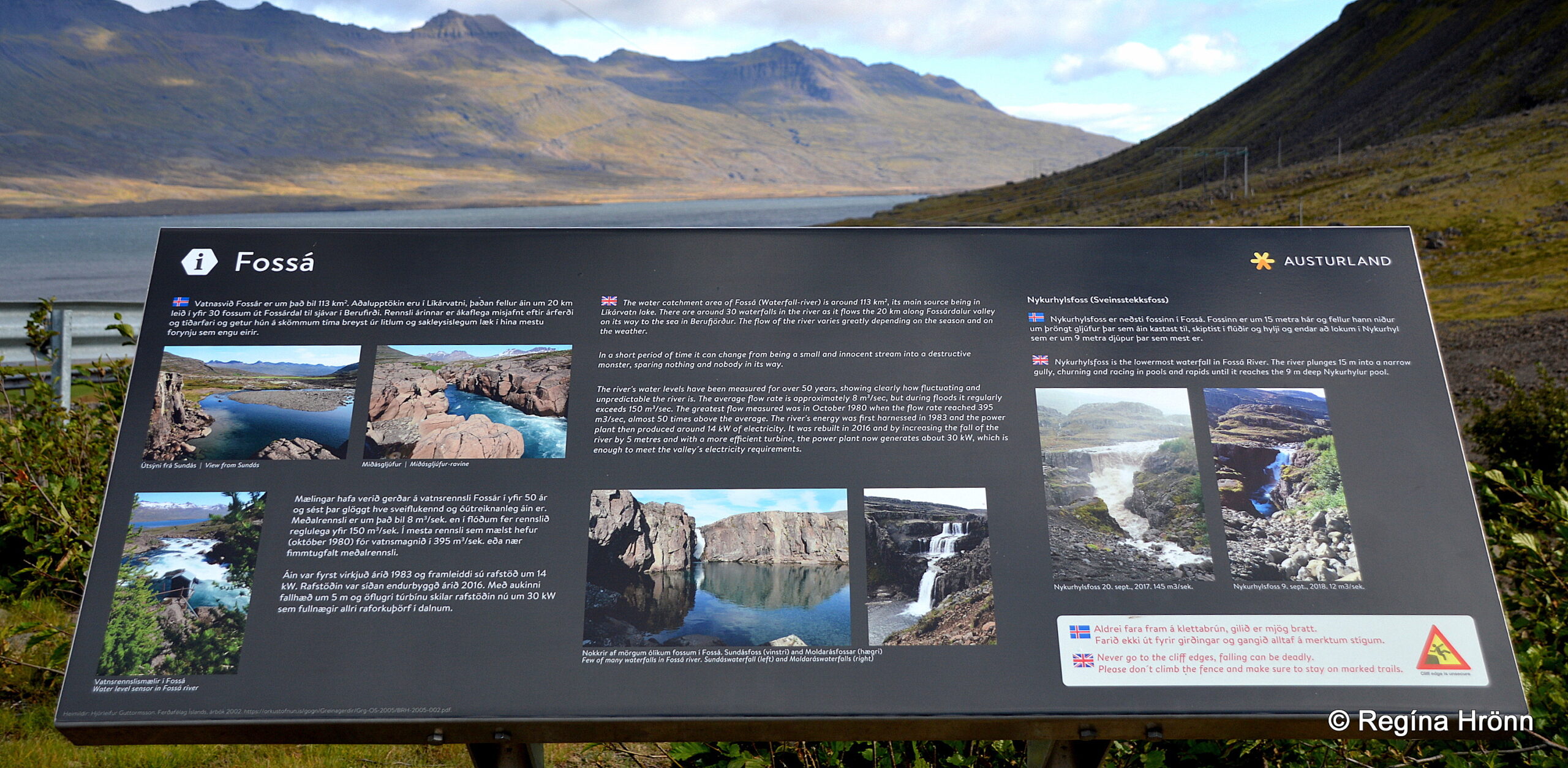
The information sign
It is possible to make a shortcut to Egilsstaðir town via the steep Öxi (Axe) heath, but we are going to explore the picturesque Eastfjords in this travel-blog, so we carry on driving on ring-road 1.
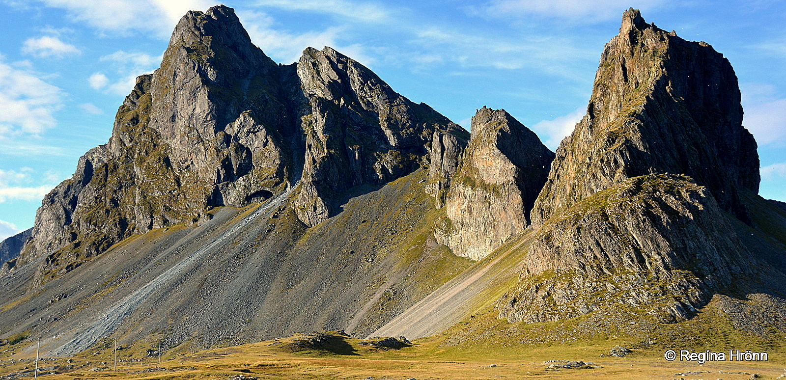
The Berufjörður mountains
Mountains in Berufjörður
The Eastfjords mountains are quite spectacular, and my favorite ones are here in Berufjörður fjord.
In Berufjörður you will see Mt. Búlandstindur and peculiar mountain peaks and beautifully shaped mountains like the shapely Mt. Stöng in my photo above.
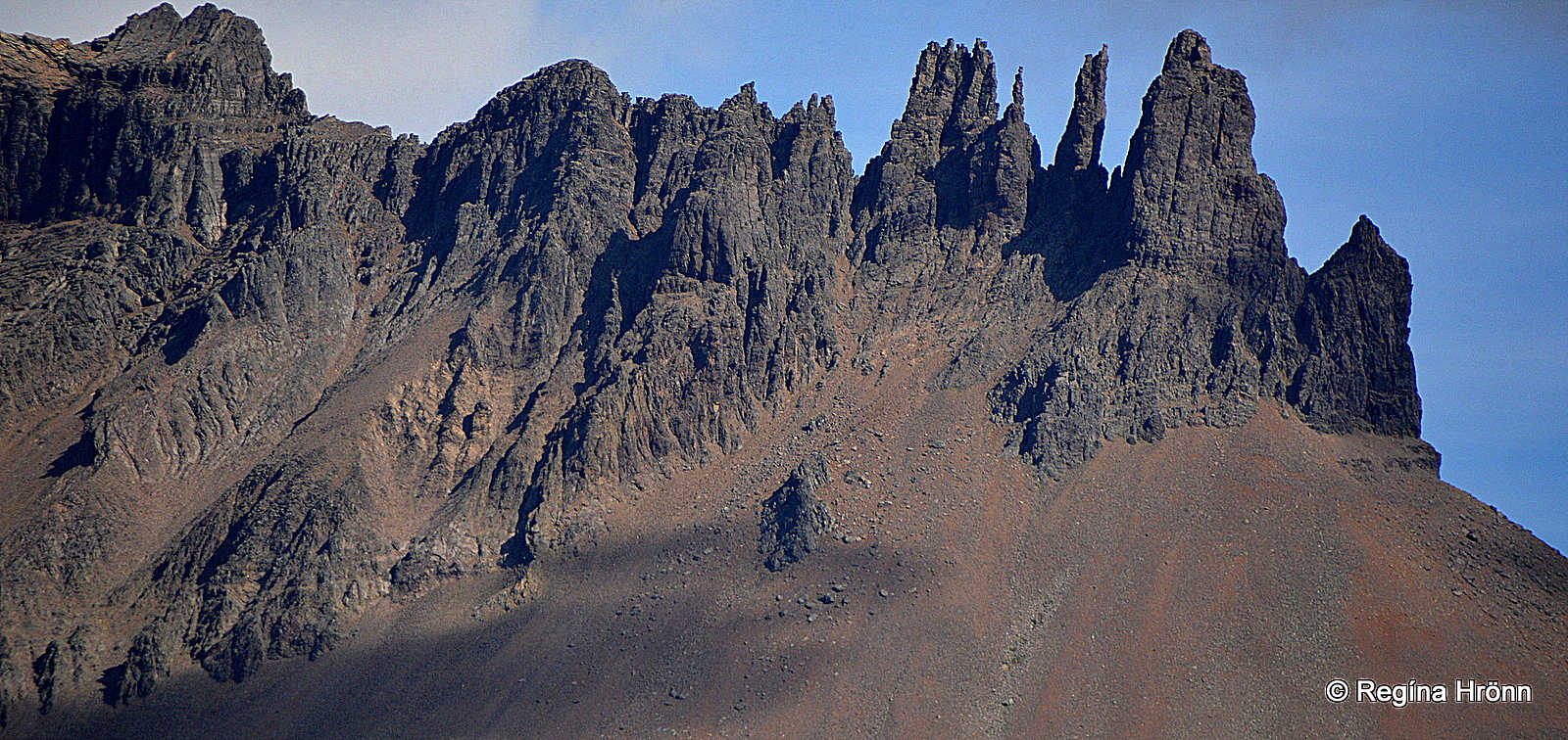
Berufjarðartindar mountain peaks
I cannot take my eyes off the mountains in Berufjörður when we are driving in this area. I hope you will get clear skies during your visit 🙂
You might notice that the mountains in the Eastfjords lean to the west to the center of Iceland. The Westfjord mountains on the other hand lean to the east.
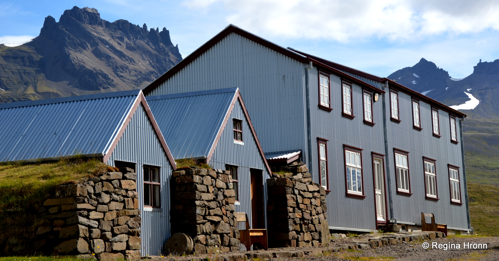
The old Berufjörður farm
Also of interest in this area is the old Berufjörður farm, and the small church, Berufjarðarkirkja.
There are 2 old timber churches here in Berufjörður, Berufjarðarkirkja and Beruneskirkja churches, both of which were built in 1874.
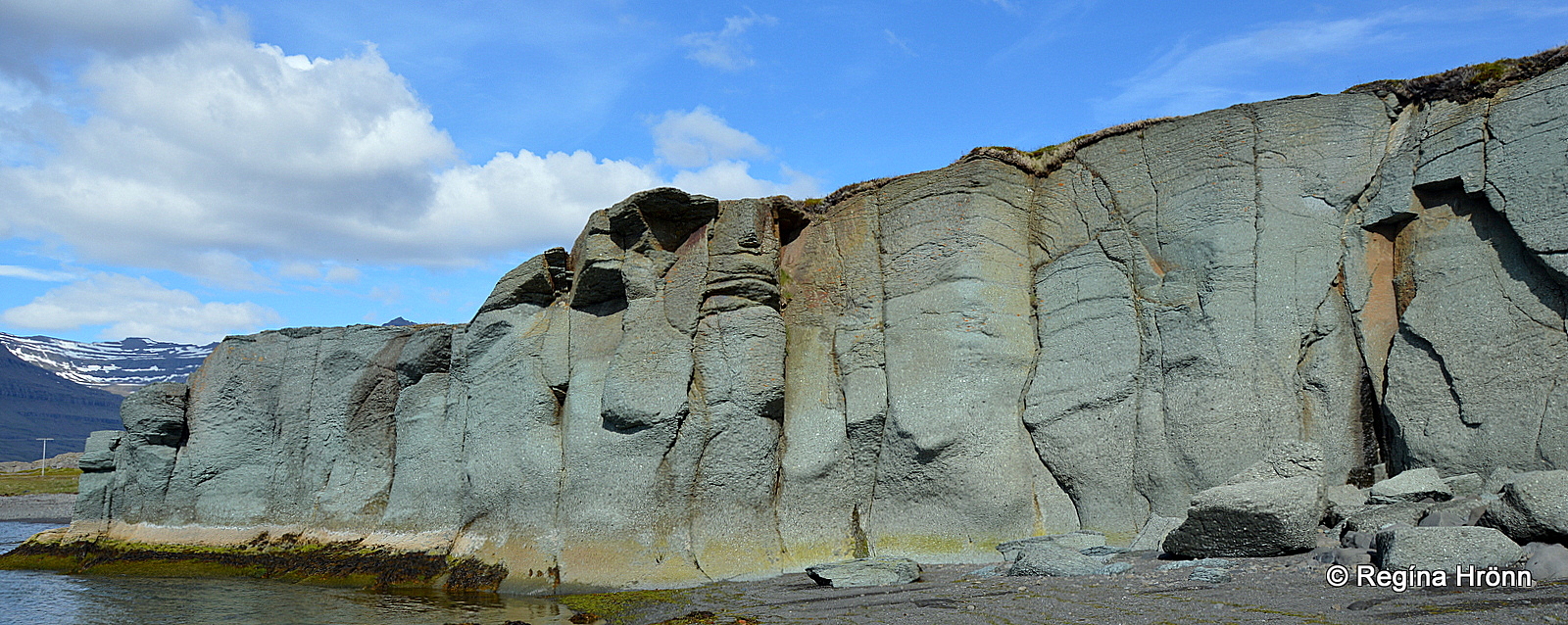
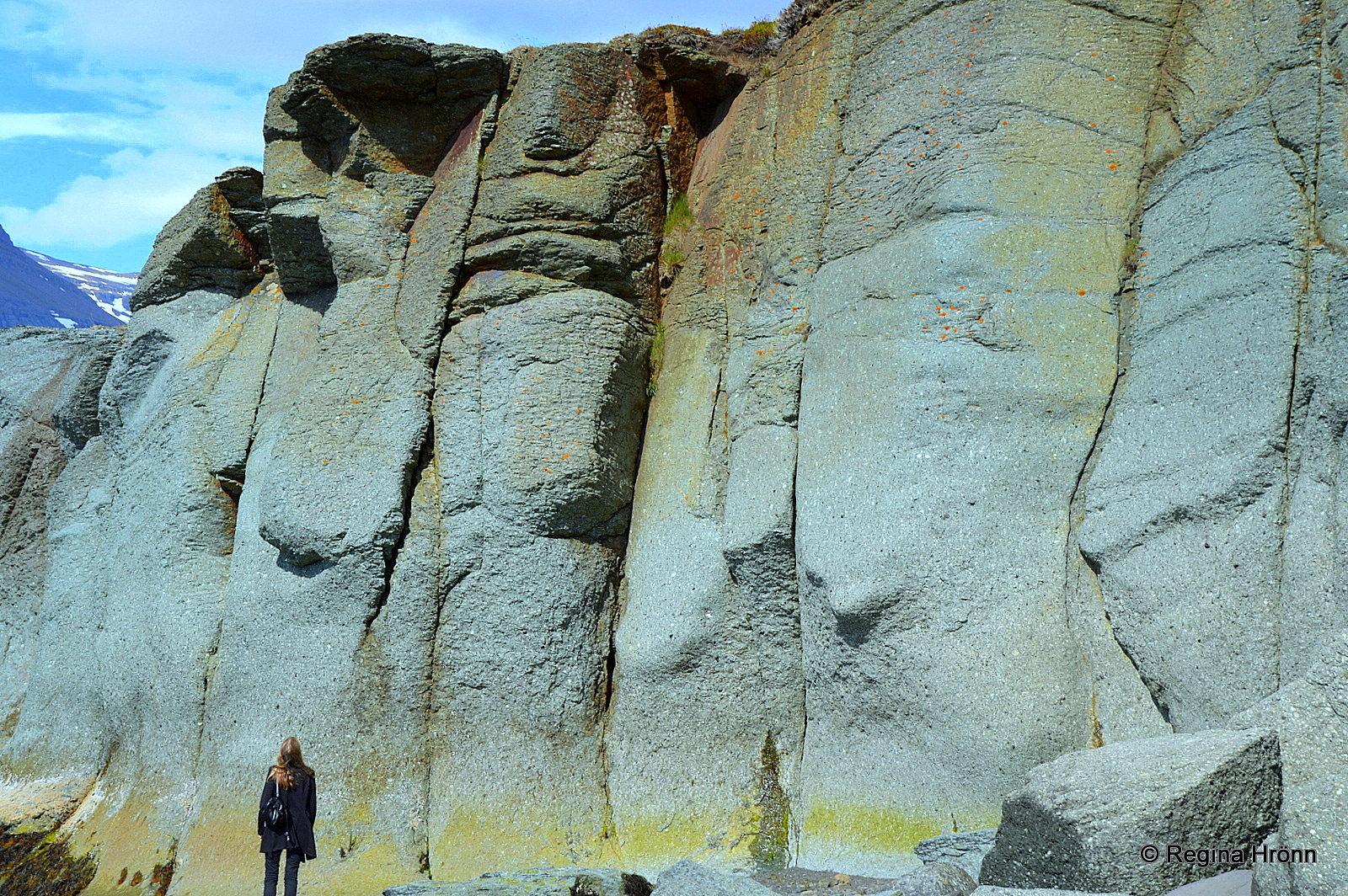
Blábjörg cliff
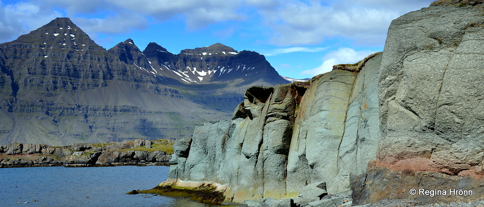
Blábjörg cliff and Mt. Búlandstindur
Blábjörg or Blue cliff is a turquoise ignimbrite cliff hidden away in Berufjörður fjord. The cliff is a part of the so-called Berufjarðar tuff.
The cliff was created in a pyroclastic flow in a massive phreatic eruption some 9-10 million years ago.
Blábjörg cliff
In my opinion, Blábjörg is a must-stop while visiting the Eastfjords. And the cliff is right by the ring road, so it is very easily accessible. It is not easily spotted though.
When I was looking for the Blue cliff for the first time I noticed a wide layer of ignimbrite in the mountain above the Blue cliff, so I knew that the cliff would be a part of this layer of ignimbrite, and thus found it.
Blábjörg cliff
This natural phenomenon was declared protected in 2012.
We carry on driving by the mountains with many farms and roadside waterfalls.
I had to stop and take some photos by the farms Núpur and Kross as the cascades were so elegant.
A cascade by Núpur farm
The waterfall in my photo above is by Núpur farm and very close by a cascade by the name Krossfoss (Cross falls) drops in a beautiful straight cascade down the steep mountain.
Streitishvarf
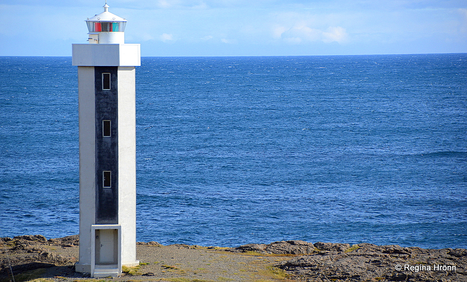
Streitisviti lighthouse
By now we have reached Streitishvarf, which is between Berufjörður fjord and Breiðdalsvík. The 12 meters tall Streitisviti lighthouse was erected in 1984.
Hiking at Streitishvarf is popular and on the 1-hour hike, you will see beautiful ravines, dykes, and coves. Close by the shore you will see Breiðdalseyjar islands.
In stormy weather, the surf can reach as high up as the lighthouse.
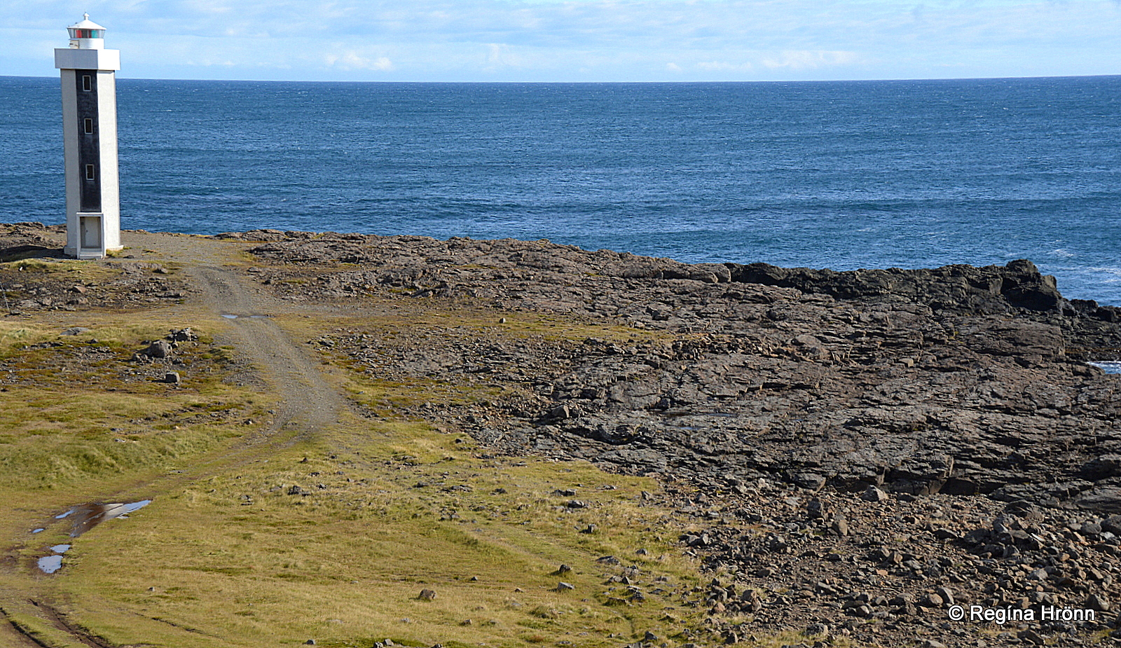
Streitishvarf
According to folklore, a troll lives in Skrúðskambur by Streitishvarf.
He is one of 3 brothers; his brothers live on Skrúður and Papey islands and on still mornings they can be heard calling to each other.
This is as far as we are going in this travel-blog. In my next travel-blog we will continue driving in the Eastfjords and visit the fjords and villages of Fjarðabyggð municipality: the Beautiful Fjords in Fjarðabyggð in the Eastfjords of Iceland.
Have a lovely time exploring East-Iceland 🙂