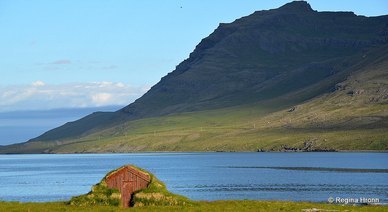
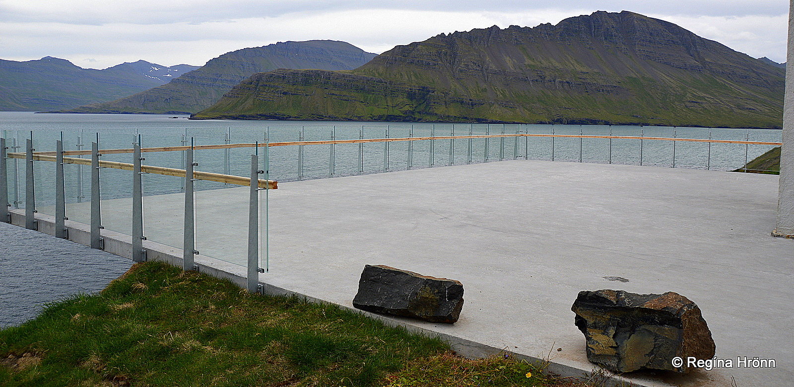
Stöðvarfjörður fjord
The Fjarðabyggð municipality consists of Breiðdalur, Stöðvarfjörður, Fáskrúðsfjörður, Reyðarfjörður, Eskifjörður, Neskaupstaður and Mjóifjörður, so we have got a lot to explore.
On this route, we will stop by lovely little villages and towns by the sea, drive through steep screes, visit waterfalls, an archaeological site, a mine, and a cave just to name a few of our stops.
Breiðdalsvík village
Breiðdalsvík harbor
First, we stop at Breiðdalsvík fishing village, with a population of approx. 139. The history of this fishing village is not long as it started forming in 1960.
Breiðdalur valley, which gives a name to the cove and the village, is one of the longest (30 km) and widest (5 km) of the valleys in the east part of Iceland.
But, we will not drive into the valley, which leads to the steep Breiðdalsheiði heath, a shortcut to Egilsstaðir town, but keep driving by the coastline of the Eastfjords.
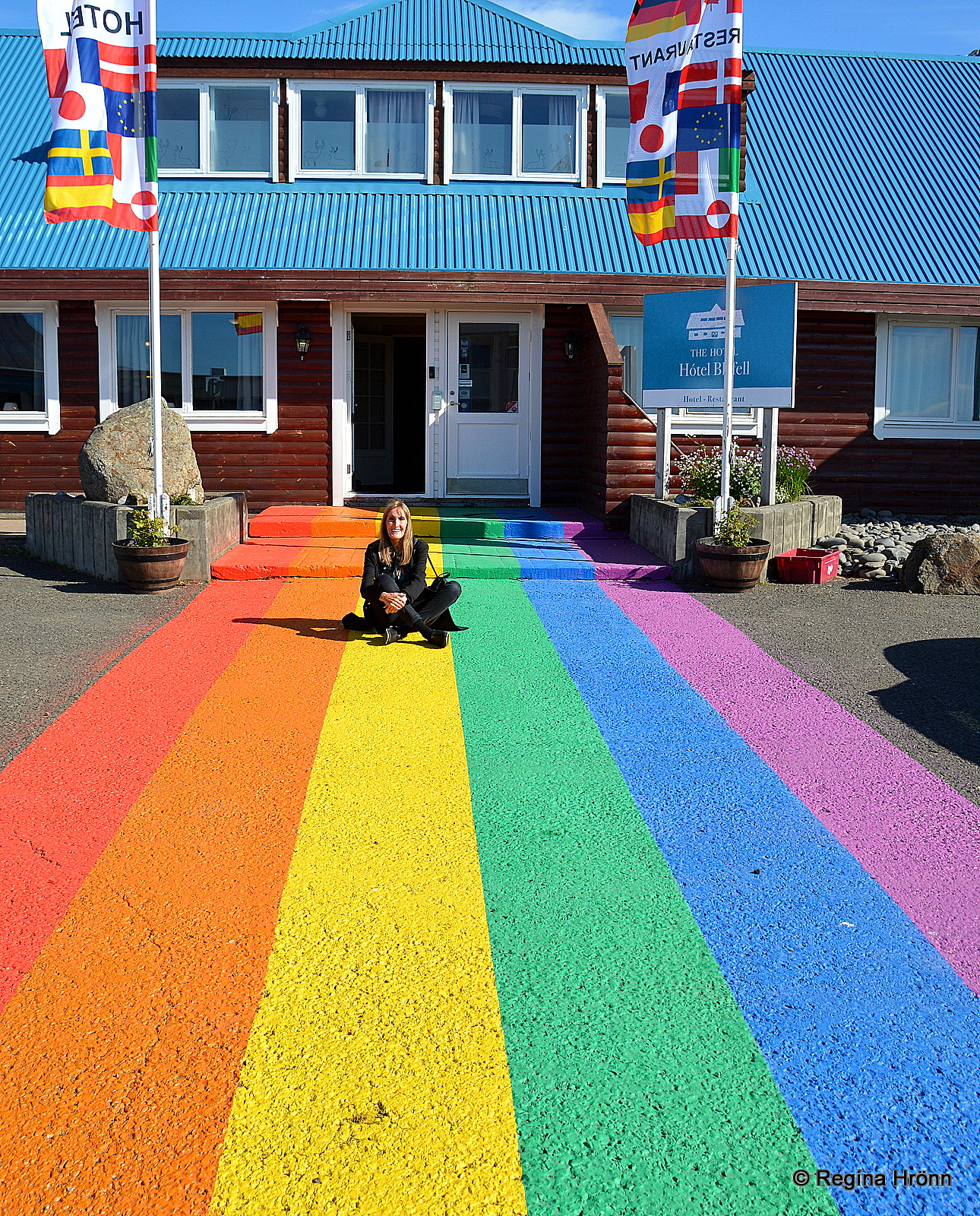
The rainbow is an extension of the zebra crossing
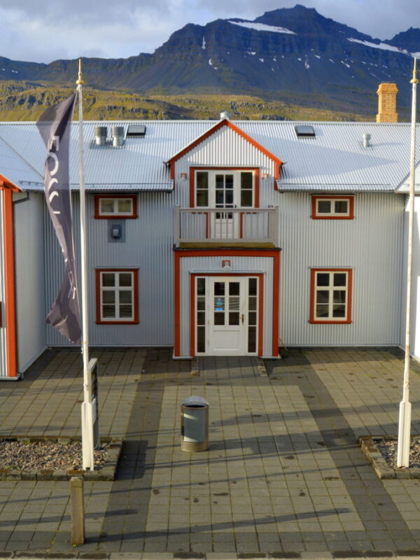
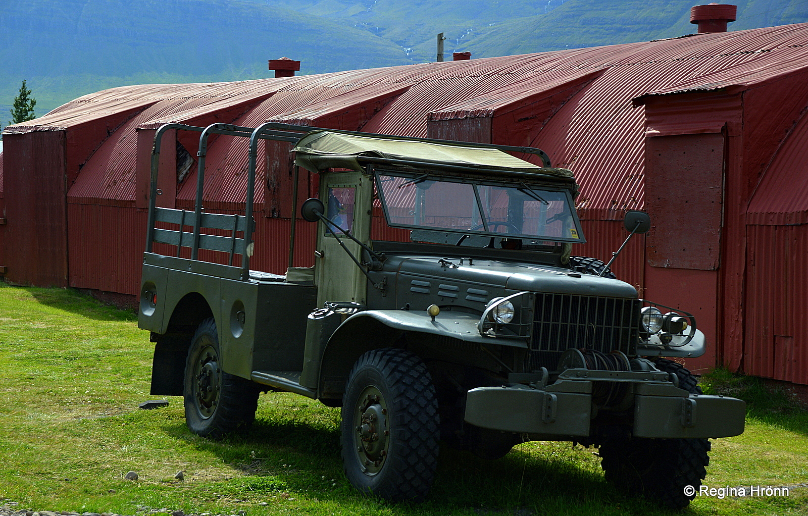
At Breiðdalsvík you will find the Factory car museum, Breiðdalssetur museum with an exhibition on the geology of East Iceland, Beljandi brewery, and a bar. The brewery is named after the waterfall Beljandi in Breiðdalur valley.
Here you will also find the old general store with a restaurant, and lovely hotels.
I stayed for one night at the charming, rustic Hotel Bláfell in Breiðdalsvík. In front of the hotel, a rainbow has been painted on the street. Another such rainbow has been painted on a street in Seyðisfjörður, which I am going to show you in my next travel-blog.
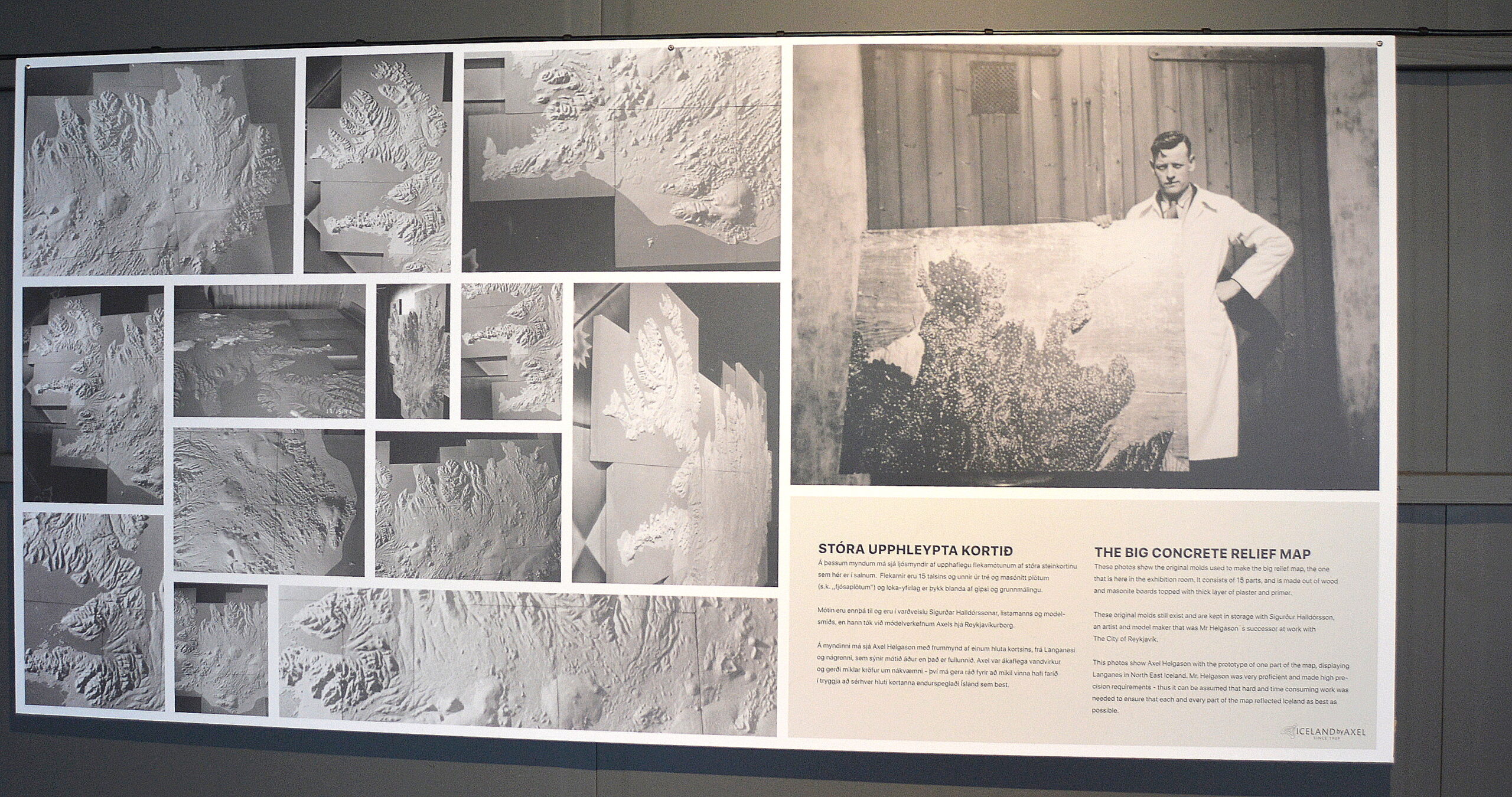
Axel Helgason and the map
In the old fish factory, an old raised-relief map of Iceland is on display, made by Axel Helgason in the thirties, but Axel was the model maker for the City of Reykjavík.
Axel’s last big project for the City of Reykjavík was the large raised-relief map in the City Hall in Reykjavík, which is a popular tourist attraction.
The next fjord we are going to visit is Stöðvarfjörður fjord.
Stöðvarfjörður
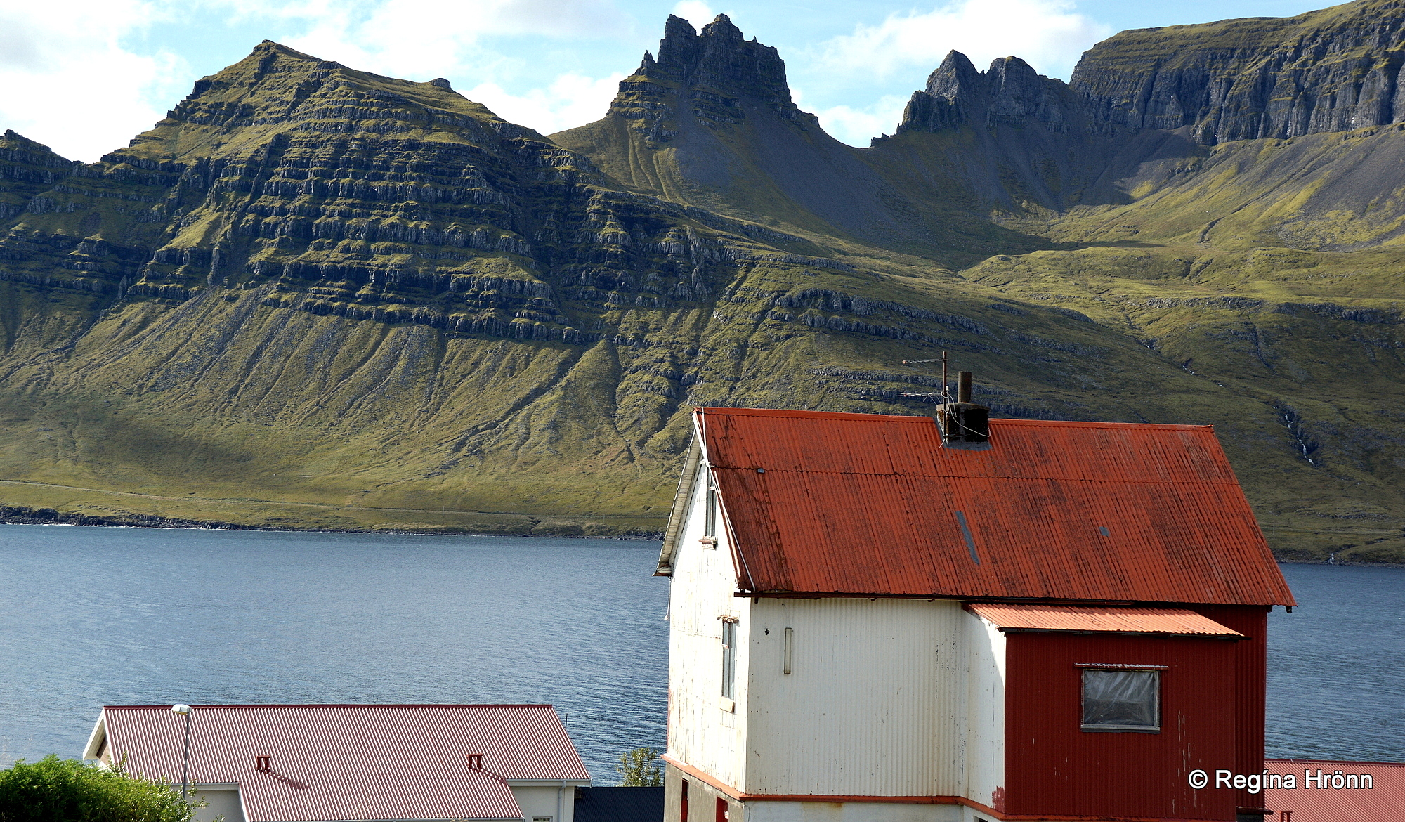
Stöðvarfjörður
The small coastal village, which has got a population of approx. 184, is also called Stöðvarfjörður like the fjord.
Stöðvarfjörður is the only village in the Eastfjords through which you drive on ring-road 1.
The Eastfjords are renowned for their beautiful mountains and rocks and at Stöðvarfjörður you will find a popular museum: Steinasafn Petru – Petra’s Stone Collection.
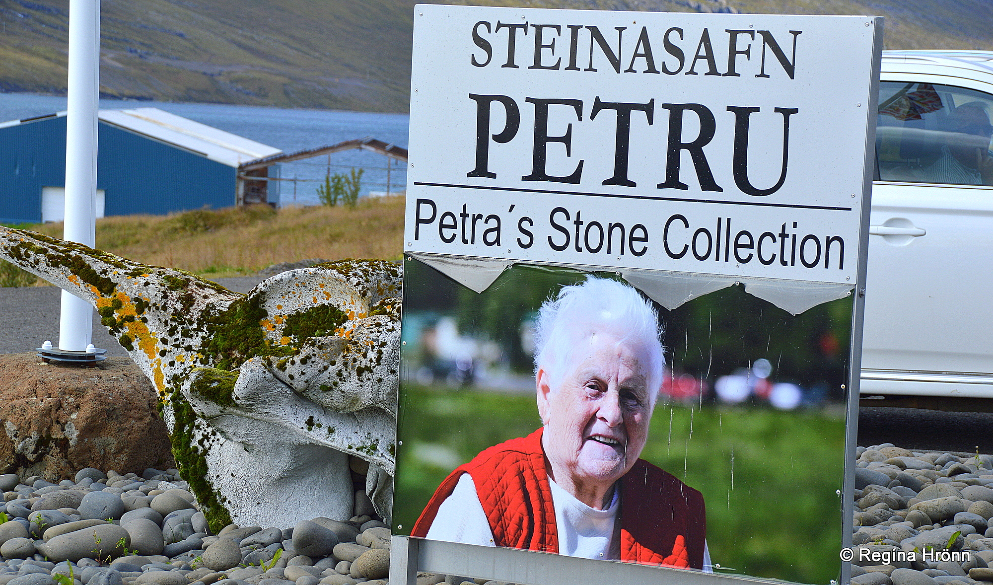
Petra’s Stone Collection
It is one of the best private collections of its kind in Iceland.
Petra started collecting stones from an early age and the collection grew so much that visitors started asking for permission to have a look at her collection, which is in her own home and garden. Finally, a museum was opened in her home.
Kudos to Petra for her work. This wonderful woman died in 2012, but her stone collection can still be visited.
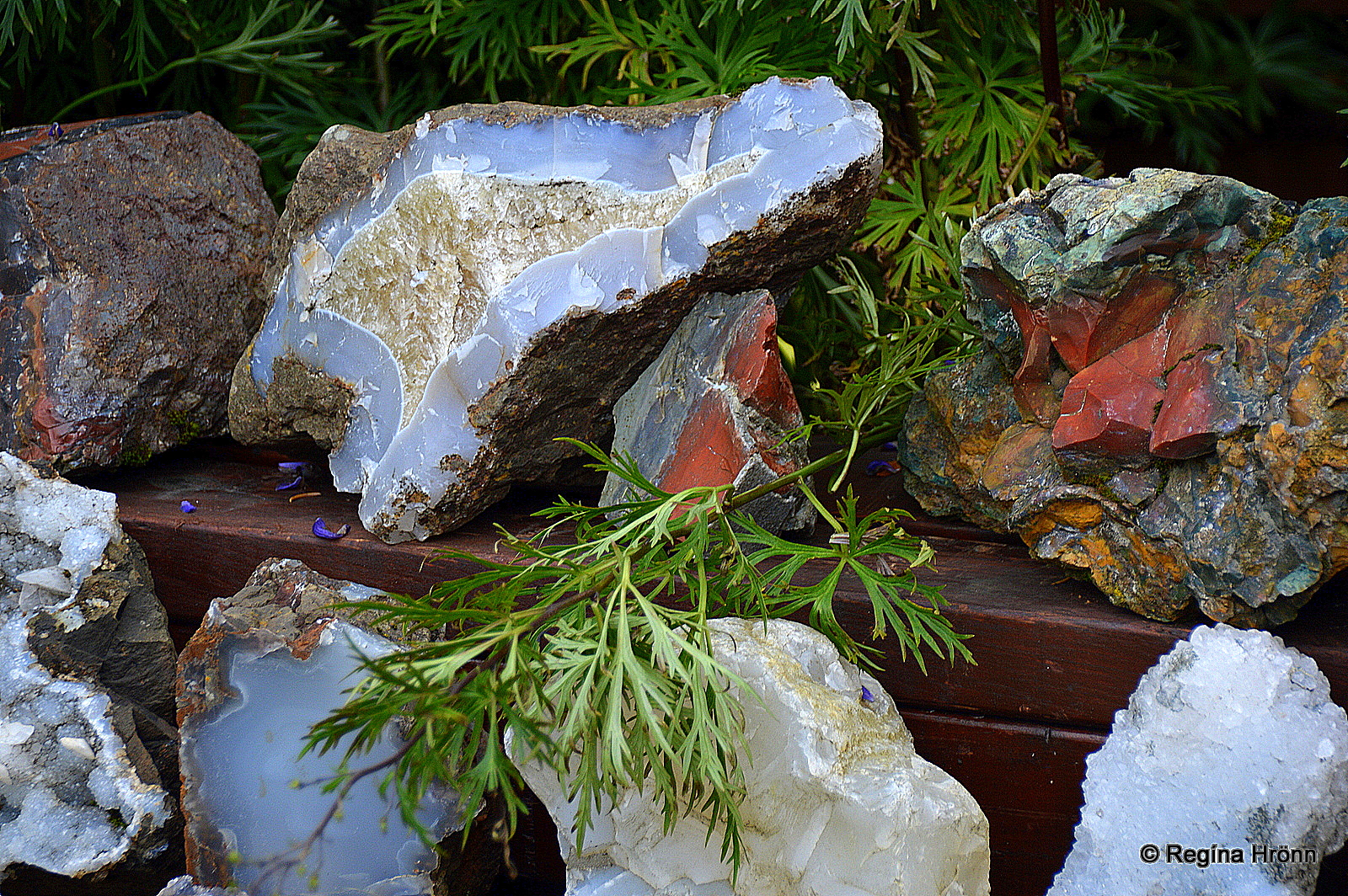
Petra’s Stone collection
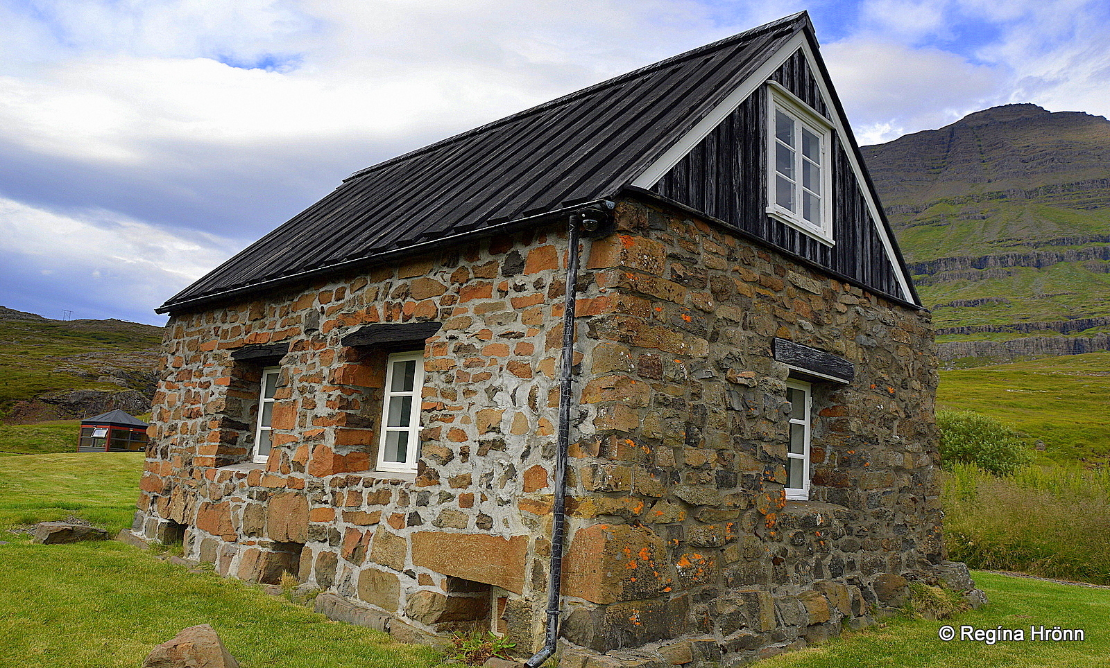
You will find two churches in Stöðvarfjörður.
The older Stöðvarfjarðarkirkja church stood from 1879 by Stöð close by, where you will now find a graveyard but no church.
The church was moved to the village in 1925 and unchurched in 1991 when the yellow church was built. The old church is now a guesthouse called Kirkjubær.
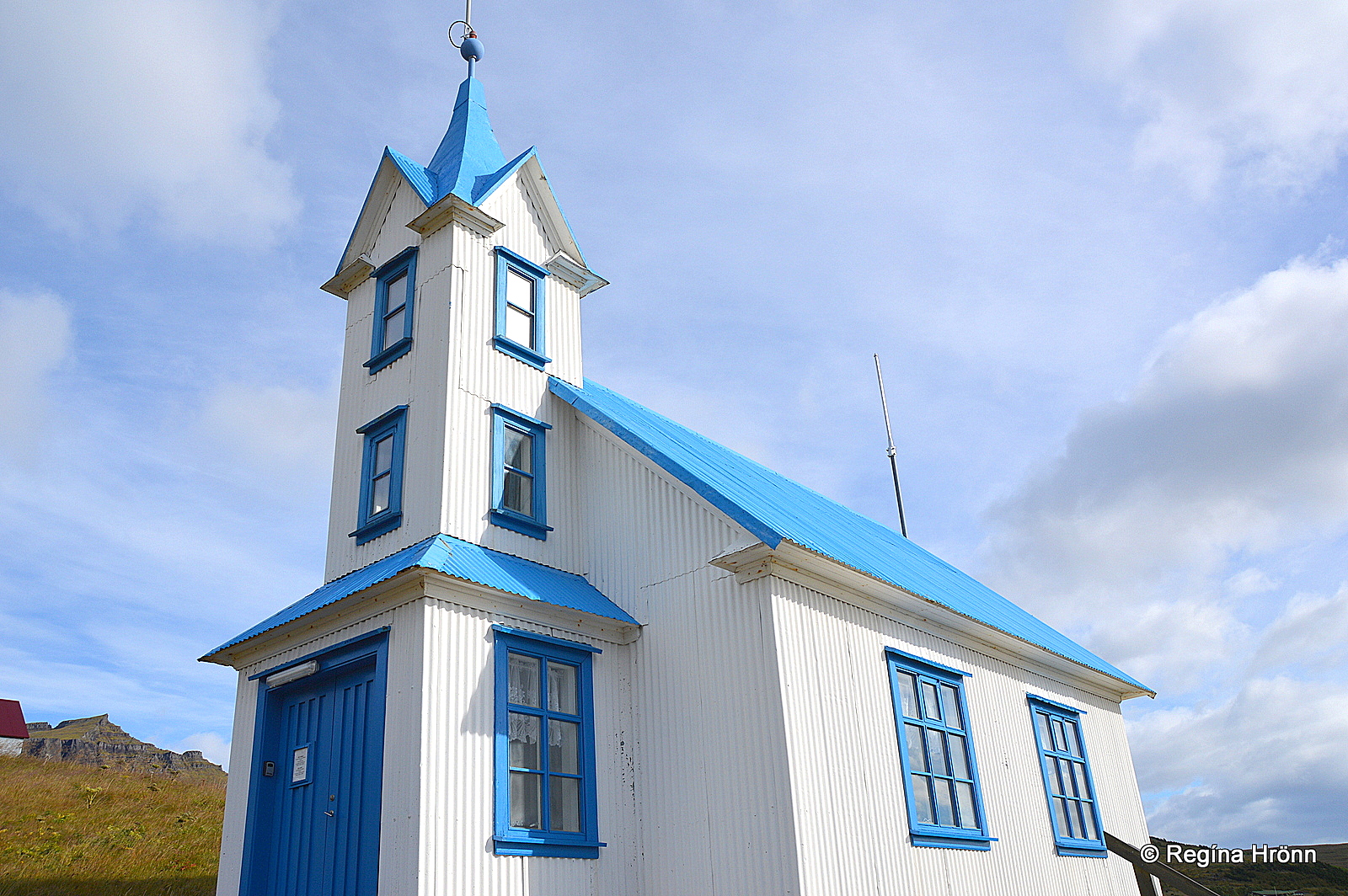
The old church is now a guesthouse
At the bottom of Stöðvarfjörður fjord, just before you reach the Stöðvarfjörður village, you will find an archaeological site at Stöð.
A couple of Viking Longhouses have been found at Stöð.
The ruins at Stöð seem to predate the Settlement of Iceland. They most likely date back to 860-870 or even earlier, so this is an interesting discovery.
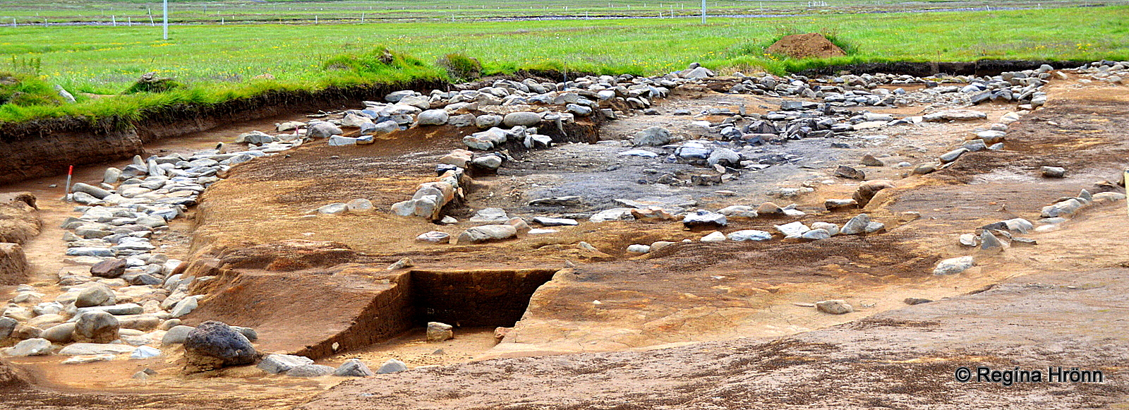
Stöð
There are speculations that there might have been a seasonal hunting camp here as a harpoon was found in the ruins.
Several Arabian silver coins have also been found on the archaeological site.
Saxa sea geyser by Stöðvarfjörður
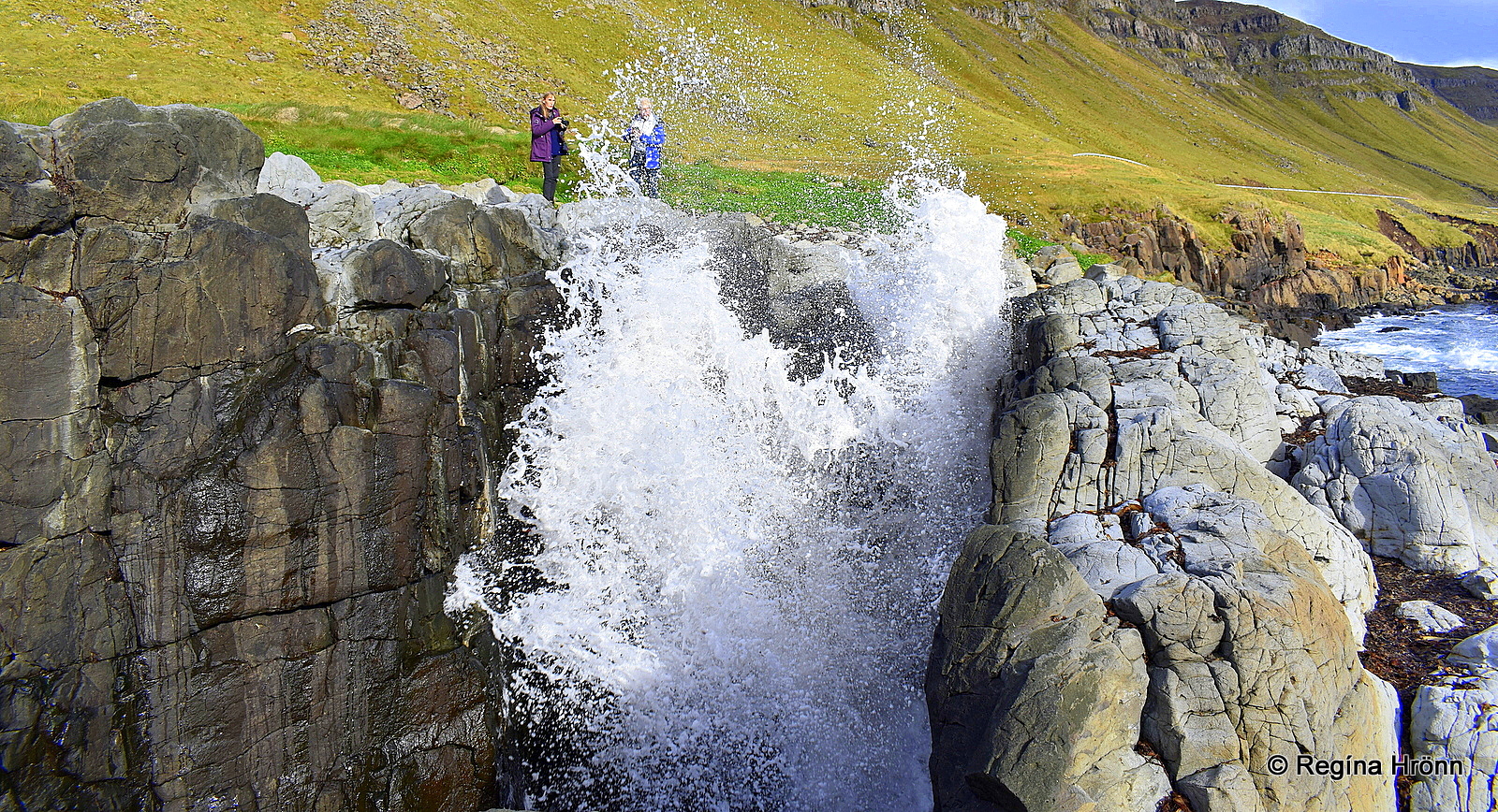
Saxa sea geyser
Just outside of Stöðvarfjörður village by ring-road 1 you will find the natural phenomenon the Saxa sea geyser.
It is a perforated cliff, which is a sight to see when the waves crash through the hole extremely close to where you stand as you can see in my photo above!
Saxa has got a natural channel and a stone bridge.
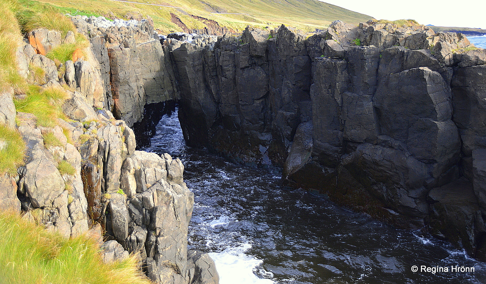
The hole and the stone bridge of Saxa
The waves of the Atlantic ocean crash through the hole in the cliff, which makes Saxa erupt like a geyser when the waves come in.
Saxa – the Grinder grinds stones and seaweed and throws them high into the air – it thus got its name Grinder.
It happens in a jiffy and you never know when it is going to blow, as it were, so let’s be careful here.
Caution is needed at Saxa
Now, let’s drive to Fáskrúðsfjörður fjord. Fáskrúðsfjörður gets its name from the island Skrúður, which you will see on the way.
We stopped by the foundations of the old French hospital at Hafnarnes (Gvendarnes).
The original hospital, which was built for French fishermen at Fáskrúðsfjörður village back in 1903, was dismantled in 1939 and rebuilt in Hafnarnes fishing village as an apartment house and a school.
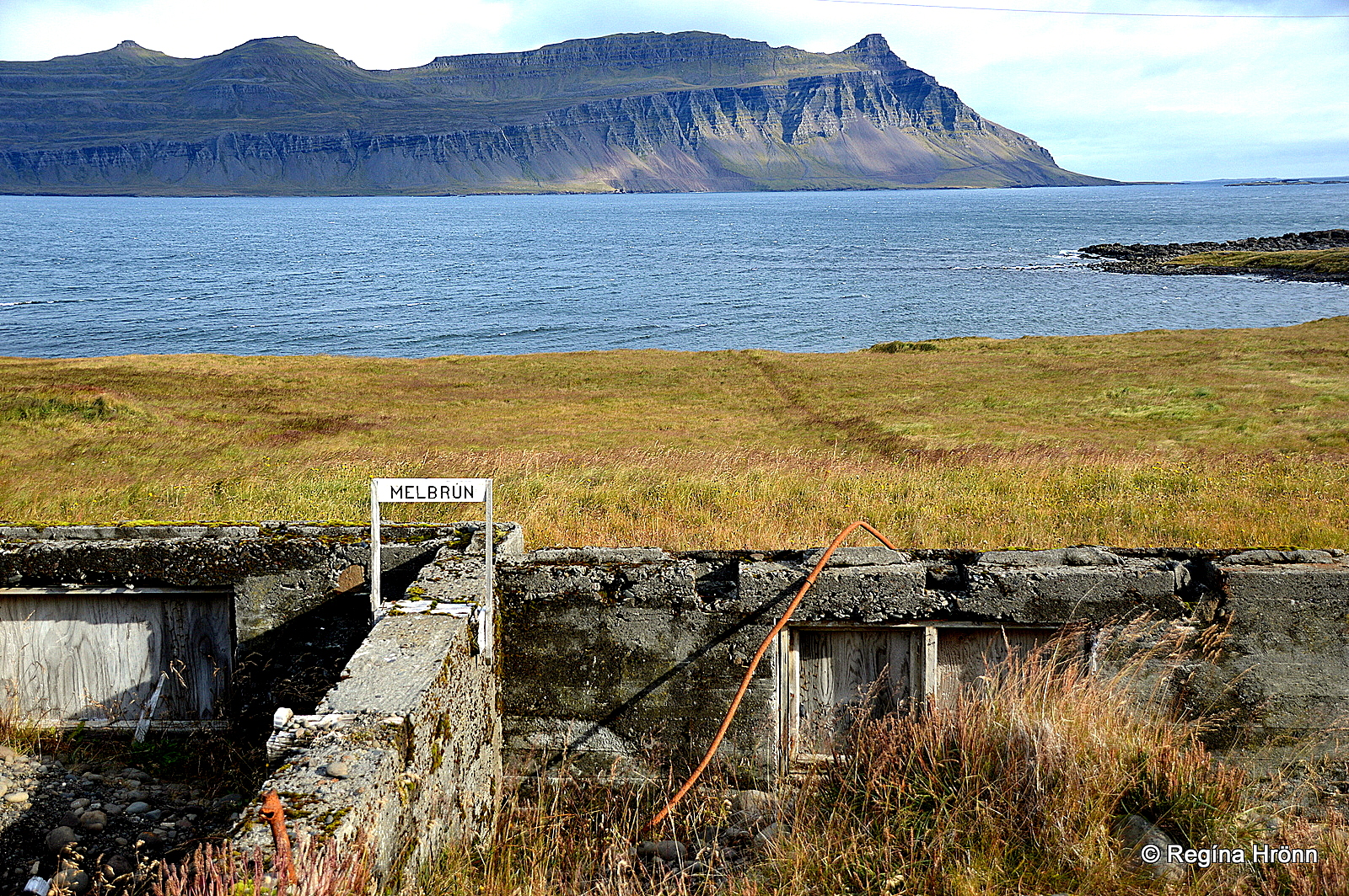
Here stood the old French hospital until 2010
The inhabitants here at Hafnarnes were approx. 100. The village was deserted in around 1980 and the old French hospital was falling apart, which was a shame.
Decades later the Icelandic Preservation of Antiquities (Minjavernd) got the good idea to renovate the old hospital.
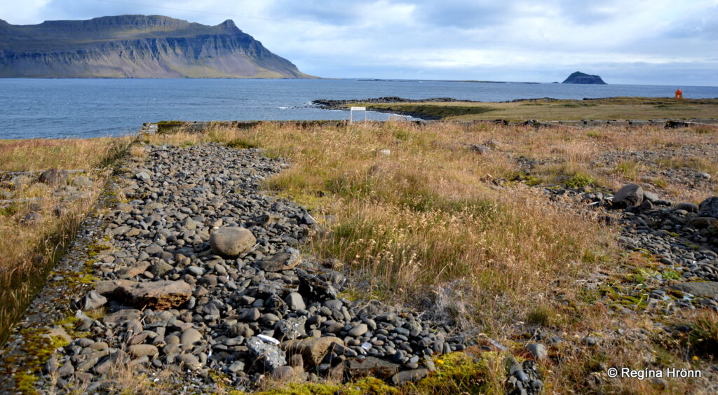
Skrúður island in the distance
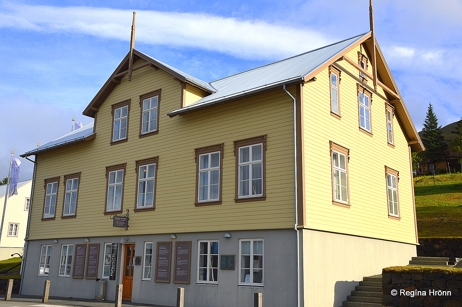
The French hospital was moved back to Fáskrúðsfjörður in 2010, beautifully renovated and opened as a hotel in 2014.
You can see photos of the operation here.
Fáskrúðsfjörður – the French Village
The old French hospital
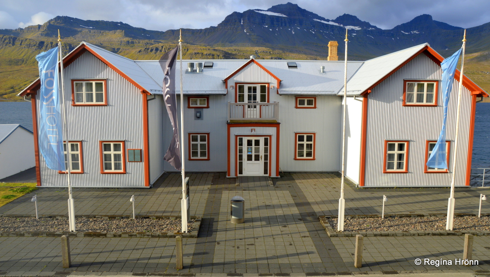
The next village we are going to visit is Fáskrúðsfjörður (Búðakauptún), a lovely fishing village with a population of approx. 749.
Fáskrúðsfjörður is often referred to as the French village, as here was one of the main hubs for French fishermen fishing in East Iceland in the latter part of the 19th century until around 1930.
Læknishúsið – the Doctor’s House
Prominent is the old hospital which was built by the French and has now been beautifully renovated, along with other old French buildings.
These beautifully renovated buildings are now the main attraction in Fáskrúðsfjörður.
One of the beautifully renovated buildings in Fáskrúðsfjörður is Læknishúsið – the Doctor’s House which was built in 1907.
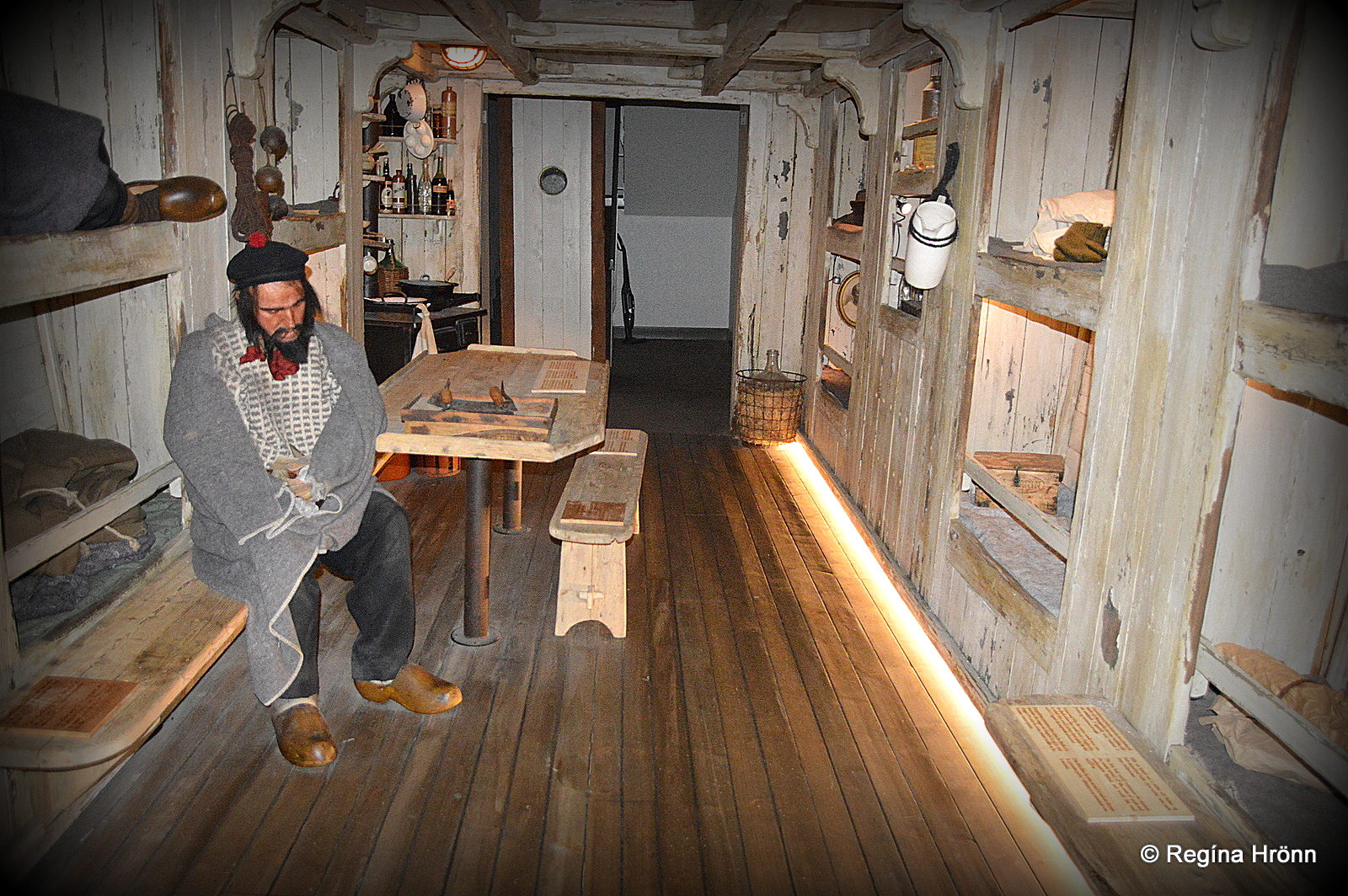
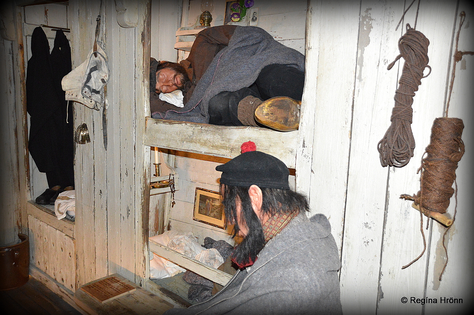
The French fishermen exhibition
It is located opposite the French hospital and also operates as a hotel. I stayed in Læknishúsið on one of my travels in the Eastfjords, as I wanted to explore Fáskrúðsfjörður better.
On the ground floor and in the basement of Læknishúsið you will find an excellent exhibition about the French fishermen.
It is so well made that I felt like I was intruding when I visited the exhibition alone outside of their opening hours 🙂
The French fishermen exhibition
Just outside of the village, down by the sea is a French graveyard with the names of 49 French and Belgian fishermen who lost their lives at sea here.
It is heartbreaking thinking about the lives of these foreign fishermen, so far from home working under extreme conditions and some of them never reaching their homeland again, but instead getting a wet grave in the sea.
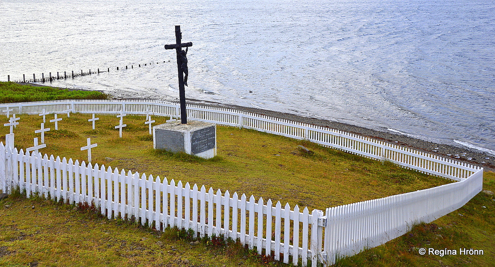
The French graveyard
During the last weekend in July, the festival Franskir dagar – the French Days, is held here at Fáskrúðsfjörður to commemorate this historic time.
A 5,850 meters long tunnel, Fáskrúðsfjarðargöng (2005), on ring-road one connects Fáskrúðsfjörður to Reyðarfjörður fjord.
You can also drive through the steep screes of Vattarnes on road 955 for a more scenic route to enjoy the lovely coastline between Fáskrúðsfjörður and Reyðarfjörður fjords.
Kolfreyjustaðarkirkja church
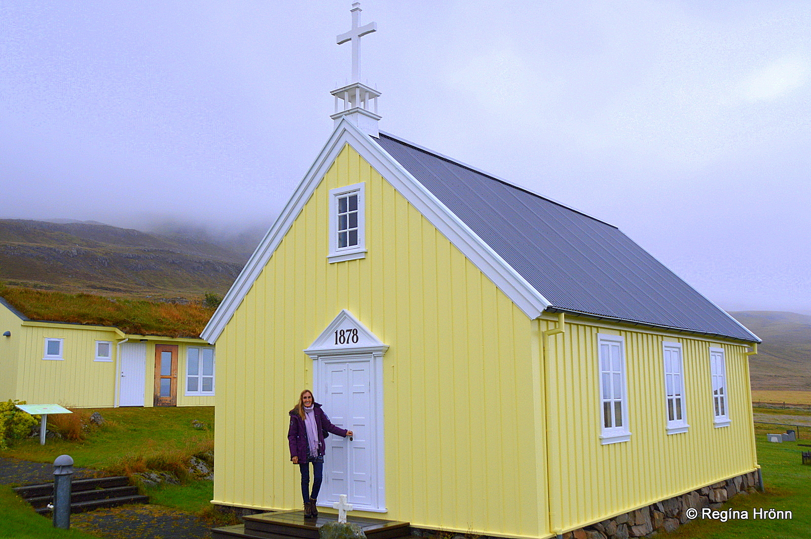
Just outside of Fáskrúðsfjörður village on our way to Vattarnes, we saw this beautiful old yellow-painted church from 1878. It is called Kolfreyjustaðarkirkja church.
The church blew away in 1991 but was restored in the following year.
I told you that this was a scenic drive -given that the Eastfjord fog doesn’t show up like it did when we drove the screes, so it was a pretty scary drive 😉
Driving in the Vattarnes screes with the Eastfjord fog creeping up on us
I told you about the Eastfjord fog in my last travel-blog. This fog can creep up on us at any given moment, so to speak.
Now, having driven either through the screes or the tunnel, let’s leave ring-road one and visit the fjords and towns by road 92.
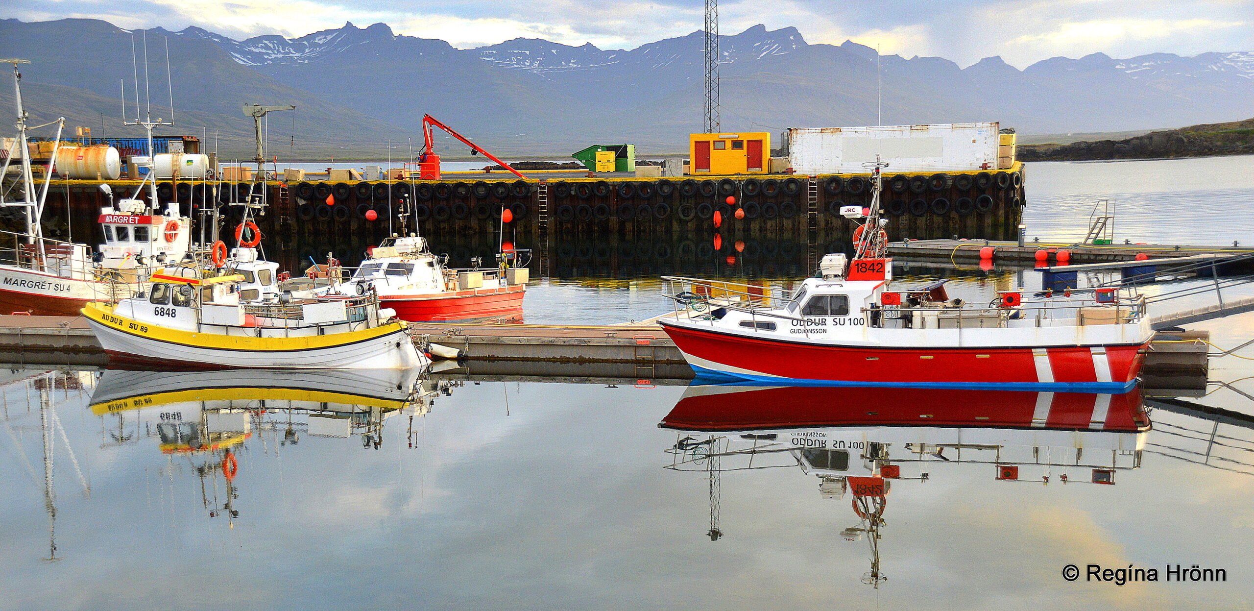
Reyðarfjörður town
Reyðarfjörður town
Reyðarfjörður fjord is the longest of the Eastfjords, 30 km long, and the town, which is now named after the fjord, used to be called Búðareyri.
Reyðarfjörður has a population of approx. 1,357, making it the second-largest of the towns in Fjarðabyggð, which I am showing you in this travel-blog.
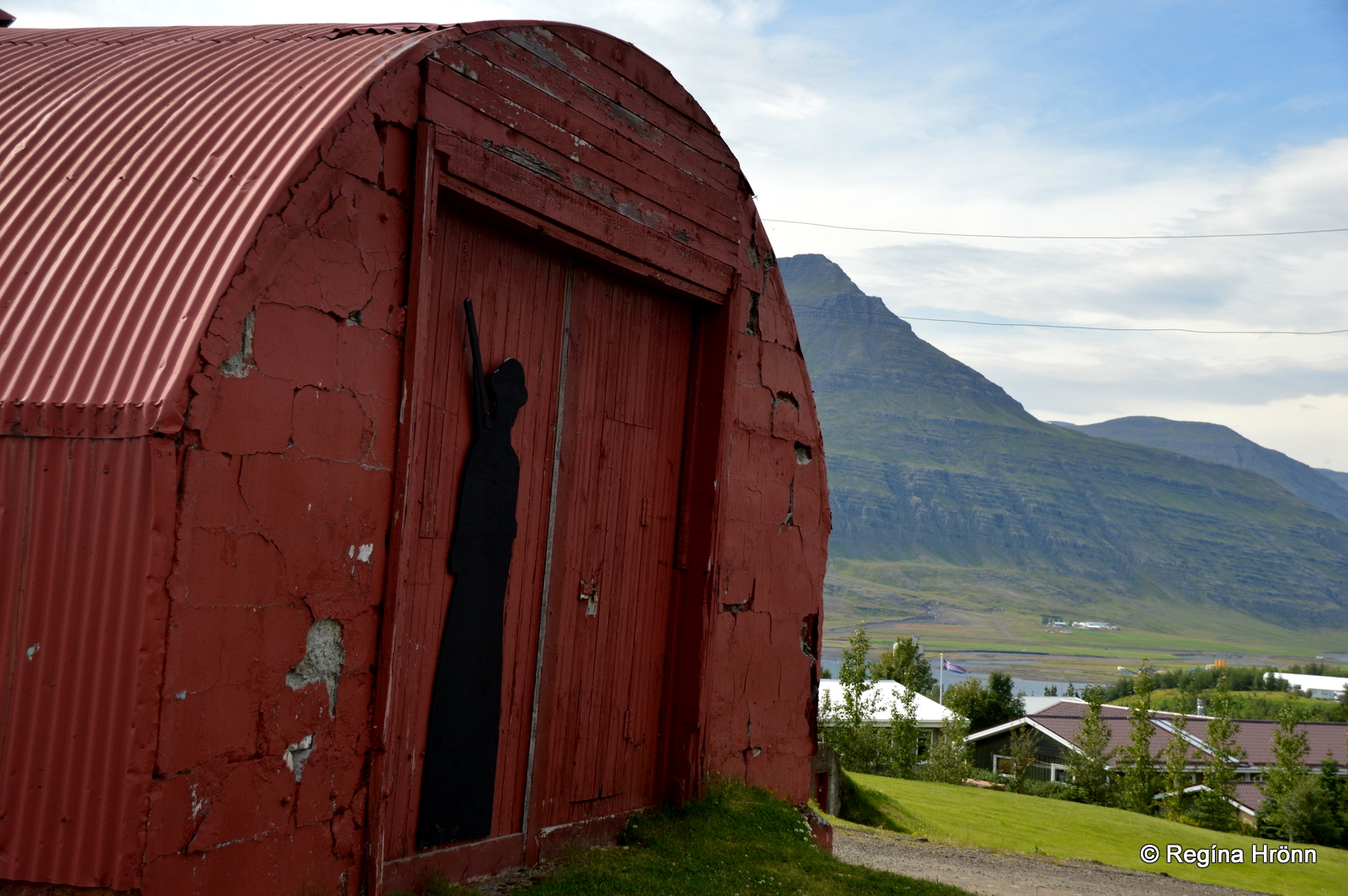
The Icelandic Wartime Museum – a Nissan hut
Much as Fáskrúðsfjörður has ties to France, then Reyðarfjörður has ties to both Britain and the USA.
In 1940, during WW2, Reyðarfjörður was occupied by the British army, which was then replaced by the American army in 1942.
There were also Norwegian and Canadian soldiers here in Reyðarfjörður.
During these years approx. 4,000 soldiers were stationed in Reyðarfjörður, a village with a population of only 300, imagine that!
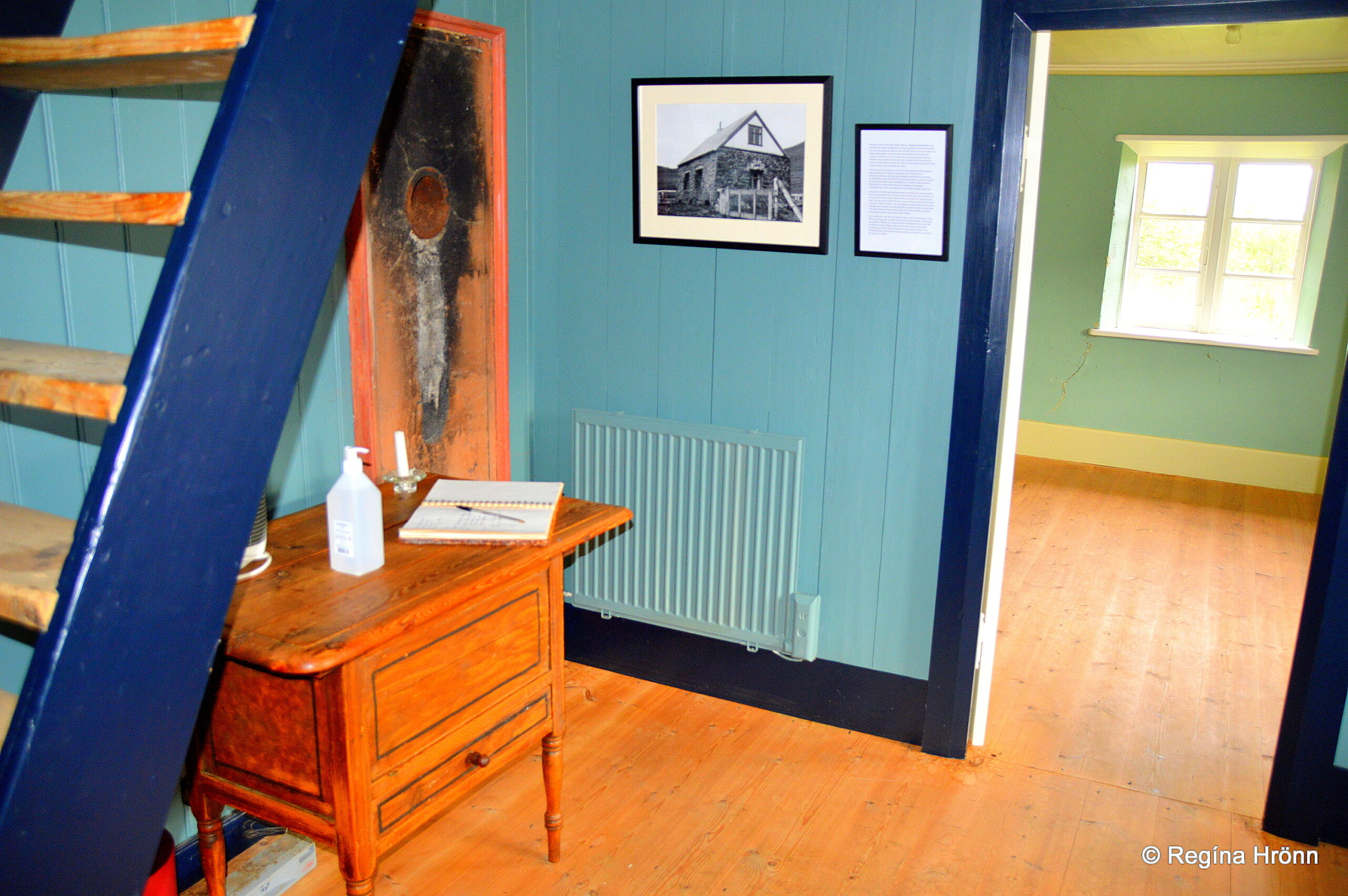
The Icelandic Wartime Museum
The town museum is called Íslenska stríðsárasafnið – the Icelandic Wartime Museum and my photos above are taken at the museum.
One of the town festivals is called Hernámsdagurinn á Reyðarfirði – the Occupation day in Reyðarfjörður and is held during the last weekend of June or the first weekend in July.
It is always good fun to visit the towns and villages during their local festivals, that is why I mention the dates of the festivals 🙂
Old meets new in East Iceland
Alcoa-Fjarðaál aluminum smelter which was erected back in 2007, is the main employer in Reyðarfjörður, providing jobs for some 544 people plus 250 additional jobs on the smelter site.
The Alcoa Fjarðaál smelter is at the outskirt of the town.
Opposite the aluminum smelter, you will see an old house called Sómastaðir.
Sómastaðir
Sómastaðir
Sómastaðir is a historic house as the building technique is unique in Iceland. The stone house was erected with local rocks and glacial clay was used as mortar.
Hans Jackob Beck fishing vessel owner and the district administrator built the house back in 1875.
Hans, by the way, had 23 children, so he must have needed additional space.
Inside Sómastaðir
The turf farm has collapsed as turf farms need constant upkeep.
Sómastaðir is a part of the historic building collection of the National Museum of Iceland and has been renovated by the museum.
The stone house can be visited in the summertime from June 1st – August 31st on Tuesdays and Thursdays from 15:00-17:00.
Inside Sómastaðir
Now, let’s continue driving on road 92 and visit a burial mound of a seeress on Hólmaháls hill between Reyðarfjörður and Eskifjörður fjords.
The Burial Mound of the Seeress
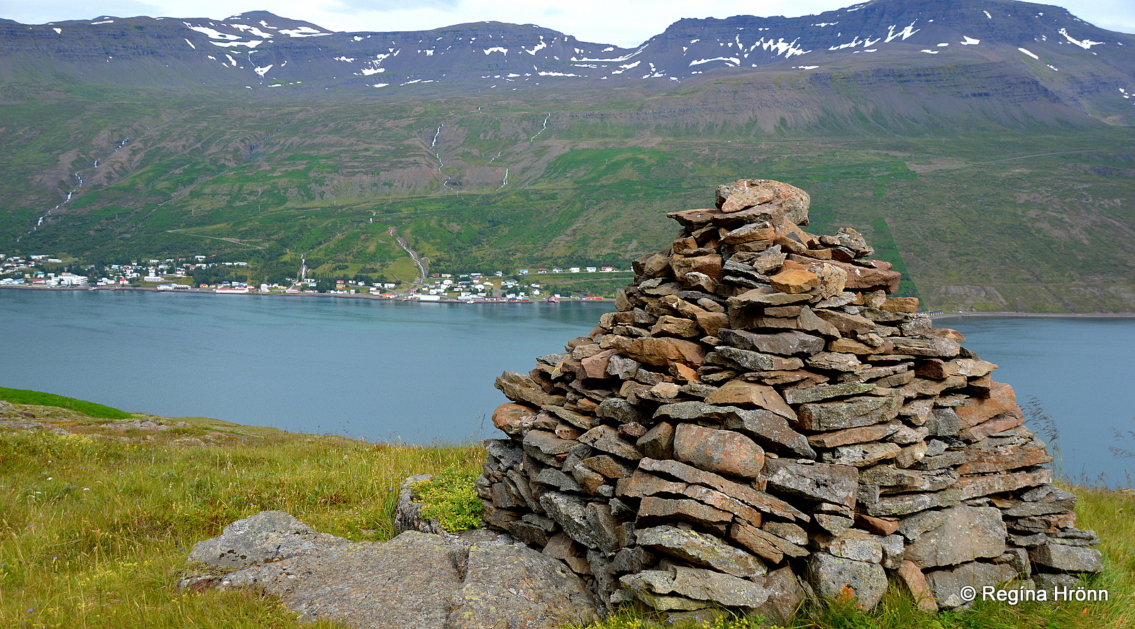
Völvuleiðið – the burial mound – Eskifjörður in the distance
On Hólmaháls hill between Reyðarfjörður and Eskifjörður fjords, you will find a huge cairn.
Folklore is related to this cairn. It is the burial mound of a seeress (prophetess), who is the protector of this area.
I found the story in Þjóðsögur Jóns Árnasonar – the Compilation of Folklore by Jón Árnason and translated it into English:
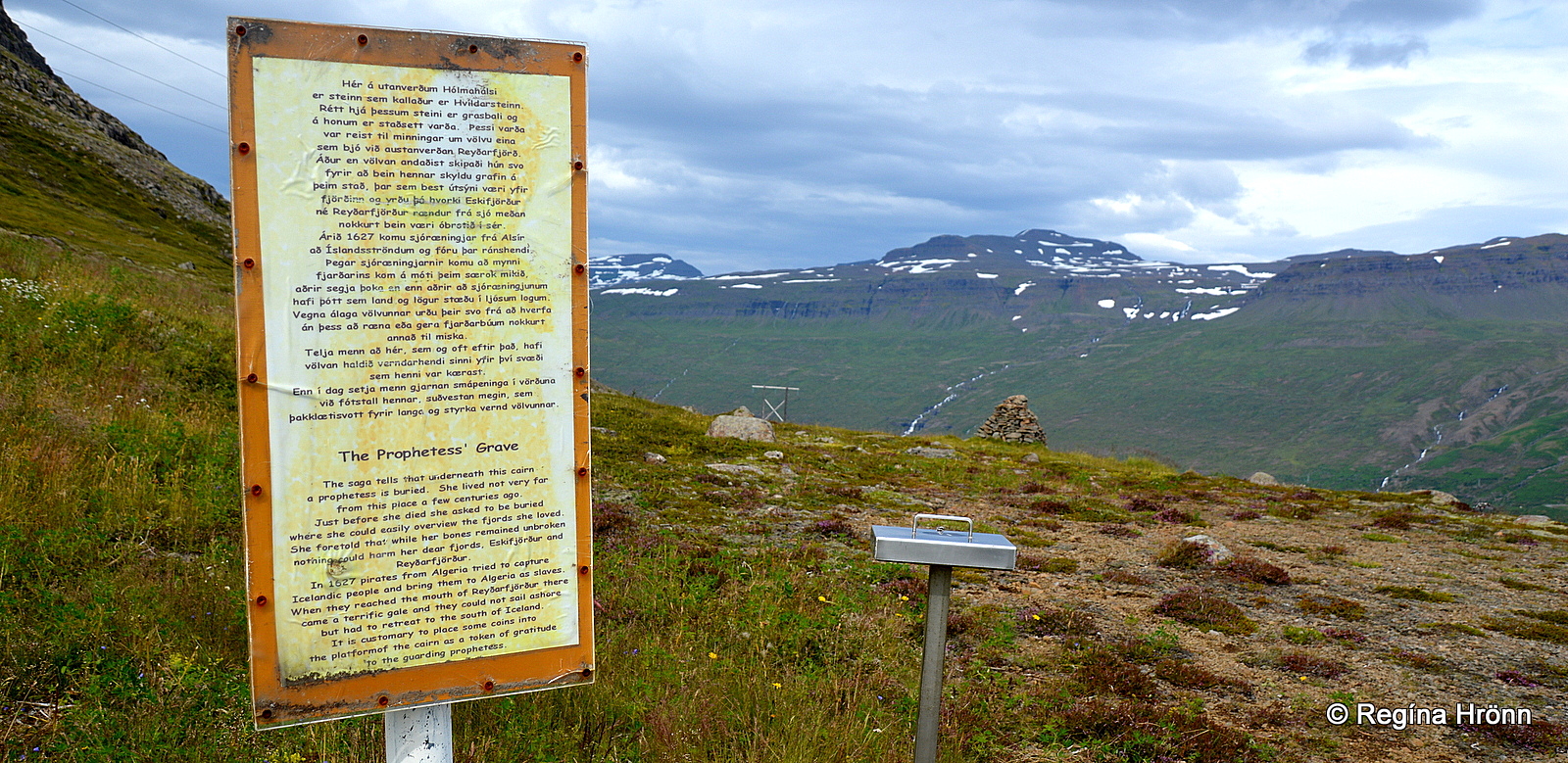
Information sign and a guestbook by the burial mound
“Once upon a time there was a prophetess; she was very wise. It is not mentioned where she lived, but before she died, she asked to be buried in Reyðarfjörður, from where there was the best view of the sea – she said that pirates would not be able to conquer Reyðarfjörður while her grave was visible.
She was buried on the spit leading from Hólmatindur which is called Hólmanes.
It splits the main fjord into Reyðarfjörður and Eskjufjörður; it is high up and the view from there towards the sea is ideal.
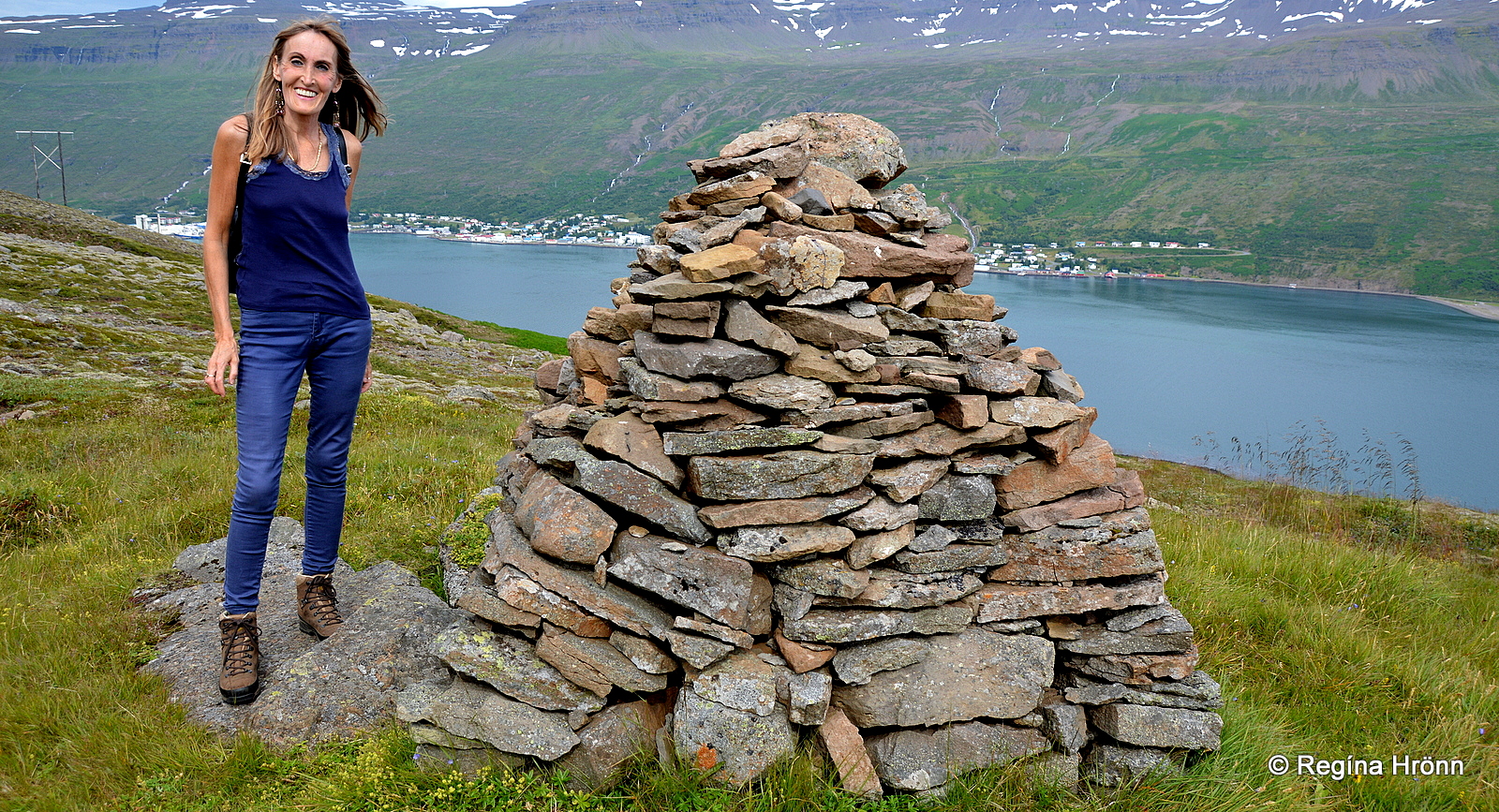
Völvuleiðið burial mound – I stand next to it so that you can see how tall it is
The thoroughfare leads through here and the grave is right by it; it looks like a green tussock.
Pirates sailed their ships here and meant to reach Reyðarfjörður; but as they arrived at the mouth of the fjord it appeared to them as the whole fjord and land were on fire and they were forced to leave; the prophetess was thanked for this.”
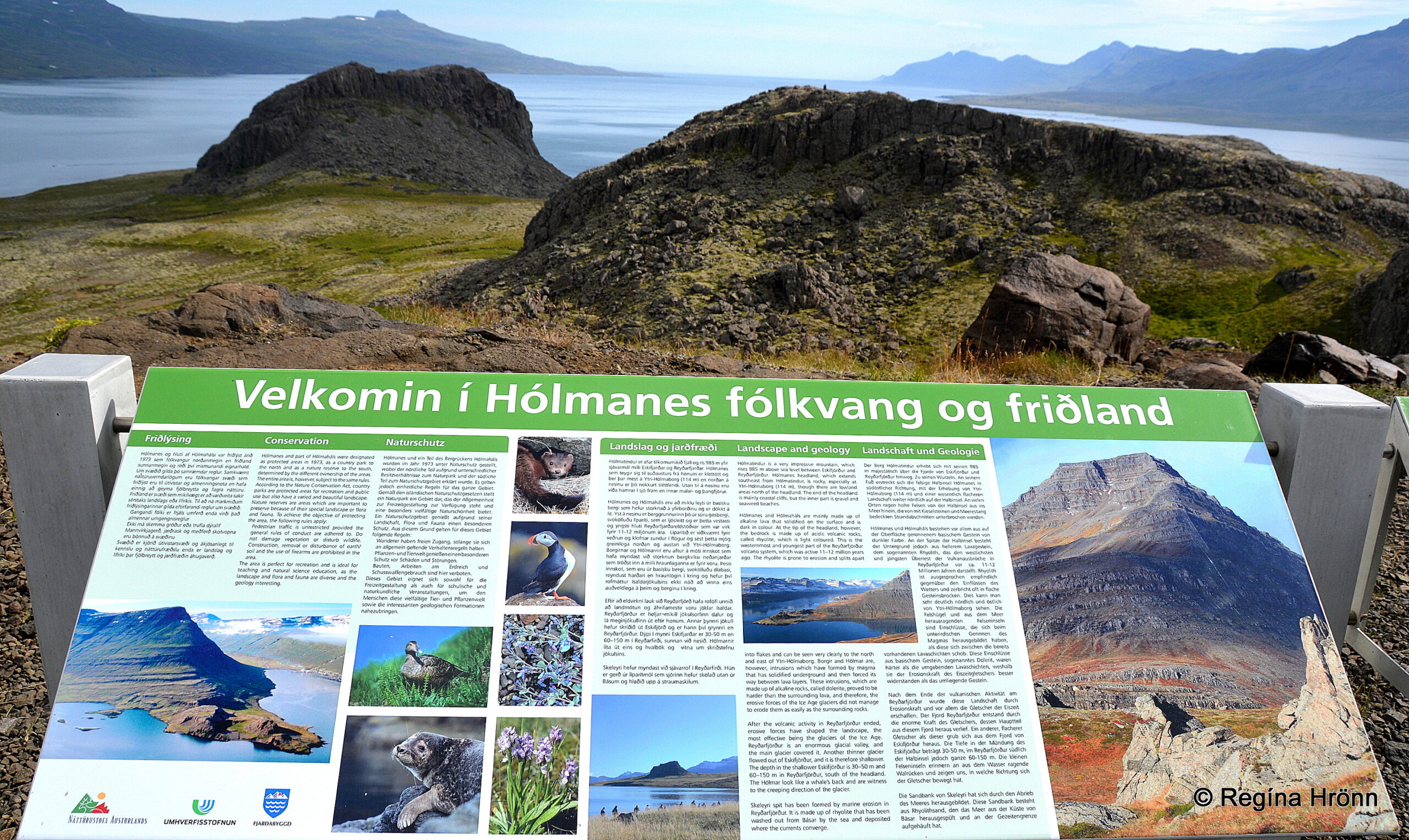
Hólmanes nature reserve
This must have happened in 1627 when pirates from Algeria came ashore in the Eastfjords and the Westman islands and kidnapped and killed a whole lot of Icelanders.
There are several such burial mounds in Iceland as I have shown you in my travel-blog: Viking ruins and burial mounds I have visited on my travels in Iceland.
Eskifjörður town
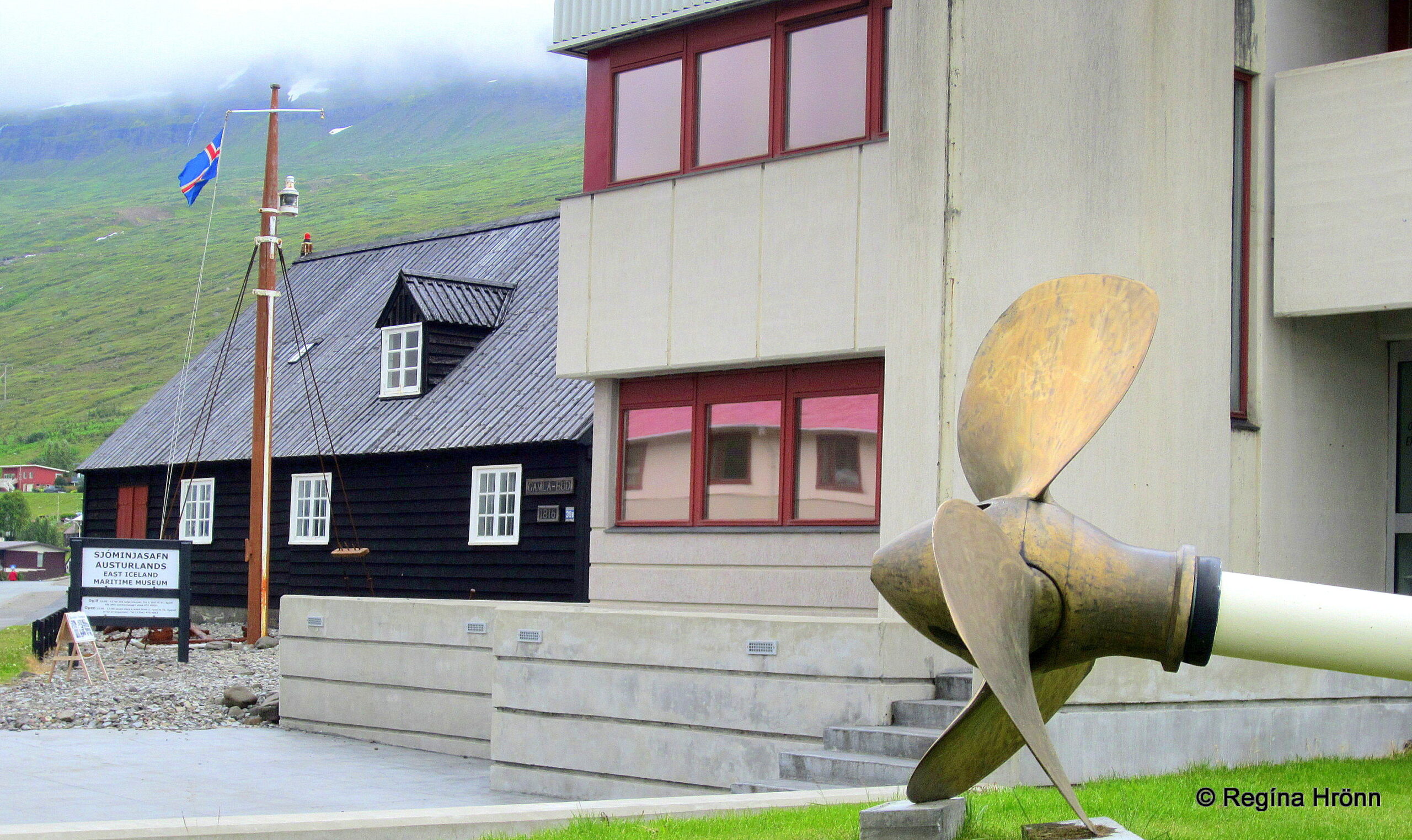
The East Iceland Maritime Museum in Gamla búð
The next fjord and town by the same name, which we are going to visit, is called Eskifjörður. To visit the town we will turn on road 950.
Eskifjörður is situated between Reyðafjörður and Norðfjörður fjords and has a population of approx. 1,050.
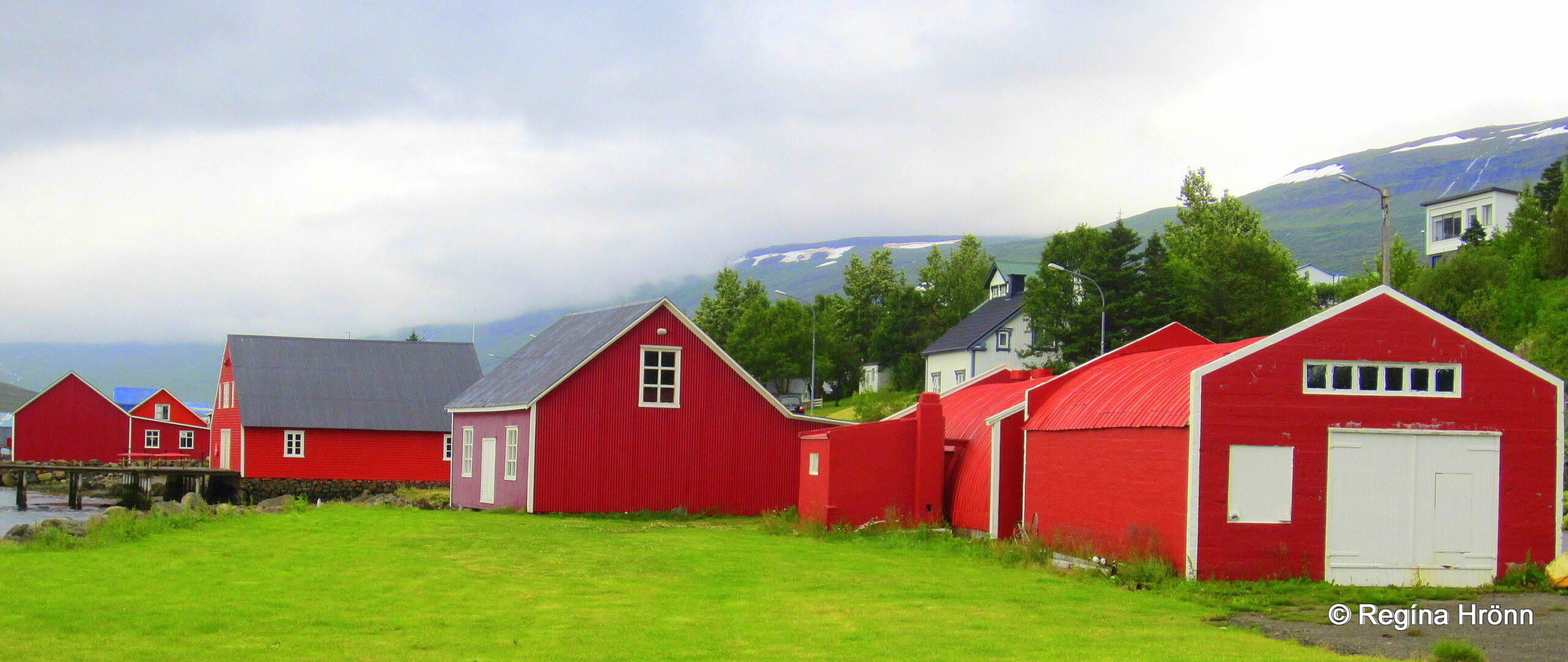
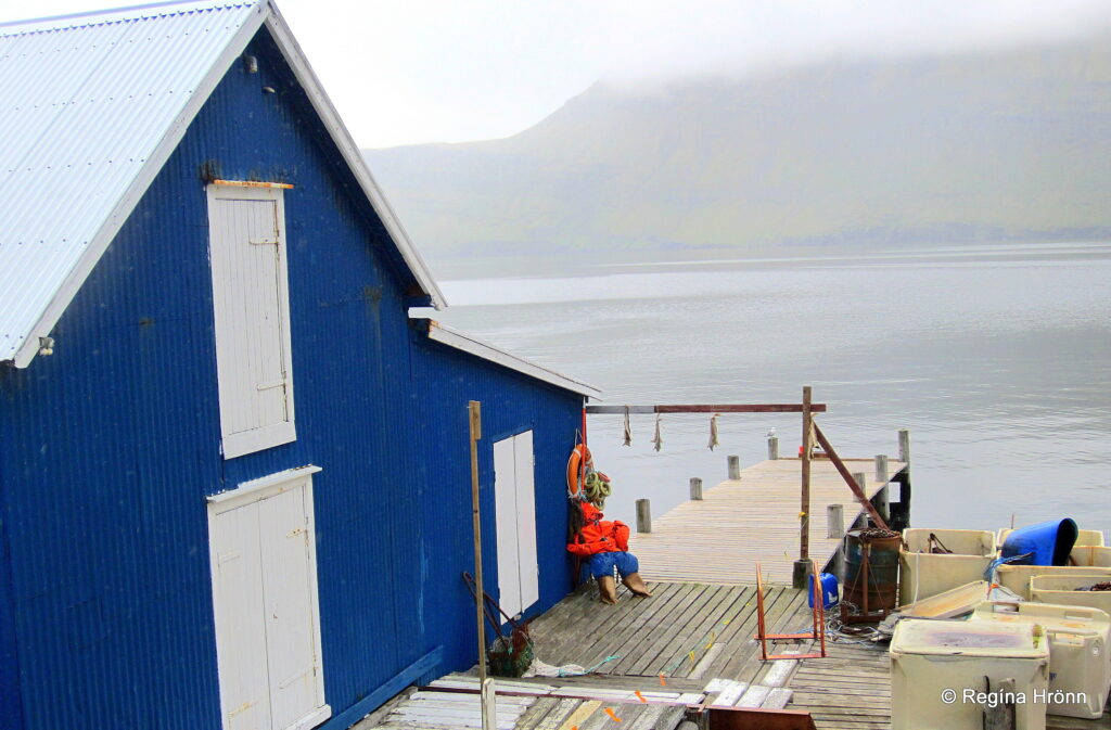
Old fishermen cottages
Eskifjörður has been an official trading post since 1786 with constant trading from 1789.
You will find several old red-painted fishermen cottages by the sea, which add character to this lovely town.
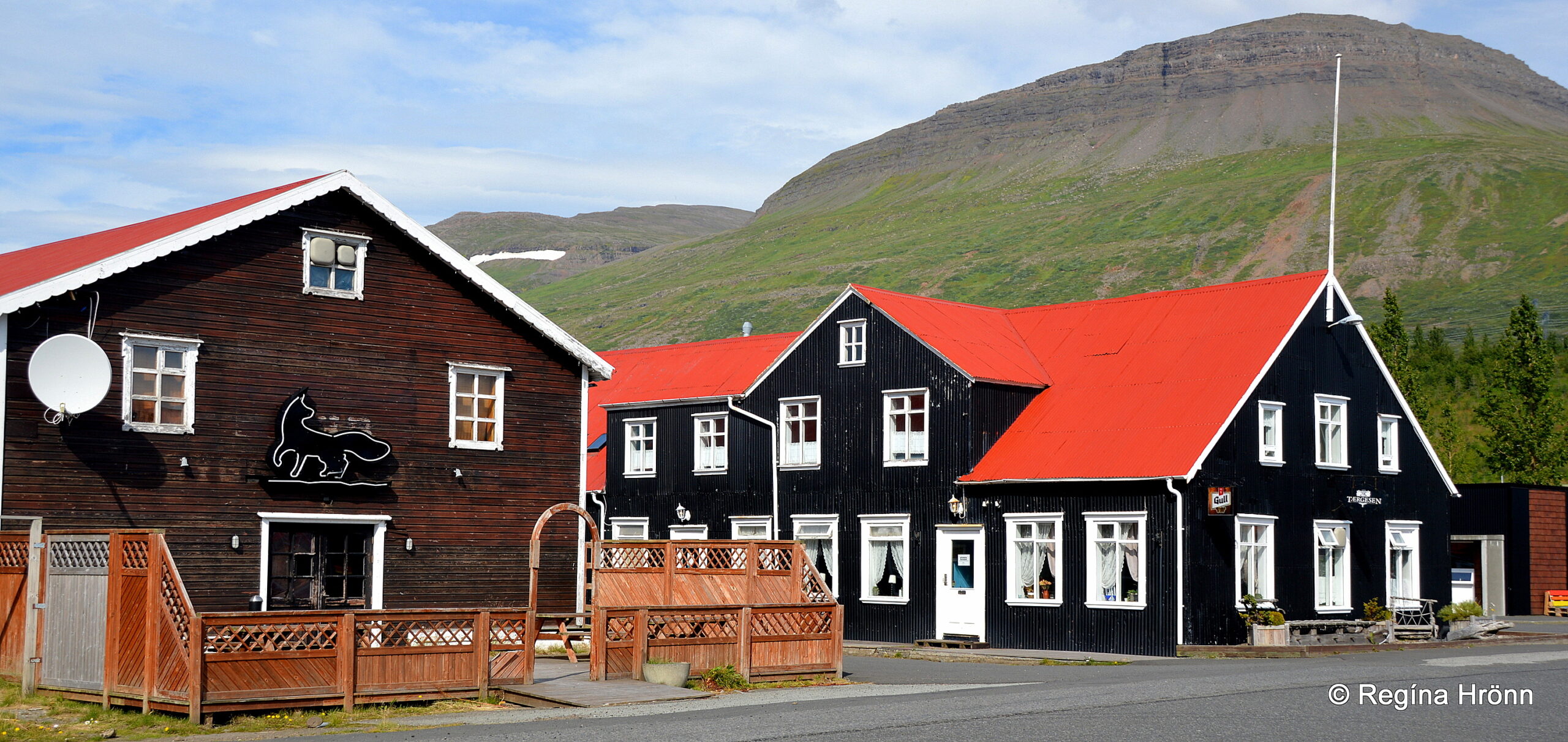
One of the most prominent of the red-painted buildings is called Randulfssjóhús.
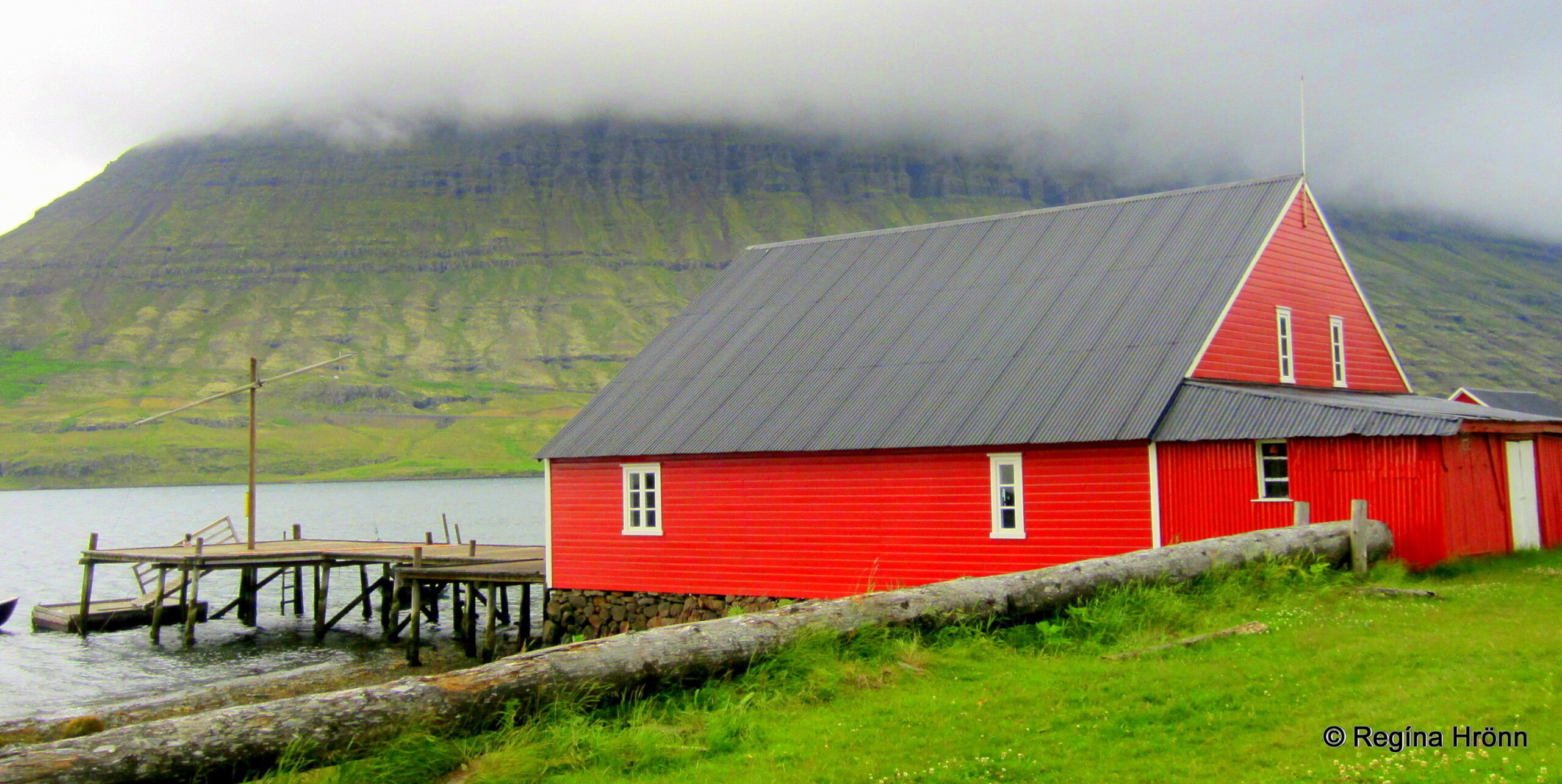
Randulfssjóhús
It was imported made to fit from Norway and has a pier attached to it. It has been in its current location since 1890.
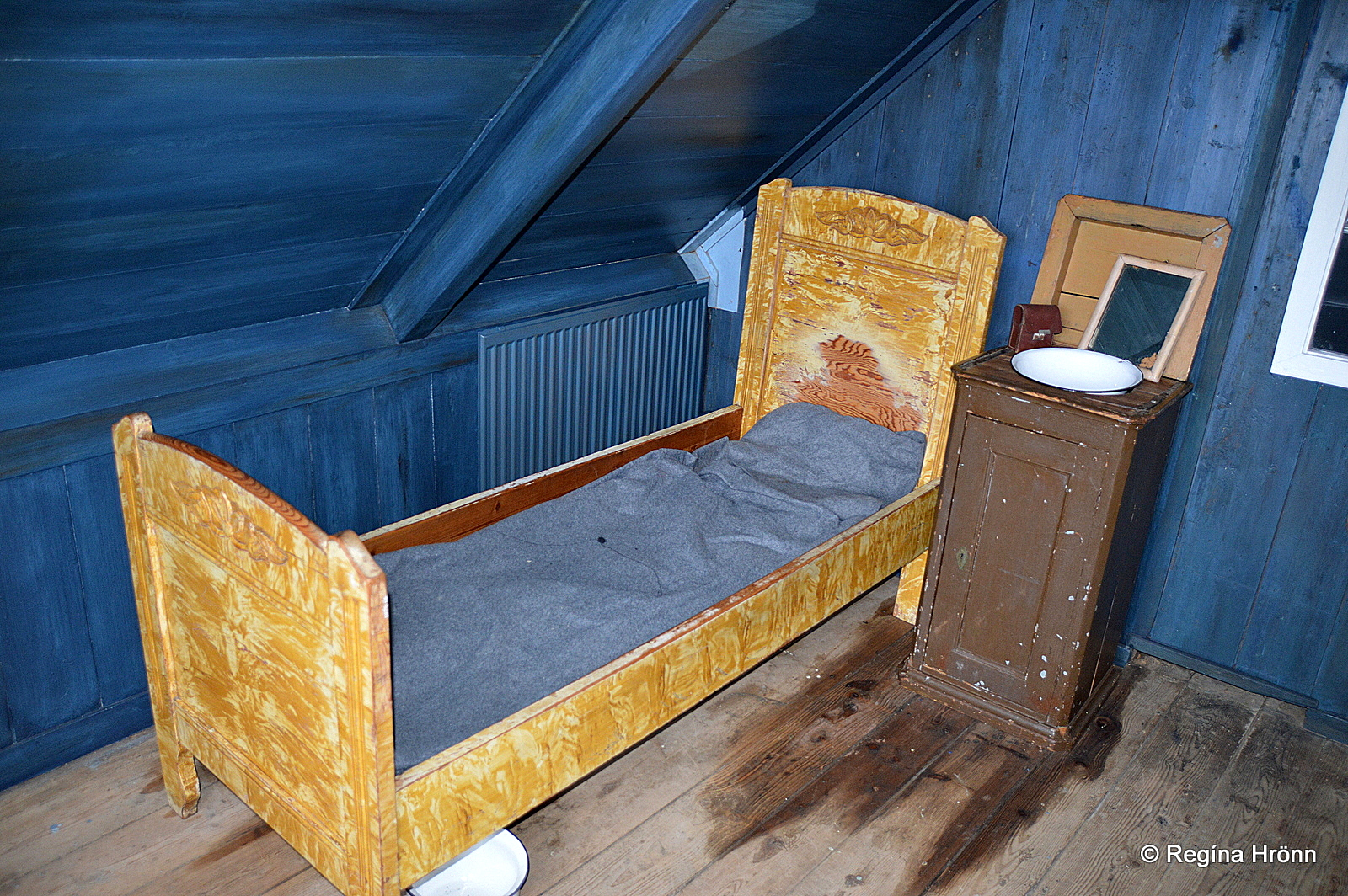
This building is now preserved and houses a museum and a restaurant. At the museum, you will see unchanged fishermen’s quarters from this time (1890).
Another museum worth visiting is in an even older black timber house, from 1816, the East Iceland Maritime Museum. You can see it in my first photo.
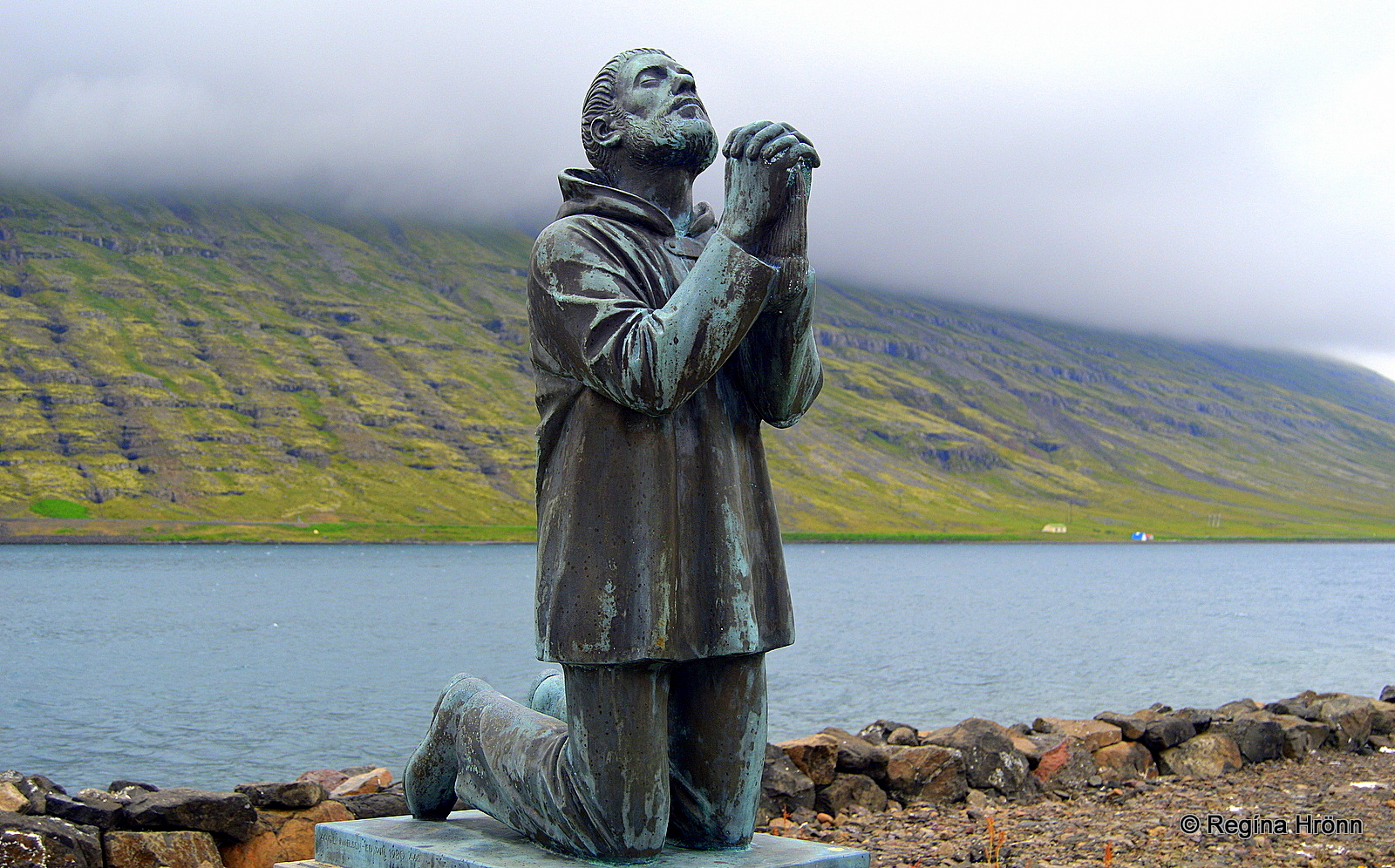
The Memorial for drowned fishermen
The symbolic monument for drowned fishermen in Eskifjörður does not go unnoticed. Such monuments for fishermen can be found in all the towns and villages by the sea around Iceland.
The sea has taken its toll and all these towns and villages have lost many valuable members of their small society to the sea.
The monument is in full size and shows a fisherman on his knees praying to God. To me, these monuments are the heart of the villages of Iceland and I always seek them out and pay my respect.
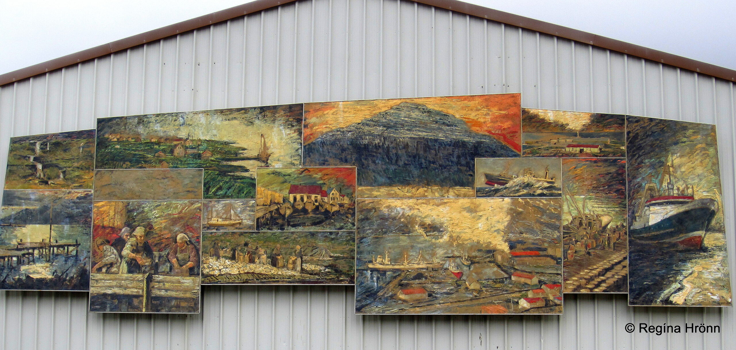
Frescoes by Baltasar Samper
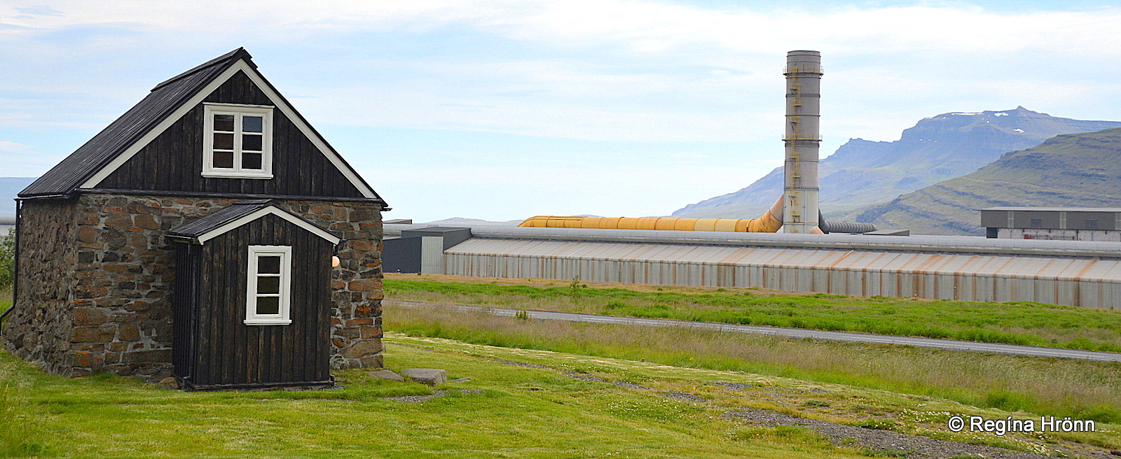
Don’t miss the 50 sq.m. artwork on the freezing plant by Baltasar Samper, extraordinary frescoes which depict the ways of work in the olden days and how they have developed. In 2022 the freezing plant was demolished and the artwork will be put up in another location.
Now, let’s visit Mjóeyri just outside of Eskifjörður town.
Mjóeyri and the last execution in East Iceland
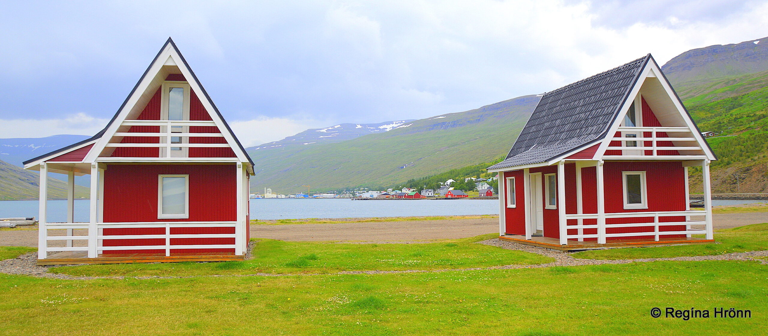
Mjóeyri cottages
At Mjóeyri the last execution in East Iceland took place.
On the 30th of September 1786, Eiríkur Þorláksson (1765-1786) from Breiðdalur was beheaded and buried close to the site of his execution in Mjóeyri.
His grave is by the sea right behind the red cottages and marked with a commemorative stone and an information sign.
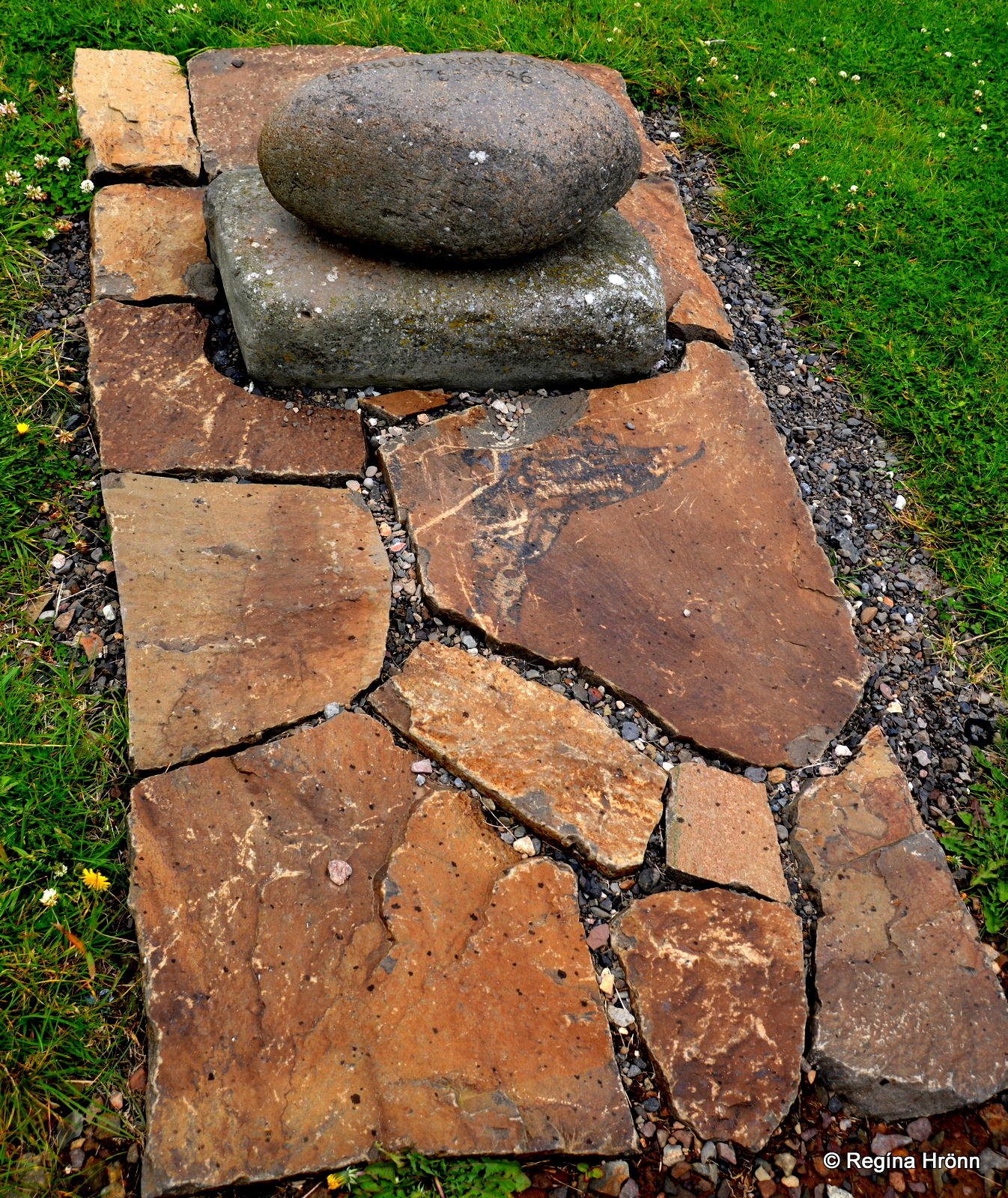
The grave of Eiríkur at Mjóeyri
The reason for Eriíkur’s execution was the murder of Jón Sveinsson (20) from Berufjörður fjord.
After the execution, Eiríkur was put in an unmarked grave, but later on, a memorial stone with his name was put on his grave and a fence was put up around it.
It is a really sad story which you can read up about in gory detail on the information sign at Mjóeyri. A really sad fate of 3 young men during very hard times in Iceland.
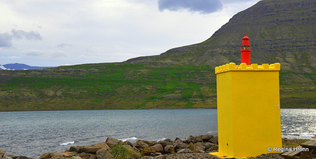
Mjóeyrarviti lighthouse
A Mjóeyri a small lighthouse stands tall, as it were. In my photo above you see Hólmaháls hill where the burial mound of the seeress is located.
Now, let’s visit one of the gems of the Eastfjords, Helgustaðanáma mine.
Helgustaðanáma mine
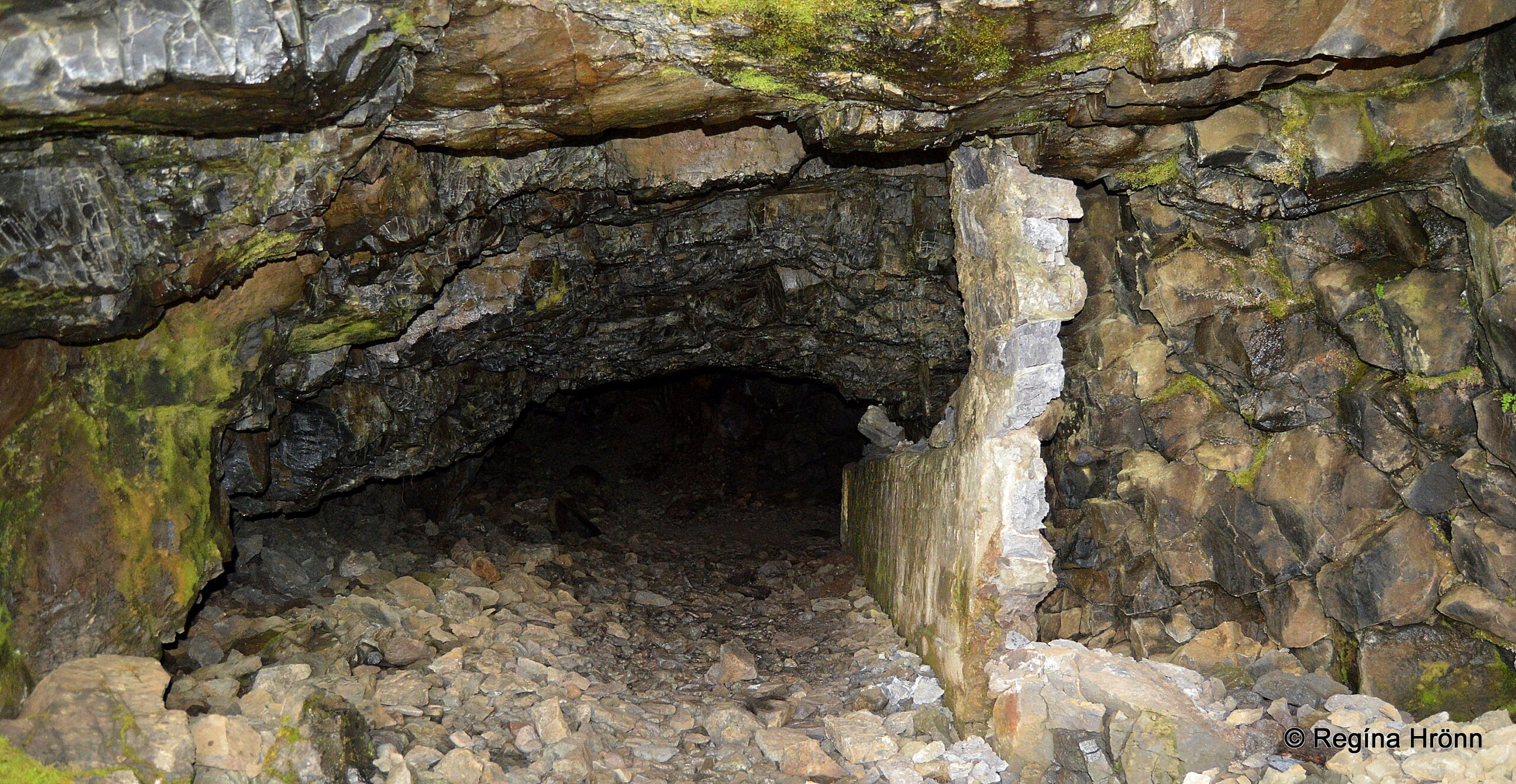
Helgustaðanáma mine
If we drive further on, we will find an old Iceland spar mine, which is one of the most famous spar crystal mines in the world.
The mine was taken into use in the mid 17th century and was in use until the early 20th century.
The spar was exported and used for optical instruments.
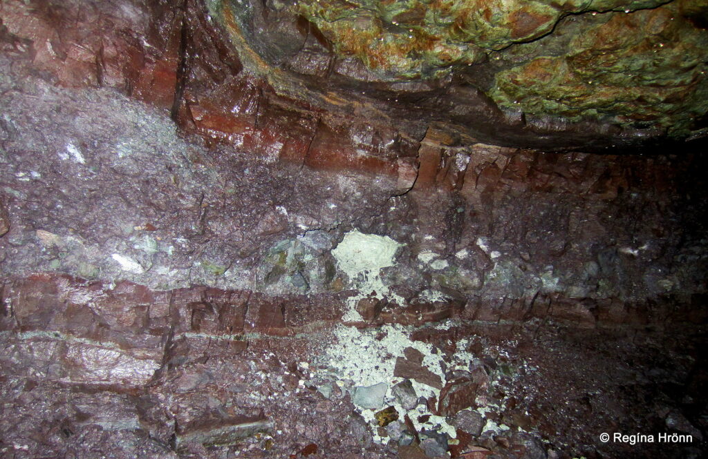
Inside Helgustaðanáma
Helgustaðanáma mine was preserved as a natural monument in 1975, and it is prohibited to remove the spar from the mine.
But you can visit the mine and have a look at the spar.
From the mine, which is located on a hill, there is a beautiful view.
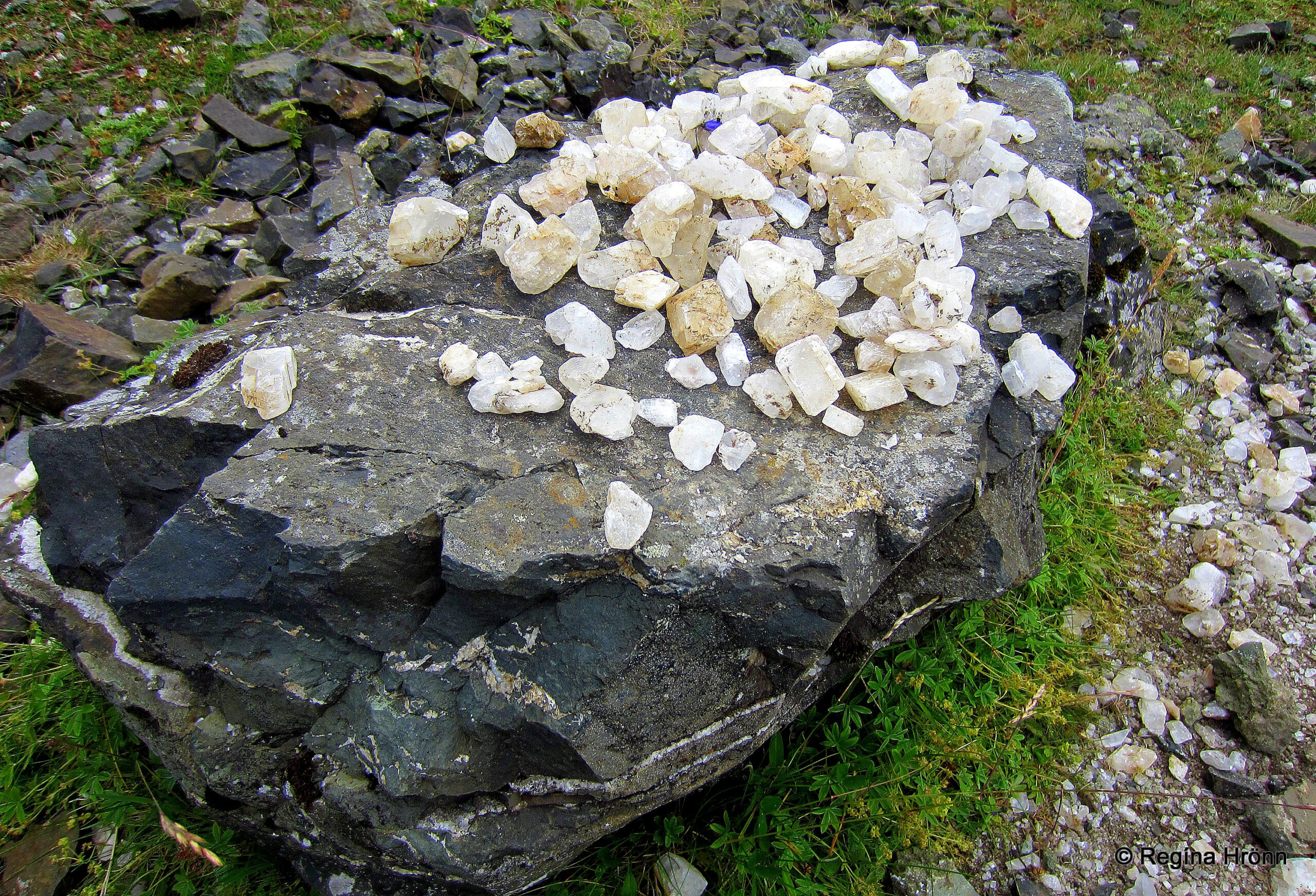
Iceland spar from Helgustaðanáma mine
Now, let’s go back to Eskifjörður town and drive through the 7.5 km long Norðfjarðargöng tunnel which opened in 2017, and visit Neskaupstaður town and Páskahellir cave.
Neskaupstaður in Norðfjörður
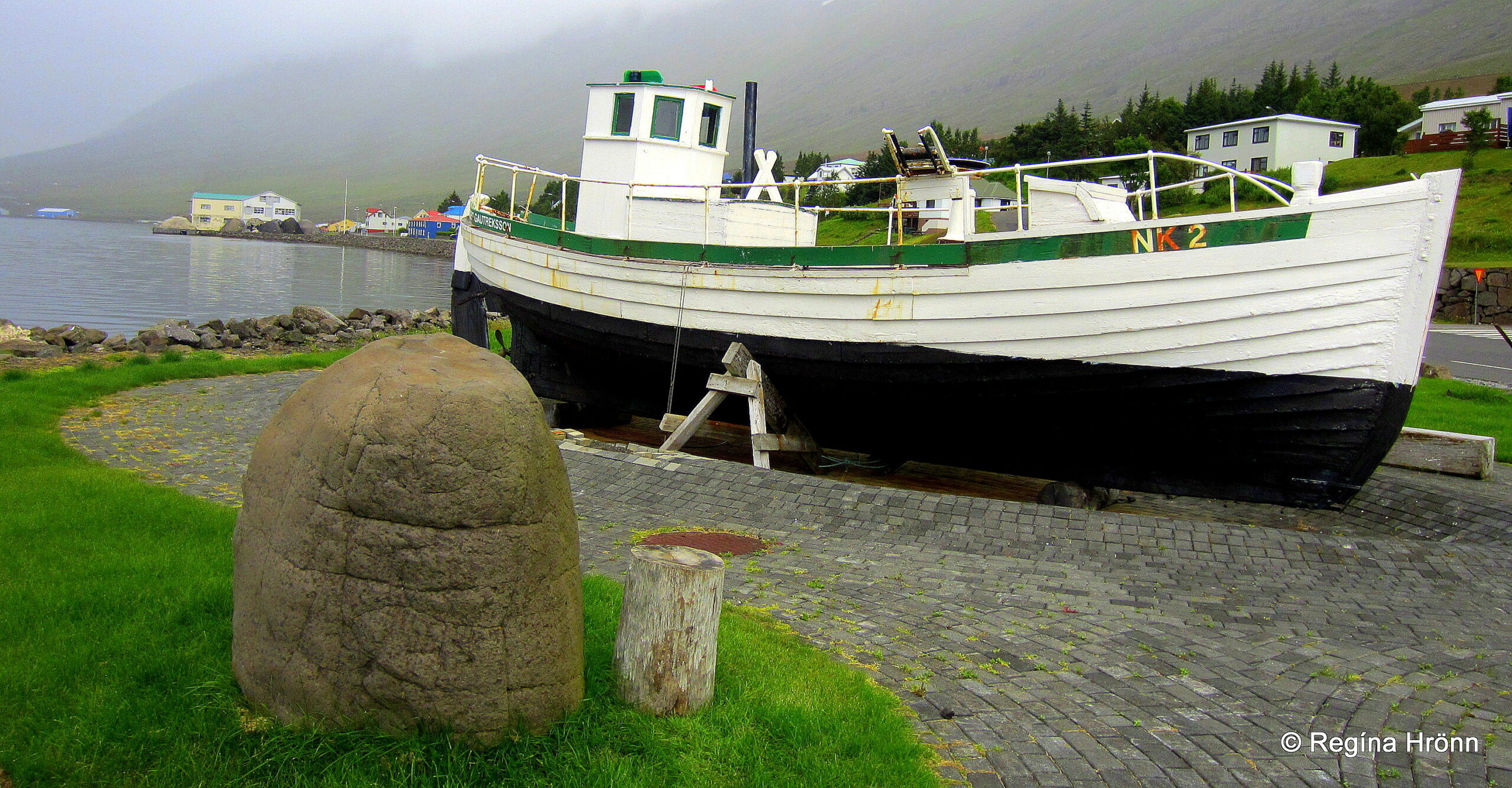
Gauti – the first motorboat in Norðfjörður (1905)
Norðfjörður fjord is the next fjord to Eskifjörður and the town here is called Neskaupstaður, sometimes also Norðfjörður.
Neskaupstaður town is the easternmost town in Iceland and the largest town in the municipality of Fjarðabyggð, with a population of approx. 1,532.
Until 1949 Neskaupstaður could only be accessed by boat. Now, both a mountain pass and a tunnel make it much easier to visit this lovely little town.
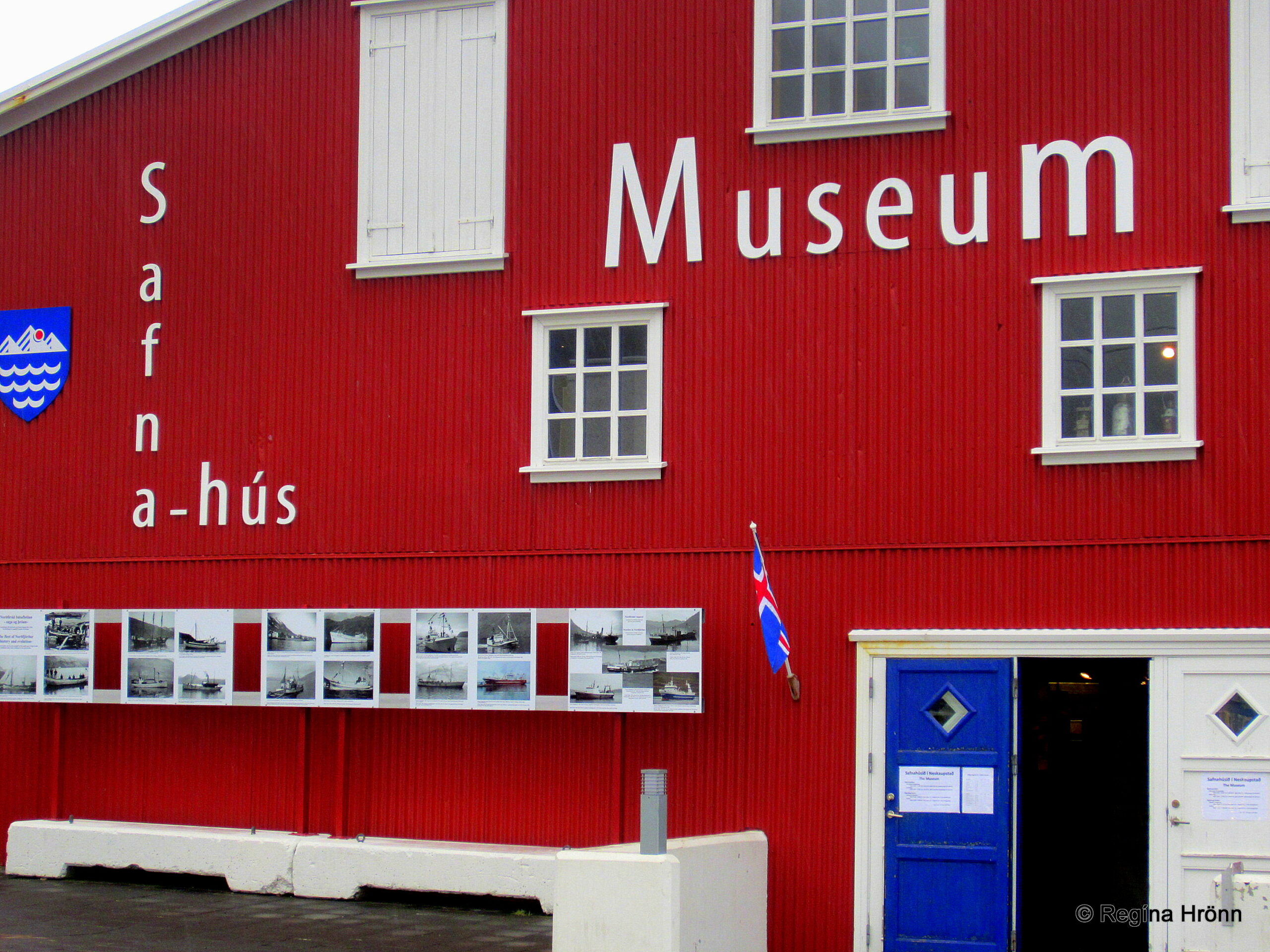
Safnahúsið – the Museum House
Fishing is the main industry here and the fishing operator Síldarvinnslan is one of the largest fishing operators in Iceland.
The museum in Neskaupstaður is located in an old red renovated building by the harbor. The museum is called Safnahúsið – the Museum House.
It is a three-in-one museum and here you can visit the Museum of Natural History, Tryggvi Ólafsson’s Art Collection, and the Seafaring and Smithy Collection of Jósafat Hinriksson.
Neskaupstaður
In Neskaupstaður in Drangagil, above the campsite, a massive avalanche barrier has been erected.
The structure is 400 meters long and 17 meters high. Several avalanche cones have been erected further up.
In the towns and villages in Iceland, which are located by the sea right beneath tall mountains there is always a risk of an avalanche falling.
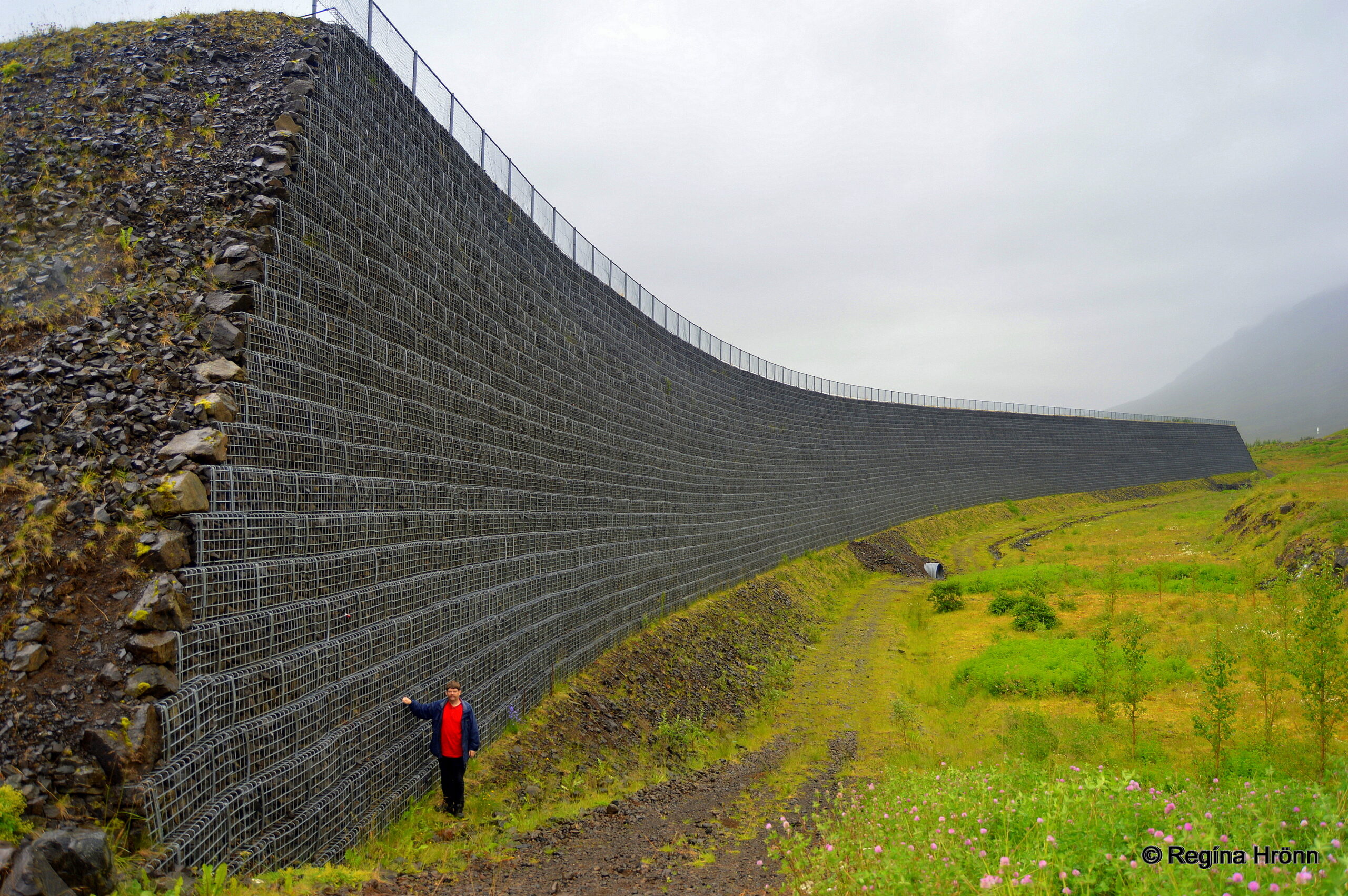
The massive avalanche barrier
We have lost way too many Icelanders to avalanches, so massive structures like this one have been built to protect the inhabitants.
On the 20th of December 1974, two avalanches fell on the town of Neskaupstaður and 12 people got killed.
These massive structures should prevent more deaths.
The observation platform in Norðfjörður
An observation platform was recently erected by the Norðfjarðarviti lighthouse at the outskirt of the town.
Just outside of Neskaupstaður town right by the lighthouse, you will find the Neskaupstaður Country Park.
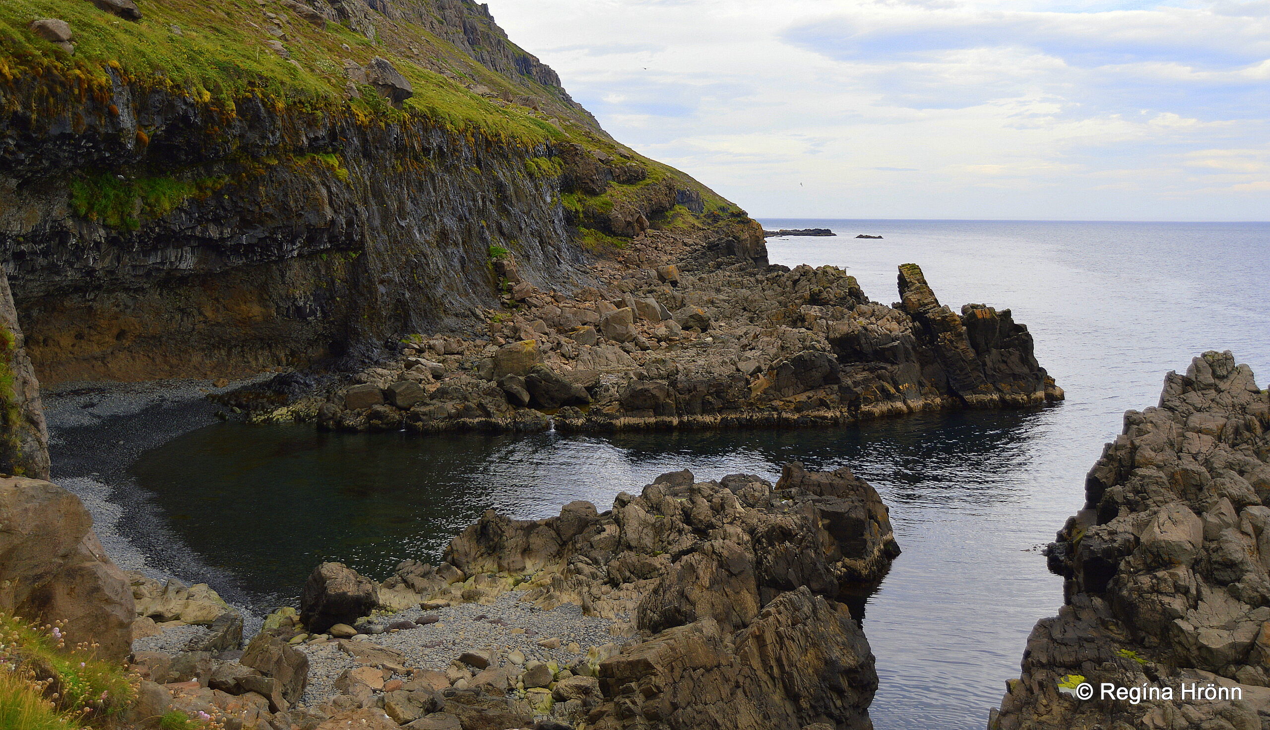
Páskahellir cave
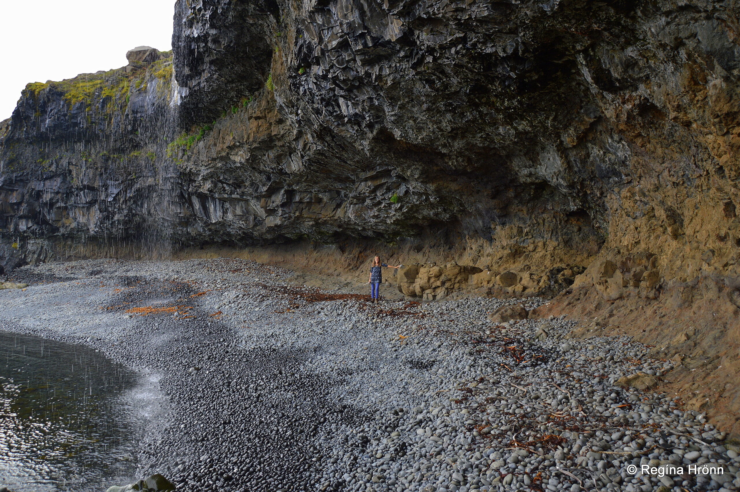
Páskahellir cave
Neskaupstaður Country Park (Fólkvangur Neskaupstaðar) is the first protected Country Park in Iceland, declared as protected in 1972.
An information path leads to Páskahellir cave, with information signs about interesting things to see on the way. It is a very beautiful walk.
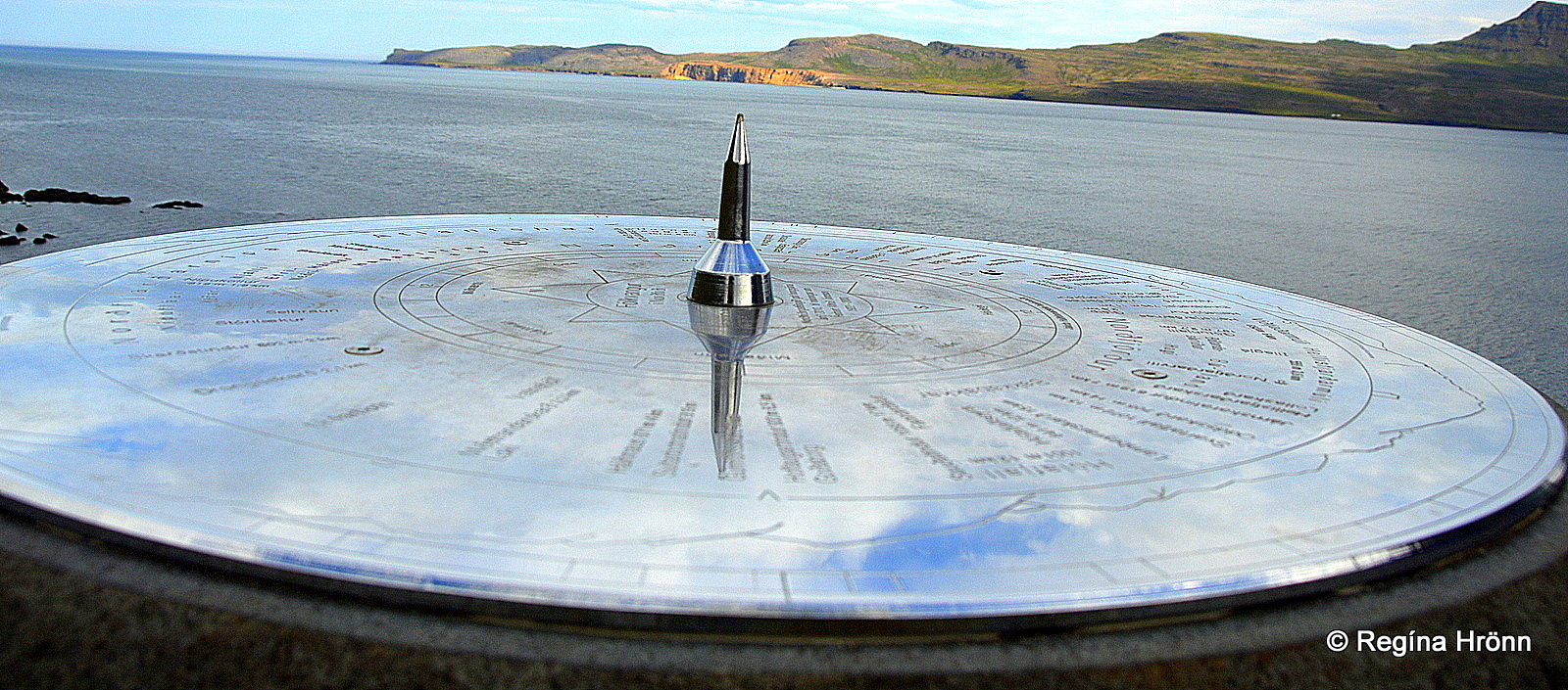
The view-dial at the country park
At the beginning of the hike, you will see one of the 90+ view-dials in Iceland. The view-dials show the names and heights of the mountains, which are visible in this area.
The view-dial in my photo above points towards the rhyolite cliffs Rauðubjörg – Red Cliffs at Barðsneshorn. It looks like the rhyolite cliffs are glowing.
This particular view-dial was designed by my father-in-law, Jakob Hálfdanarson, and erected in 2010.
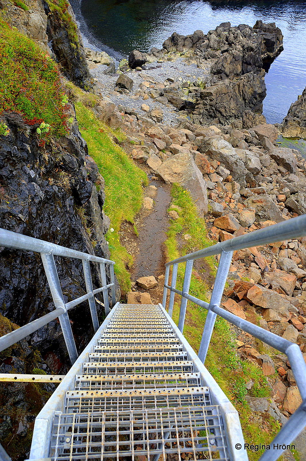
The steep ladder leading to the cave
Now, let’s examine Páskahellir cave, which is by the end of the information path.
It is possible to walk down to the cave via a steep ladder.
Beware though as one has to clamber a bit where the ladder ends. So wear good hiking shoes.
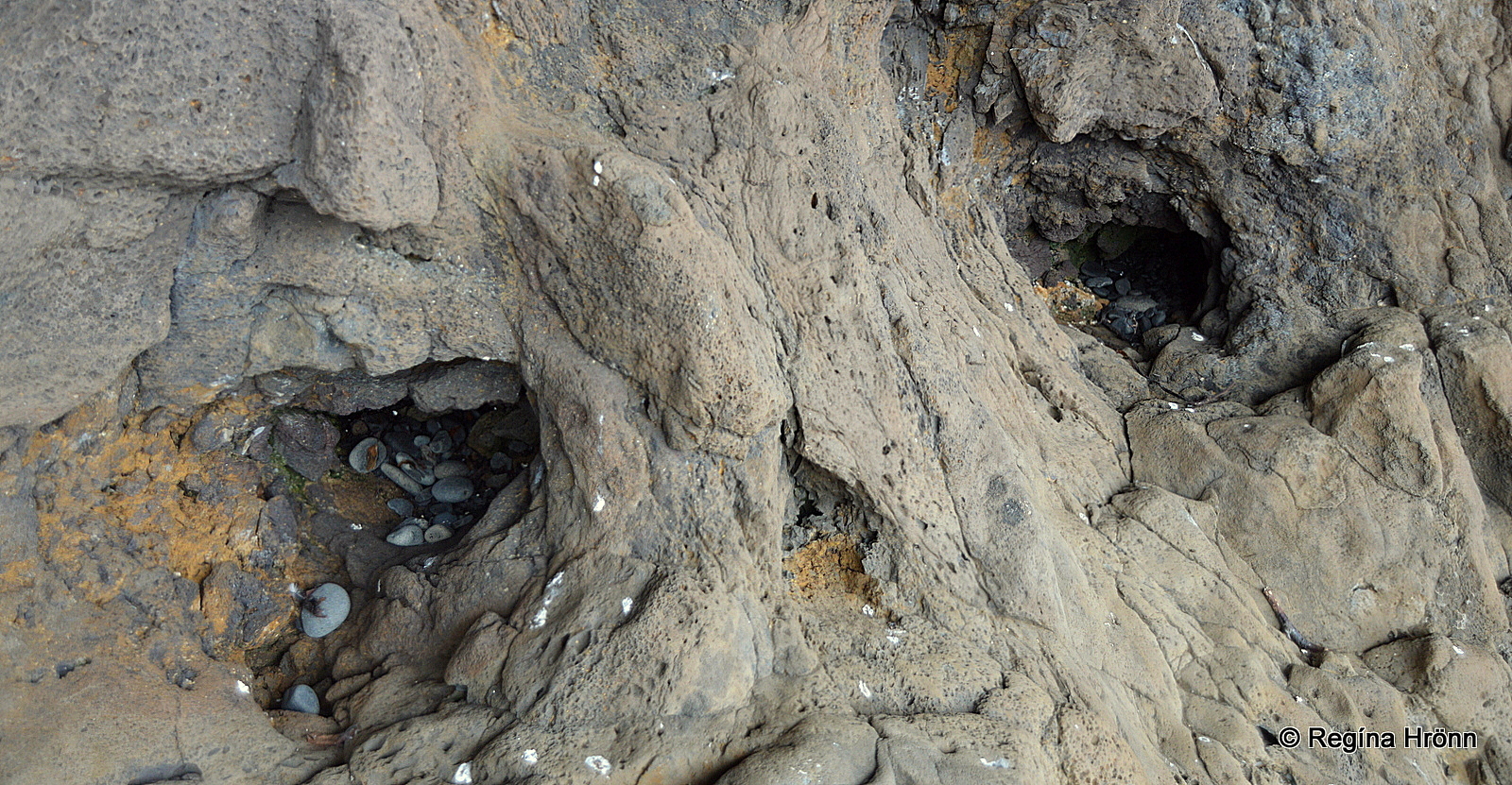
The ancient holes in the cliff
The cave has been carved out by the erosion of the sea and there are strange holes in the walls of the cliff.
These holes are believed to have been left by trees, which stood in this location in a forest some 12 million years ago – until the forest was covered with lava!
By the cave, you will see beautiful lava formations, pillow lava, dykes, and crystals glistening in the rocks.
Páskahellir cave means the Easter Cave and from the cave, you can apparently watch the sun dance on Easter morning.
Folklore is connected to the cave about the farmer of Bakki and a seal woman.
Páskahellir cave
We will now return back and drive through the Norðfjarðargöng tunnel again and all the way to ring-road 1.
We have one more fjord to examine in this travel-blog, Mjóifjörður fjord.
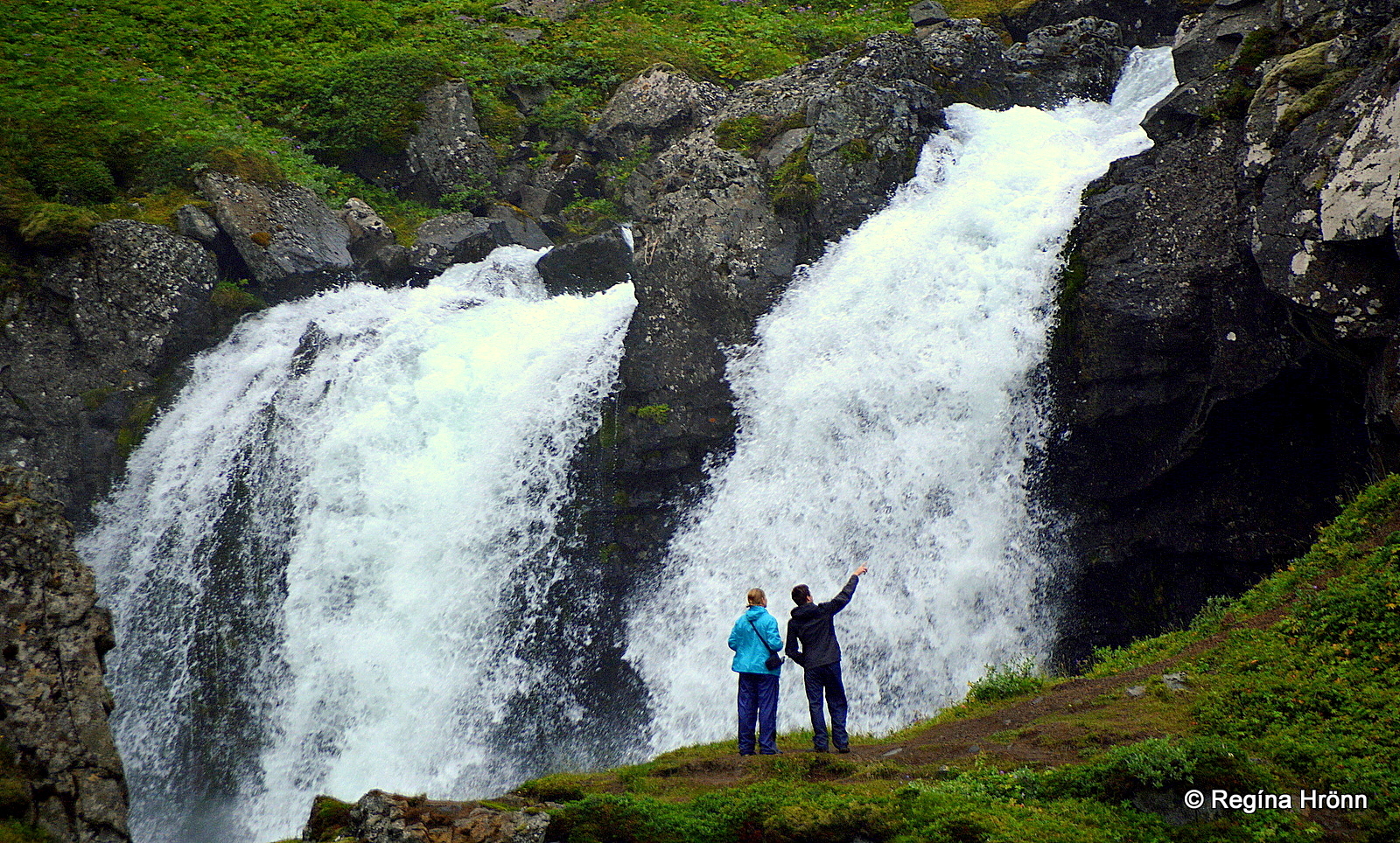
Mjóifjörður fjord and Klifbrekkufossar
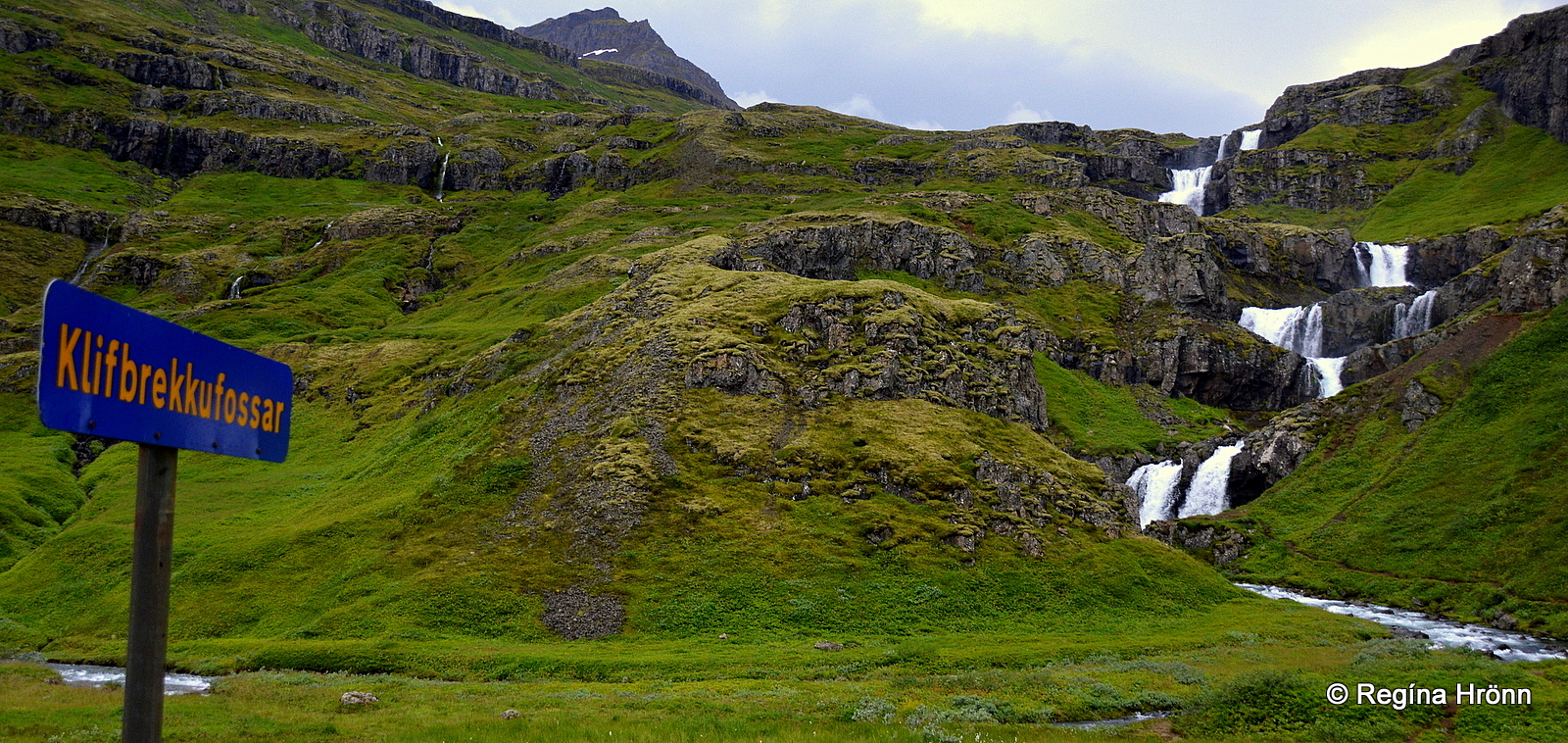
Klifbrekkufossar falls
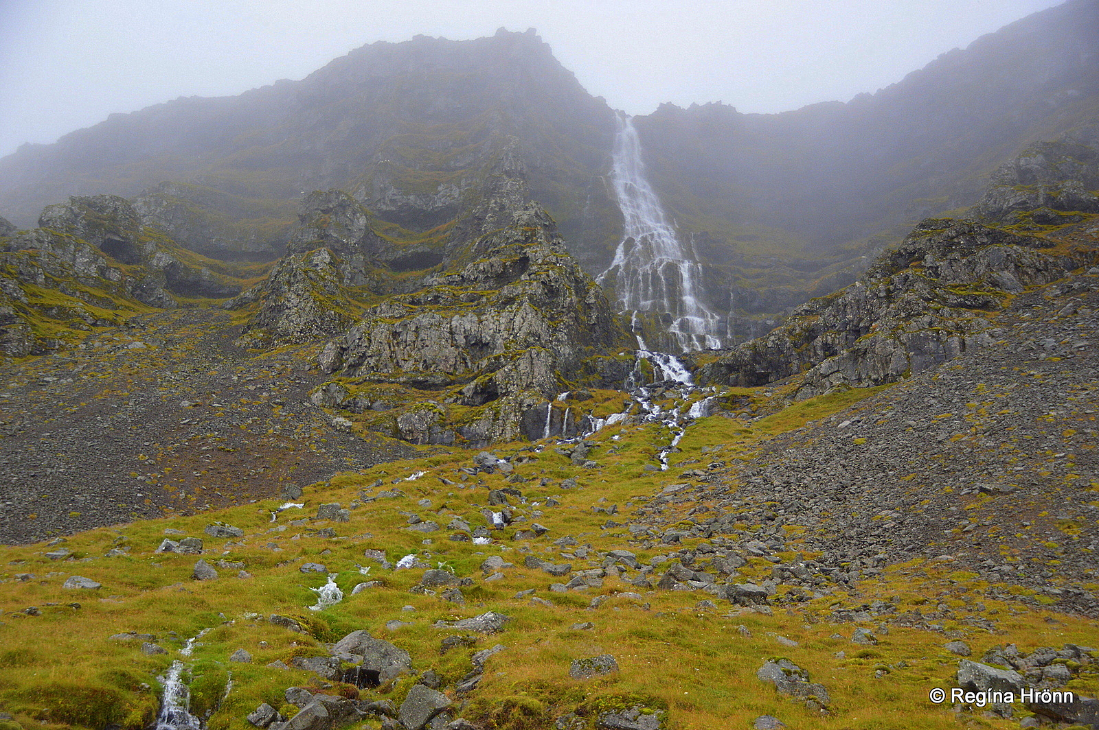
From ring-road 1 we turn on road 935, and drive down the steep gravel road and descend into Mjóifjörður – the Narrow fjord, and have a look at the pearl of Mjóifjörður – Klifbrekkufossar falls at the bottom of the fjord.
The series of waterfalls one on top of the other have become a very popular tourist attraction.
The roads here in Mjóifjörður are steep and narrow gravel roads, and the road to Mjóifjörður is only open in the summertime.
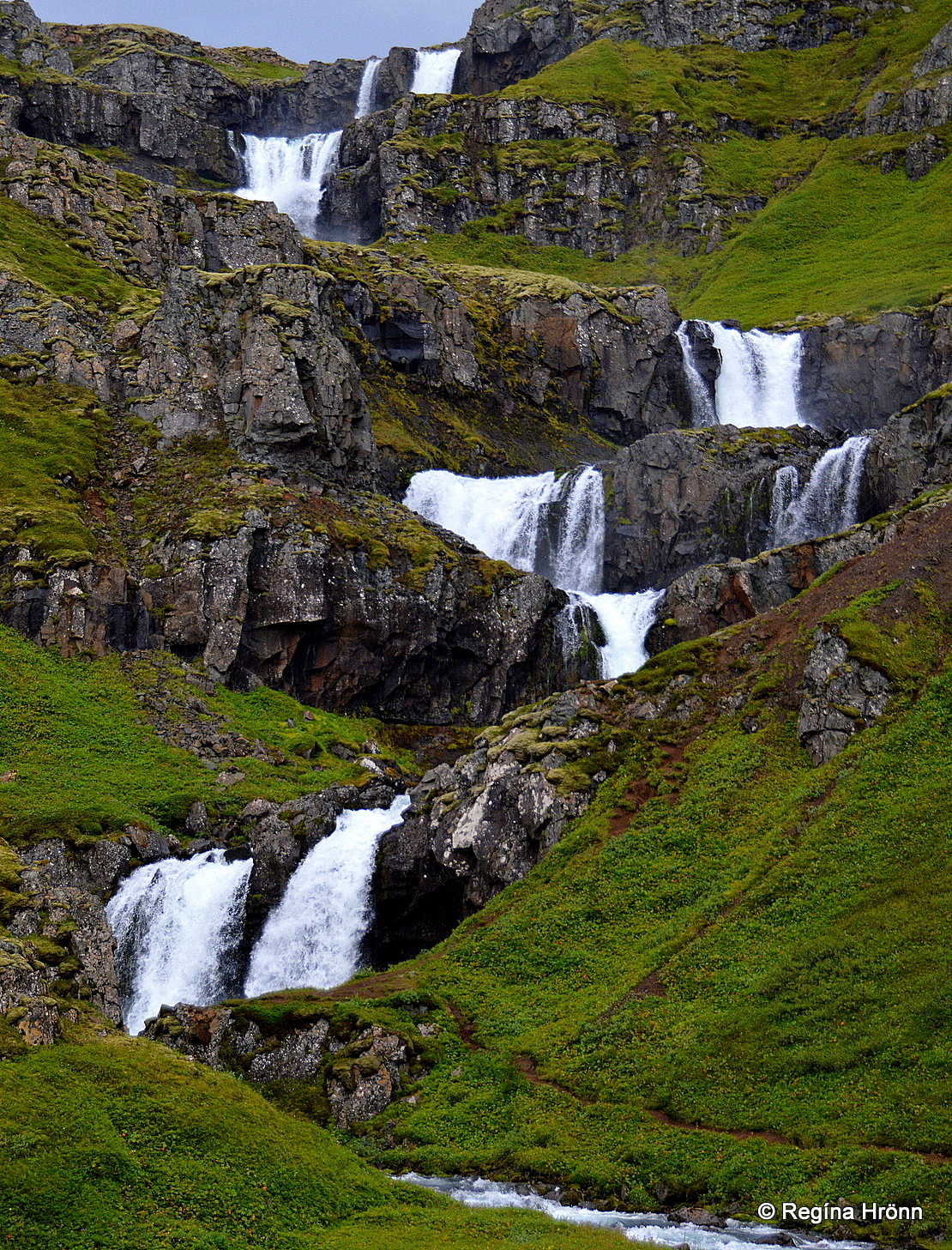
Klifbrekkufossar falls
The Klifbrekkufossar falls are 90 meters tall and fall in 6-7 falls on ledges. The best view of the waterfalls is at the bottom of the fjord, from the sign.
A path leads to Klifbrekkufossar, but as you get closer to it the series of waterfalls disappear from sight.
Still, it is worth it to stand close to the lowest waterfall in the series.
Up close to the lowest falls
There are many more interesting sights in Mjóifjörður than Klifbrekkufossar, even though they are the biggest attraction of this fjord.
Prominent is Prestagil – the Priests’ gorge, but an interesting troll story gives a name to this gorge.
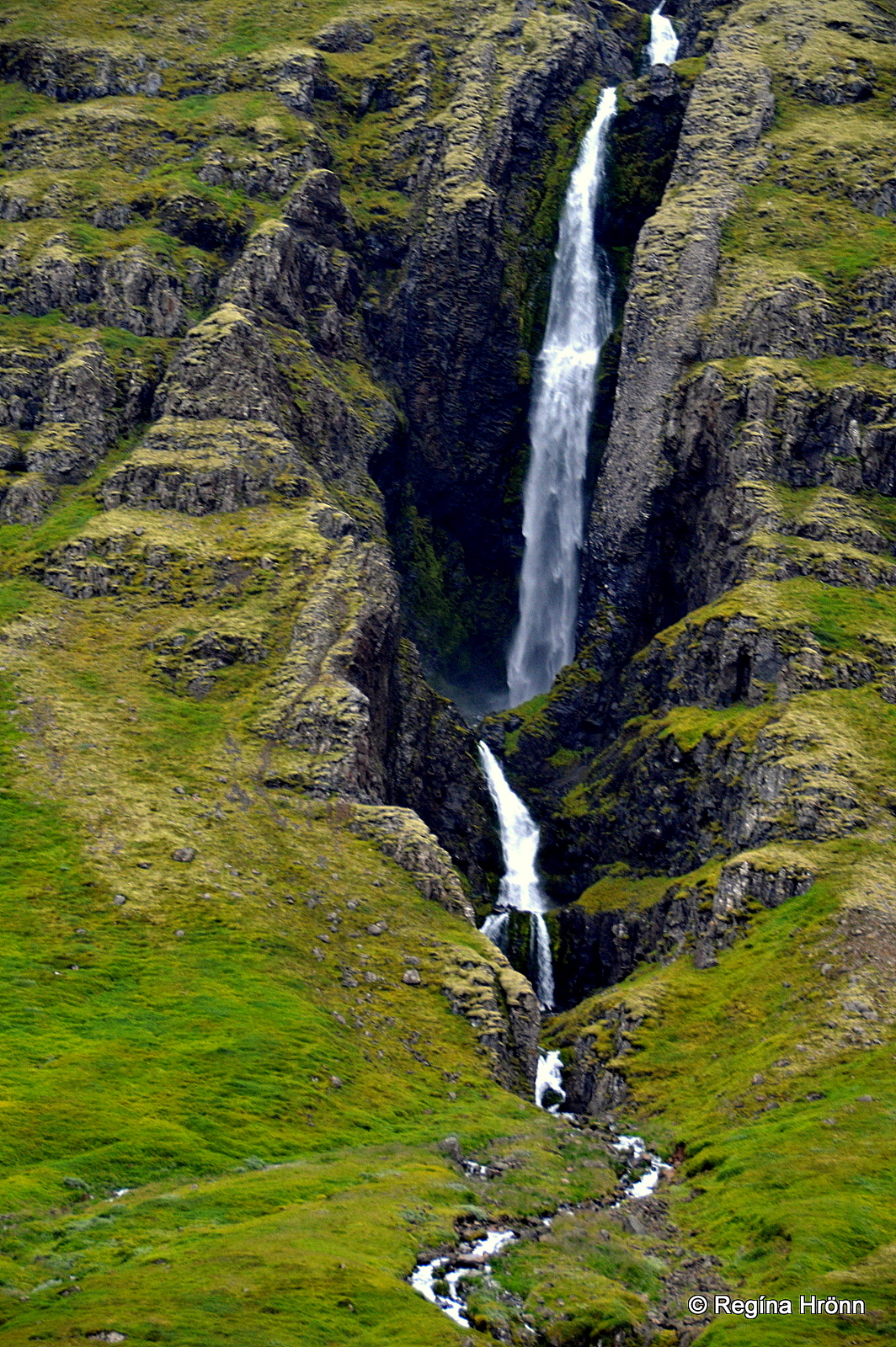
Prestagil gorge
A giantess apparently lived in the gorge and twice she kidnapped priests from the church on Christmas Night and took them home with her to the gorge and ate them, thus the name Priests’ gorge.
The folk tale, which can be found in Þjóðsögur Jóns Árnasonar – the Collection of Folklore by Jón Árnason, tells us that she didn’t manage to kidnap the third priest.
Several waterfalls cascade majestically in the steep and narrow Prestagil gorge.
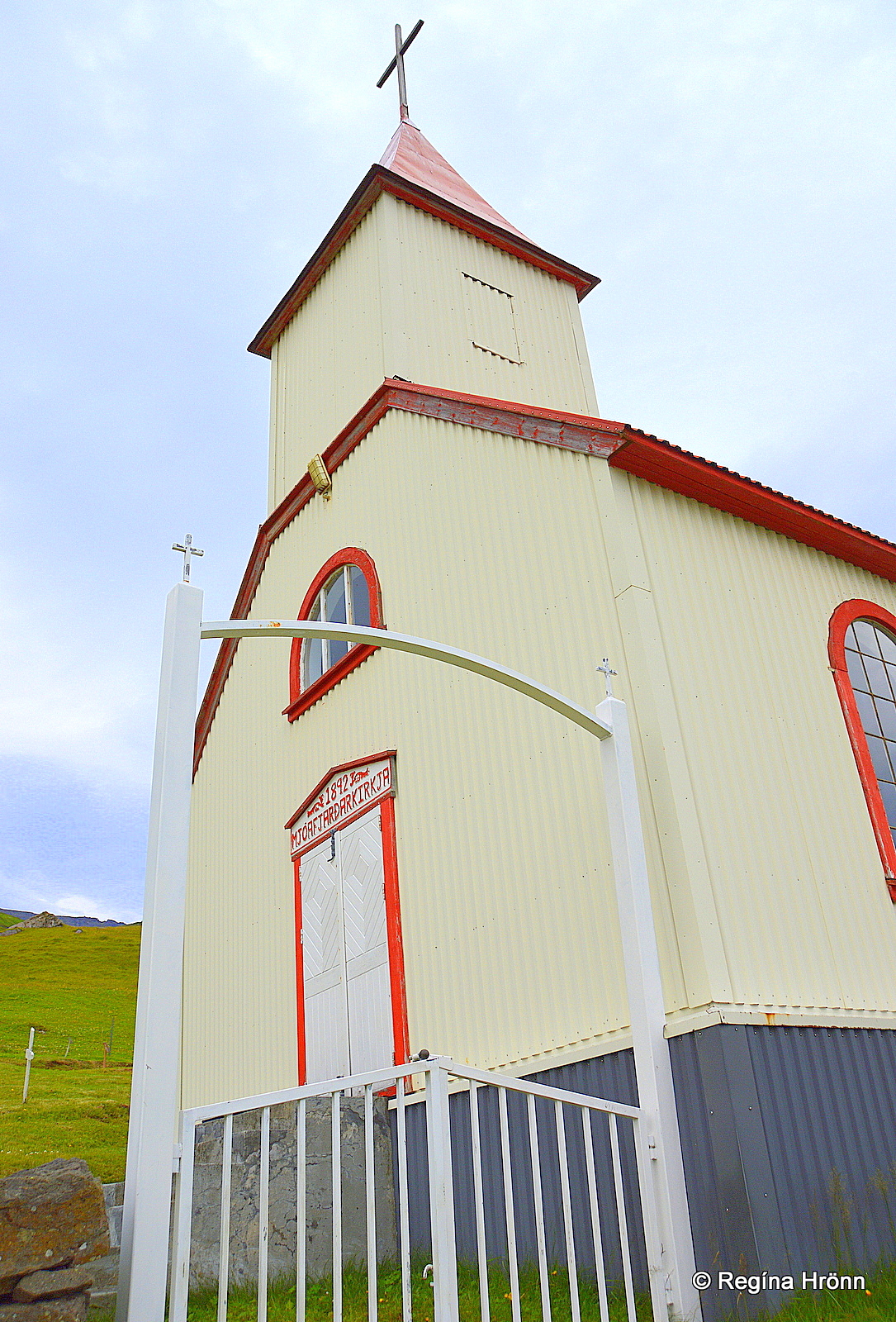
Brekkukirkja church
Let’s drive further on to the small village in Mjóifjörður, Brekkuþorp, with only approx. 24 inhabitants.
Even though the village is very small you will find a church, Brekkukirkja erected in 1892, a guesthouse called Sólbrekka, and a café.
A waterfall, Heljarfoss, is hidden away from sight right by the road a little further on.
When we visited Mjóiförður fjord, we drove to the very end of the narrow road all the way to Dalatangi.
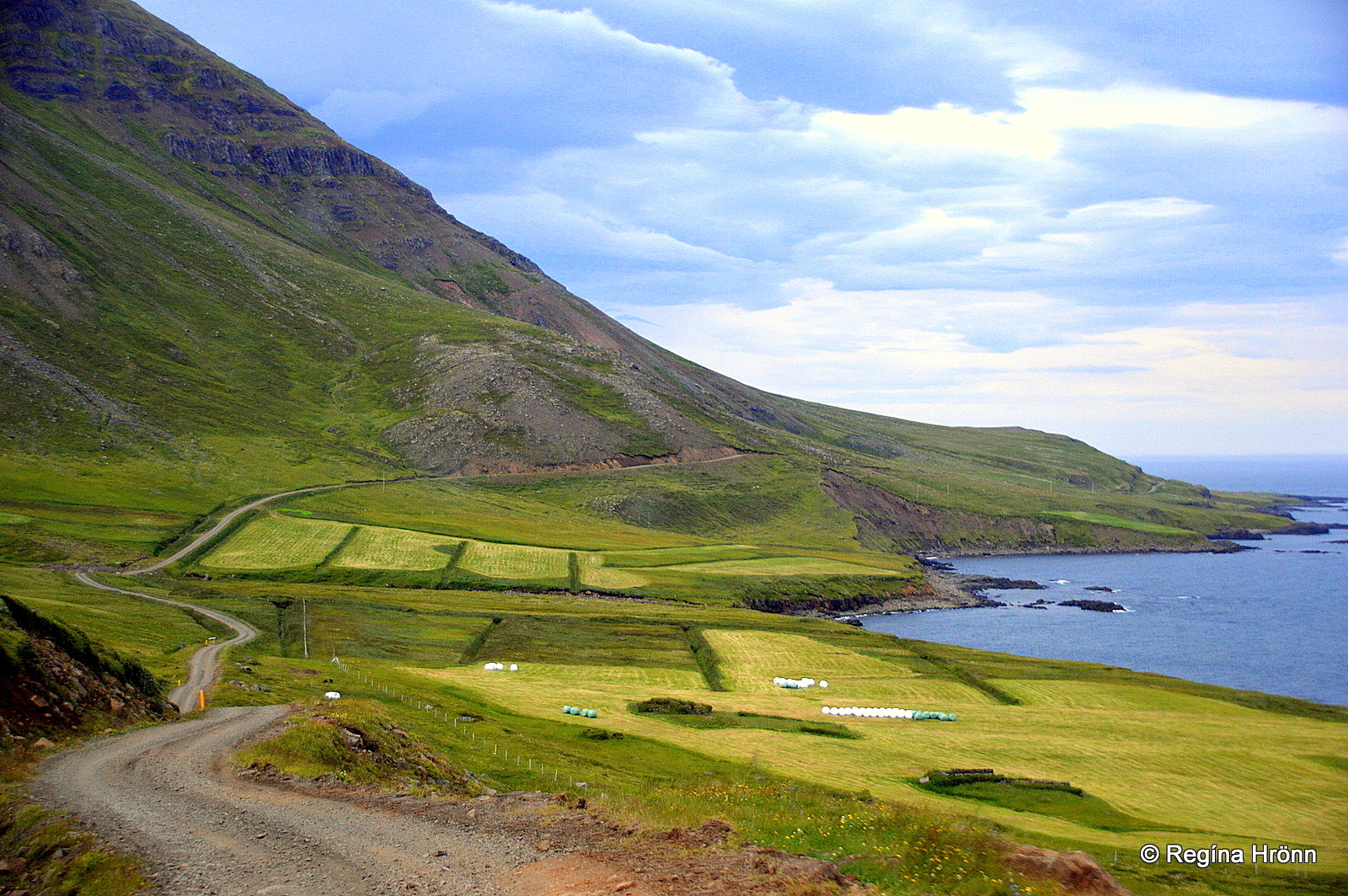
Driving to Dalatangi
At Dalatangi you will find a farm, a weather station, and 2 old lighthouses, erected in 1895 and 1908.
Now, this is what I call remote here in Iceland.
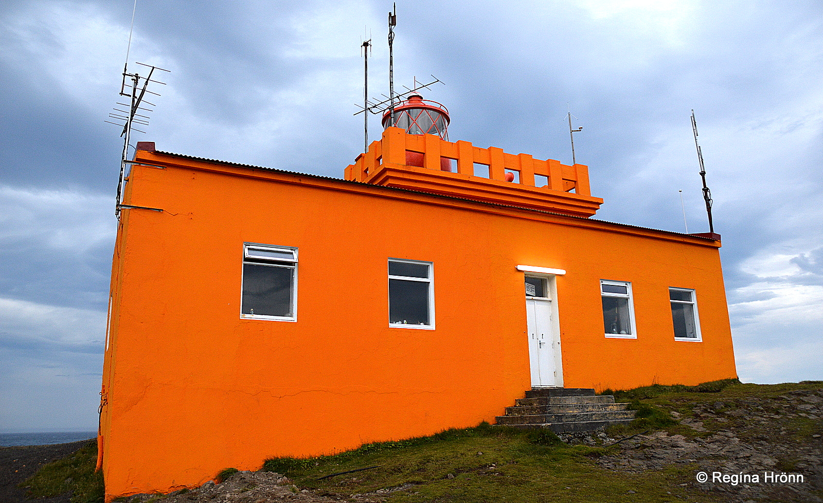
Dalatangi lighthouse (1908)
I love visiting such remote places where I feel the heartbeat of my country, so to speak.
And I for sure felt the heartbeat of Iceland when I stood by the old lighthouses at Dalatangi.
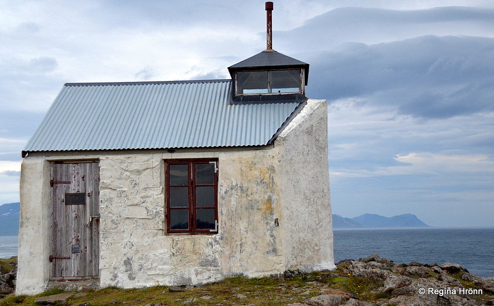
The older lighthouse at Dalatangi
In this travel-blog I have shown you what I find to be of interest in the Eastfjords from Breiðdalsvík village to Mjóifjörður fjord in the Fjarðabyggð municipality.
In my last travel-blog I showed you the interesting stops from Höfn to Berufjörður.
In my next travel-blog we are going to explore what Fljótsdalur valley has got to offer and visit Egilsstaðir the largest town in East Iceland: Egilsstaðir in East Iceland and the Pearls of Fljótsdalur Valley.
We drive through Fagridalur – Beautiful valley which connects Reyðafjörður with Egilsstaðir on ring-road 1.
Have a lovely time in the Eastfjords of Iceland 🙂